TopoQuest Logo
Do you find TopoQuest useful?
Help keep TopoQuest running and adding new maps/features by donating!
Bitcoin:  19c7KJd3qBynnjoSw5npx9KScwjBe4ifkT
Litecoin:  LXs6TkuXGGXo1vDsWCkWVdjQX94eUKd6ui
Home View Maps Find Maps Find Places Resources & Links


Beach, Virginia Topographic Map

USGS Map Title: Beach, VA
USGS Map MRC: 37077C5
DRG (GeoTIFF) Download: o37077c5.tif


Neighboring USGS Topographic Map Quads:


  Hallsboro, VA  
37077D6
 

  Chesterfield, VA  
37077D5
 

  Drewrys Bluff, VA  
37077D4
 

  Winterpock, VA  
37077C6
 

  Beach, VA  
37077C5
 

  Chester, VA  
37077C4
 

  Church Road, VA  
37077B6
 

  Sutherland, VA  
37077B5
 

  Petersburg, VA  
37077B4


Map MRC Location:

N38°
W78°
N38°
W77°
H8 H7 H6 H5 H4 H3 H2 H1
G8 G7 G6 G5 G4 G3 G2 G1
F8 F7 F6 F5 F4 F3 F2 F1
E8 E7 E6 E5 E4 E3 E2 E1
D8 D7 D6 D5 D4 D3 D2 D1
C8 C7 C6 C5 C4 C3 C2 C1
B8 B7 B6 B5 B4 B3 B2 B1
A8 A7 A6 A5 A4 A3 A2 A1
N37°
W78°
N37°
W77°

Beach, VA USGS 1:24K Topographic Map Preview:
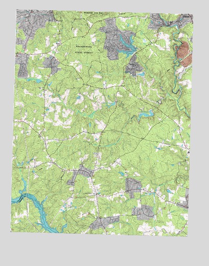
Beach, VA USGS Topographic Map
Click on map above to begin viewing in our Map Viewer.

This topographic map contains these locations and features:
Feature Name Type Latitude Longitude GNIS ID View Map
BeachLocaleN37.3551°W77.5947°1462848View Map
Camp BakerLocaleN37.3688°W77.5169°1464305View Map
Carson Volunteer Fire Department SubstationBuildingN37.2703°W77.5969°2086067View Map
Cattle CreekStreamN37.2704°W77.6178°1464569View Map
Chesterfield Fire and Emergency Medical Services Station 13 PhillipsBuildingN37.2773°W77.5668°2331865View Map
Chesterfield Meadows Shopping CenterLocaleN37.3724°W77.5005°1760048View Map
Chesterfield Post OfficePost OfficeN37.3739°W77.5083°1759933View Map
Crostick DamDamN37.3238°W77.5533°1489477View Map
Crostick MillpondReservoirN37.3228°W77.5561°1501996View Map
Dahl CemeteryCemeteryN37.3032°W77.6050°1465570View Map
Dale QuarryMineN37.3497°W77.5047°2724883View Map
Fendley (historical)Populated PlaceN37.3718°W77.5594°1760154View Map
First BranchStreamN37.3421°W77.5314°1466579View Map
Gill Grove CemeteryCemeteryN37.2795°W77.5680°1760067View Map
Gill Grove ChurchChurchN37.2793°W77.5678°1467086View Map
Gills PondReservoirN37.2738°W77.5251°1467101View Map
Highlands Golfers ClubLocaleN37.3330°W77.5296°2520167View Map
Ivys PondsReservoirN37.2874°W77.6209°1468565View Map
Lake DaleReservoirN37.3390°W77.5092°1501998View Map
Lake Dale DamDamN37.3385°W77.5097°1489467View Map
Lake MargaretReservoirN37.3178°W77.5314°1502064View Map
Lake Margaret DamDamN37.3201°W77.5272°1489460View Map
LeaderPopulated PlaceN37.2724°W77.5655°1760090View Map
Lees ChapelChurchN37.2988°W77.6011°1469276View Map
Licking CreekStreamN37.3257°W77.5097°1469413View Map
Locust BranchStreamN37.2729°W77.5255°1469722View Map
Mann BranchStreamN37.3226°W77.5905°1470052View Map
Mount Gilead ChurchChurchN37.3363°W77.5792°1470873View Map
Mount Gilead United Methodist Church CemeteryCemeteryN37.3368°W77.5800°1760101View Map
Nash GrovePopulated PlaceN37.2854°W77.5708°1760102View Map
Nash Road LakeReservoirN37.3554°W77.5457°1489483View Map
Nash Road Lake DamDamN37.3535°W77.5414°1489482View Map
Oak Grove Baptist ChurchChurchN37.3004°W77.5153°1471721View Map
Oak Grove Baptist Church CemeteryCemeteryN37.3009°W77.5158°1760105View Map
Phillips Station Number 13BuildingN37.2775°W77.5669°2075490View Map
Piney BranchStreamN37.3354°W77.5114°1472385View Map
Pocahontas State ForestForestN37.3565°W77.5775°1472539View Map
Rita BranchStreamN37.3126°W77.5436°1473257View Map
Rocky RunStreamN37.3724°W77.6150°1473490View Map
Rudy Store (historical)LocaleN37.2665°W77.5017°1760125View Map
Second BranchStreamN37.3285°W77.5167°1474138View Map
Shoosmith Sanitary LandfillLocaleN37.3453°W77.5068°2519493View Map
Southern Area LandfillLocaleN37.3529°W77.5080°1760136View Map
Traylor CemeteryCemeteryN37.2588°W77.5628°1475843View Map
Union Branch CemeteryCemeteryN37.2854°W77.5893°1760144View Map
Union Branch ChurchChurchN37.2846°W77.5897°1476024View Map
Union Branch Elementary SchoolSchoolN37.2882°W77.5947°1476027View Map
Union Grove ChurchChurchN37.2560°W77.5019°1476066View Map
Union Grove SchoolSchoolN37.2518°W77.5061°1476069View Map
Vaughn DamDamN37.2768°W77.5147°1489495View Map
Wilson CemeteryCemeteryN37.3307°W77.6053°1476815View Map

Note: Coordinates in the location and feature list above are referenced to NAD83 datum.


Copyright (C) 2008-2025 Ryan Niemi / Sunset Dynamics ... All Rights Reserved