TopoQuest Logo
Do you find TopoQuest useful?
Help keep TopoQuest running and adding new maps/features by donating!
Bitcoin:  19c7KJd3qBynnjoSw5npx9KScwjBe4ifkT
Litecoin:  LXs6TkuXGGXo1vDsWCkWVdjQX94eUKd6ui
Home View Maps Find Maps Find Places Resources & Links


Marion Lake, Oregon Topographic Map

USGS Map Title: Marion Lake, OR
USGS Map MRC: 44121E7
DRG (GeoTIFF) Download: o44121e7.tif


Neighboring USGS Topographic Map Quads:


  Mount Bruno, OR  
44121F8
 

  Mount Jefferson, OR  
44121F7
 

  Lionshead, OR  
44121F6
 

  Marion Forks, OR  
44121E8
 

  Marion Lake, OR  
44121E7
 

  Candle Creek, OR  
44121E6
 

  Santiam Junction, OR  
44121D8
 

  Three Fingered Jack, OR  
44121D7
 

  Black Butte, OR  
44121D6


Map MRC Location:

N45°
W122°
N45°
W121°
H8 H7 H6 H5 H4 H3 H2 H1
G8 G7 G6 G5 G4 G3 G2 G1
F8 F7 F6 F5 F4 F3 F2 F1
E8 E7 E6 E5 E4 E3 E2 E1
D8 D7 D6 D5 D4 D3 D2 D1
C8 C7 C6 C5 C4 C3 C2 C1
B8 B7 B6 B5 B4 B3 B2 B1
A8 A7 A6 A5 A4 A3 A2 A1
N44°
W122°
N44°
W121°

Marion Lake, OR USGS 1:24K Topographic Map Preview:
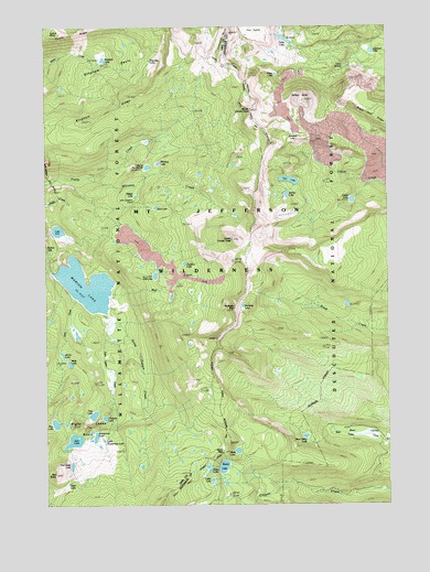
Marion Lake, OR USGS Topographic Map
Click on map above to begin viewing in our Map Viewer.

This topographic map contains these locations and features:
Feature Name Type Latitude Longitude GNIS ID View Map
Alice LakeLakeN44.5057°W121.8684°1137124View Map
Bear ValleyValleyN44.5162°W121.7514°1137759View Map
Bear Valley LakeFlatN44.5179°W121.7817°1116610View Map
Bingham BasinBasinN44.6129°W121.8545°1138131View Map
Bingham LakeLakeN44.6163°W121.8547°1138134View Map
Bingham Ridge TrailTrailN44.5993°W121.8701°1138139View Map
Blue LakeLakeN44.5213°W121.8730°1138313View Map
Blue Lake TrailTrailN44.5526°W121.8728°1138317View Map
Bowerman LakeLakeN44.5178°W121.8583°1138516View Map
Brush Creek TrailTrailN44.5554°W121.7576°1138720View Map
Cabot LakeLakeN44.5794°W121.7640°1139122View Map
Camp MarionLocaleN44.5568°W121.8509°1139253View Map
Carl LakeLakeN44.5847°W121.7868°1139374View Map
Cathedral RocksSummitN44.6233°W121.8075°1139468View Map
Catlin LakeLakeN44.5064°W121.8160°1139471View Map
Chiquito LakeLakeN44.5227°W121.8549°1139705View Map
Eight Lakes BasinBasinN44.5207°W121.8634°1141701View Map
Eight Lakes CreekStreamN44.5501°W121.8537°1141702View Map
Forked ButteSummitN44.6057°W121.7808°1142304View Map
Horse Pasture CreekStreamN44.5473°W121.8520°1143776View Map
Jack CreekStreamN44.5540°W121.8656°1144162View Map
Jefferson LakeLakeN44.6181°W121.7564°1144241View Map
Jenny LakeLakeN44.5393°W121.8701°1144253View Map
John Swallow GraveCemeteryN44.5793°W121.8437°1144309View Map
Jorn LakeLakeN44.5167°W121.8663°1144402View Map
Junction LakeLakeN44.5965°W121.7851°1144433View Map
Koko LakeLakeN44.5099°W121.8176°1156682View Map
Lake AnnLakeN44.5717°W121.8716°1137223View Map
Lake of the WoodsLakeN44.5883°W121.8387°1152644View Map
Lava SpringSpringN44.6145°W121.7669°1144880View Map
Little Bowerman LakeLakeN44.5170°W121.8554°1156683View Map
Lizard PointSummitN44.6240°W121.8703°1145301View Map
Lizard RidgeRidgeN44.6229°W121.8653°1145302View Map
Marion LakeLakeN44.5573°W121.8615°1145813View Map
Marion Lake Guard StationLocaleN44.5651°W121.8667°1145814View Map
Mazama Creek Campground (historical)ParkN44.5607°W121.8559°1145899View Map
Melis LakeLakeN44.5370°W121.8676°1146084View Map
Midget LakeLakeN44.5807°W121.8432°1146188View Map
Minto LakeLakeN44.5141°W121.8065°1116611View Map
Minto PassGapN44.5135°W121.8115°1146347View Map
Minto Pass TrailTrailN44.5201°W121.8231°1146348View Map
Mist CreekStreamN44.5551°W121.8520°1146367View Map
Mount Jefferson WildernessReserveN44.5908°W121.8346°1155122View Map
North Cinder PeakSummitN44.6035°W121.8009°1146889View Map
Papoose LakeLakeN44.6159°W121.8375°1147407View Map
Patsy LakeLakeN44.6122°W121.7915°1147491View Map
Prill LakeLakeN44.5599°W121.8362°1147997View Map
Red ButteSummitN44.5082°W121.8731°1148278View Map
Red Butte LakeLakeN44.5102°W121.8671°1148279View Map
Rockpile LakeLakeN44.5520°W121.8043°1148645View Map
Rockpile MountainSummitN44.5512°W121.8073°1148646View Map
Sad LakeLakeN44.5778°W121.8358°1148894View Map
Shirley LakeLakeN44.5810°W121.7879°1149404View Map
South Cinder PeakSummitN44.5690°W121.8078°1149912View Map
Summit TrailTrailN44.5251°W121.7845°1150646View Map
Swallow LakeLakeN44.5630°W121.8254°1127786View Map
Swallow Lake TrailTrailN44.5723°W121.8292°1150728View Map
Table LakeLakeN44.6214°W121.7881°1150811View Map
Teto LakeLakeN44.5235°W121.8590°1150988View Map
Wasco LakeLakeN44.5099°W121.8116°1151919View Map
Whiskey CreekStreamN44.5873°W121.8601°1152186View Map
Whiskey LakeLakeN44.5893°W121.8347°1152193View Map

Note: Coordinates in the location and feature list above are referenced to NAD83 datum.


Copyright (C) 2008-2025 Ryan Niemi / Sunset Dynamics ... All Rights Reserved