TopoQuest Logo
Do you find TopoQuest useful?
Help keep TopoQuest running and adding new maps/features by donating!
Bitcoin:  19c7KJd3qBynnjoSw5npx9KScwjBe4ifkT
Litecoin:  LXs6TkuXGGXo1vDsWCkWVdjQX94eUKd6ui
Home View Maps Find Maps Find Places Resources & Links


Mount Jefferson, Oregon Topographic Map

USGS Map Title: Mount Jefferson, OR
USGS Map MRC: 44121F7
DRG (GeoTIFF) Download: o44121f7.tif


Neighboring USGS Topographic Map Quads:


  Breitenbush Hot Springs, OR  
44121G8
 

  Olallie Butte, OR  
44121G7
 

  Boulder Lake, OR  
44121G6
 

  Mount Bruno, OR  
44121F8
 

  Mount Jefferson, OR  
44121F7
 

  Lionshead, OR  
44121F6
 

  Marion Forks, OR  
44121E8
 

  Marion Lake, OR  
44121E7
 

  Candle Creek, OR  
44121E6


Map MRC Location:

N45°
W122°
N45°
W121°
H8 H7 H6 H5 H4 H3 H2 H1
G8 G7 G6 G5 G4 G3 G2 G1
F8 F7 F6 F5 F4 F3 F2 F1
E8 E7 E6 E5 E4 E3 E2 E1
D8 D7 D6 D5 D4 D3 D2 D1
C8 C7 C6 C5 C4 C3 C2 C1
B8 B7 B6 B5 B4 B3 B2 B1
A8 A7 A6 A5 A4 A3 A2 A1
N44°
W122°
N44°
W121°

Mount Jefferson, OR USGS 1:24K Topographic Map Preview:
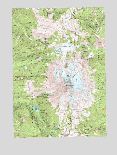
Mount Jefferson, OR USGS Topographic Map
Click on map above to begin viewing in our Map Viewer.

This topographic map contains these locations and features:
Feature Name Type Latitude Longitude GNIS ID View Map
Bays LakeLakeN44.7072°W121.8169°1137608View Map
Bear ButteSummitN44.6315°W121.7639°1137633View Map
Bear LakeLakeN44.7492°W121.8426°1137724View Map
Coyote LakeLakeN44.6369°W121.8195°1140331View Map
Dinah-mo PeakSummitN44.7438°W121.8286°1155377View Map
Flapper SpringsSpringN44.6569°W121.8552°1156684View Map
Flapper Springs Guard StationLocaleN44.6557°W121.8503°1142226View Map
Goat PeakSummitN44.6431°W121.7985°1142787View Map
Grizzly FlatFlatN44.6348°W121.8601°1143103View Map
Grizzly PeakSummitN44.6436°W121.8533°1143110View Map
Hanks LakeLakeN44.6273°W121.8233°1143265View Map
Hole-in-the-Wall ParkFlatN44.6329°W121.7778°1143663View Map
Hunts CoveBasinN44.6287°W121.8203°1143953View Map
Hunts CreekStreamN44.6504°W121.8442°1143954View Map
Hunts LakeLakeN44.6322°W121.8215°1143955View Map
Jeff CreekStreamN44.6948°W121.8623°1144237View Map
Jefferson Creek TrailTrailN44.6576°W121.7603°1144240View Map
Jefferson ParkValleyN44.7123°W121.8053°1154261View Map
Jefferson Park GlacierGlacierN44.6845°W121.8065°1144243View Map
Jefferson Park TrailTrailN44.7151°W121.8706°1144244View Map
Kuckup ParkFlatN44.7460°W121.7751°1144711View Map
Lizard LakeLakeN44.6272°W121.8688°1145300View Map
Milk Creek GlacierGlacierN44.6740°W121.8022°1156484View Map
Mount JeffersonSummitN44.6742°W121.7997°1144246View Map
Pamelia LakeLakeN44.6533°W121.8466°1147380View Map
Pamelia Lake TrailTrailN44.6587°W121.8678°1147381View Map
Park ButteSummitN44.7210°W121.8070°1147430View Map
Park LakeLakeN44.7123°W121.8130°1147437View Map
Quitters PointSummitN44.7493°W121.8717°1159087View Map
Rock LakeLakeN44.7099°W121.8137°1148614View Map
Russell GlacierGlacierN44.6852°W121.8168°1148858View Map
Russell LakeLakeN44.7149°W121.7998°1148859View Map
Scout LakeLakeN44.7081°W121.8117°1149187View Map
Sentinel HillsSummitN44.7088°W121.8276°1149233View Map
Shale LakeLakeN44.6361°W121.8164°1149279View Map
Sprague LakeLakeN44.7257°W121.8046°1154326View Map
The TableSummitN44.6273°W121.8003°1151046View Map
Waldo GlacierGlacierN44.6627°W121.7960°1151816View Map
Whitewater GlacierGlacierN44.6813°W121.7908°1152272View Map
Whitewater LakeLakeN44.6911°W121.8594°1152273View Map

Note: Coordinates in the location and feature list above are referenced to NAD83 datum.


Copyright (C) 2008-2025 Ryan Niemi / Sunset Dynamics ... All Rights Reserved