TopoQuest Logo
Do you find TopoQuest useful?
Help keep TopoQuest running and adding new maps/features by donating!
Bitcoin:  19c7KJd3qBynnjoSw5npx9KScwjBe4ifkT
Litecoin:  LXs6TkuXGGXo1vDsWCkWVdjQX94eUKd6ui
Home View Maps Find Maps Find Places Resources & Links


Candle Creek, Oregon Topographic Map

USGS Map Title: Candle Creek, OR
USGS Map MRC: 44121E6
DRG (GeoTIFF) Download: o44121e6.tif


Neighboring USGS Topographic Map Quads:


  Mount Jefferson, OR  
44121F7
 

  Lionshead, OR  
44121F6
 

  Shitike Butte, OR  
44121F5
 

  Marion Lake, OR  
44121E7
 

  Candle Creek, OR  
44121E6
 

  Prairie Farm Spring, OR  
44121E5
 

  Three Fingered Jack, OR  
44121D7
 

  Black Butte, OR  
44121D6
 

  Little Squaw Back, OR  
44121D5


Map MRC Location:

N45°
W122°
N45°
W121°
H8 H7 H6 H5 H4 H3 H2 H1
G8 G7 G6 G5 G4 G3 G2 G1
F8 F7 F6 F5 F4 F3 F2 F1
E8 E7 E6 E5 E4 E3 E2 E1
D8 D7 D6 D5 D4 D3 D2 D1
C8 C7 C6 C5 C4 C3 C2 C1
B8 B7 B6 B5 B4 B3 B2 B1
A8 A7 A6 A5 A4 A3 A2 A1
N44°
W122°
N44°
W121°

Candle Creek, OR USGS 1:24K Topographic Map Preview:
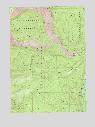
Candle Creek, OR USGS Topographic Map
Click on map above to begin viewing in our Map Viewer.

This topographic map contains these locations and features:
Feature Name Type Latitude Longitude GNIS ID View Map
Abbot ButteSummitN44.5576°W121.7089°1136992View Map
Abbot Butte SpringSpringN44.5549°W121.7284°1136993View Map
Abbot Creek Recreation SiteLocaleN44.5457°W121.6731°1161245View Map
Allen Springs Recreation SiteLocaleN44.5287°W121.6303°1161251View Map
Bear Valley CreekStreamN44.5096°W121.7326°1137762View Map
Brush CreekStreamN44.5040°W121.6587°1138717View Map
Cabot CreekStreamN44.5829°W121.6784°1139121View Map
Cabot Lake TrailTrailN44.5768°W121.7440°1139123View Map
Canyon CreekStreamN44.5010°W121.6426°1139331View Map
Canyon Creek Recreation SiteLocaleN44.5048°W121.6534°1139334View Map
Cold SpringSpringN44.5412°W121.6677°1139940View Map
Cougar SpringSpringN44.6056°W121.6925°1155408View Map
Jefferson Lake TrailTrailN44.6221°W121.7251°1144242View Map
Roaring CreekStreamN44.5079°W121.6873°1148516View Map
Roaring SpringSpringN44.5267°W121.7084°1148527View Map
Sheep Spring Horse CampLocaleN44.5221°W121.6987°1155899View Map
Sugar Pine RidgeRidgeN44.5962°W121.7262°1150542View Map
Sugar Pine Ridge TrailTrailN44.6018°W121.7470°1150543View Map
Sugarpine SpringSpringN44.5995°W121.7418°1155409View Map
Two SpringsSpringN44.5321°W121.7445°1151613View Map
Wizard FallsFallsN44.5187°W121.6321°1152565View Map
Wizard Falls Campground (historical)LocaleN44.5209°W121.6320°1161597View Map
Wizard Falls State Fish HatcheryLocaleN44.5229°W121.6328°1159337View Map
Wizzard Falls SpringSpringN44.5197°W121.6350°1153047View Map

Note: Coordinates in the location and feature list above are referenced to NAD83 datum.


Copyright (C) 2008-2025 Ryan Niemi / Sunset Dynamics ... All Rights Reserved