TopoQuest Logo
Do you find TopoQuest useful?
Help keep TopoQuest running and adding new maps/features by donating!
Bitcoin:  19c7KJd3qBynnjoSw5npx9KScwjBe4ifkT
Litecoin:  LXs6TkuXGGXo1vDsWCkWVdjQX94eUKd6ui
Home View Maps Find Maps Find Places Resources & Links


Arpin, Wisconsin Topographic Map

USGS Map Title: Arpin, WI
USGS Map MRC: 44090E1
DRG (GeoTIFF) Download: o44090e1.tif


Neighboring USGS Topographic Map Quads:


  Marshfield, WI  
44090F2
 

  Hewitt, WI  
44090F1
 

  Honey Island, WI  
44089F8
 

  Lake Manakiki, WI  
44090E2
 

  Arpin, WI  
44090E1
 

  Sherry, WI  
44089E8
 

  Pittsville, WI  
44090D2
 

  Lake Dexter, WI  
44090D1
 

  Vesper, WI  
44089D8


Map MRC Location:

N45°
W91°
N45°
W90°
H8 H7 H6 H5 H4 H3 H2 H1
G8 G7 G6 G5 G4 G3 G2 G1
F8 F7 F6 F5 F4 F3 F2 F1
E8 E7 E6 E5 E4 E3 E2 E1
D8 D7 D6 D5 D4 D3 D2 D1
C8 C7 C6 C5 C4 C3 C2 C1
B8 B7 B6 B5 B4 B3 B2 B1
A8 A7 A6 A5 A4 A3 A2 A1
N44°
W91°
N44°
W90°

Arpin, WI USGS 1:24K Topographic Map Preview:
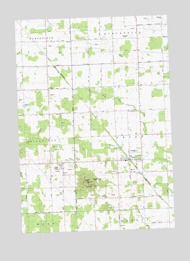
Arpin, WI USGS Topographic Map
Click on map above to begin viewing in our Map Viewer.

This topographic map contains these locations and features:
Feature Name Type Latitude Longitude GNIS ID View Map
ArpinPopulated PlaceN44.5405°W90.0351°1560955View Map
Arpin CemeteryCemeteryN44.5344°W90.0457°1560956View Map
Arpin SchoolSchoolN44.5350°W90.0343°1560958View Map
Arpin Volunteer Fire DepartmentBuildingN44.5403°W90.0349°2698162View Map
Berryland FarmLocaleN44.6236°W90.0750°2631411View Map
BethelPopulated PlaceN44.5405°W90.0899°1561624View Map
Bethel CemeteryCemeteryN44.5350°W90.0904°1561631View Map
Bethel Junior AcademySchoolN44.5375°W90.0892°2715821View Map
Greenwood CemeteryCemeteryN44.6233°W90.0040°1565869View Map
Indian Bill CemeteryCemeteryN44.5261°W90.0721°1566897View Map
John Ne-Wee CemeteryCemeteryN44.5288°W90.0704°1567200View Map
Kandy Kane ParkParkN44.5411°W90.0326°1567340View Map
Maple Grove School (historical)SchoolN44.5333°W90.0996°1847046View Map
Mill Creek Grove School (historical)SchoolN44.6116°W90.1154°1847056View Map
North Arpin ChurchChurchN44.5694°W90.0307°1570348View Map
North Arpin School (historical)SchoolN44.5769°W90.0260°1847064View Map
Powers Bluff County ParkParkN44.5300°W90.0726°1571856View Map
Powers Bluff Maple Woods State Natural AreaParkN44.5300°W90.0676°2061067View Map
Shady Nook School (historical)SchoolN44.5839°W90.1001°1847118View Map
Slidre CemeteryCemeteryN44.6111°W90.0793°1574273View Map
Town of ArpinCivilN44.5551°W90.0217°1582719View Map
Town of MarshfieldCivilN44.6189°W90.0946°1583667View Map
Trinity CemeteryCemeteryN44.5197°W90.0251°1575613View Map
Village of ArpinCivilN44.5394°W90.0317°1582718View Map
WLBL-AM (Auburndale)TowerN44.6144°W90.0357°1582288View Map
Woodland Echo School (historical)SchoolN44.5722°W90.0657°1847144View Map

Note: Coordinates in the location and feature list above are referenced to NAD83 datum.


Copyright (C) 2008-2024 Ryan Niemi / Sunset Dynamics ... All Rights Reserved