TopoQuest Logo
Do you find TopoQuest useful?
Help keep TopoQuest running and adding new maps/features by donating!
Bitcoin:  19c7KJd3qBynnjoSw5npx9KScwjBe4ifkT
Litecoin:  LXs6TkuXGGXo1vDsWCkWVdjQX94eUKd6ui
Home View Maps Find Maps Find Places Resources & Links


Martin, Michigan Topographic Map

USGS Map Title: Martin, MI
USGS Map MRC: 42085E6
DRG (GeoTIFF) Download: o42085e6.tif


Neighboring USGS Topographic Map Quads:


  Burnips, MI  
42085F7
 

  Wayland, MI  
42085F6
 

  Bowens Mill, MI  
42085F5
 

  Allegan, MI  
42085E7
 

  Martin, MI  
42085E6
 

  Orangeville, MI  
42085E5
 

  Merson, MI  
42085D7
 

  Otsego, MI  
42085D6
 

  Kalamazoo NE, MI  
42085D5


Map MRC Location:

N43°
W86°
N43°
W85°
H8 H7 H6 H5 H4 H3 H2 H1
G8 G7 G6 G5 G4 G3 G2 G1
F8 F7 F6 F5 F4 F3 F2 F1
E8 E7 E6 E5 E4 E3 E2 E1
D8 D7 D6 D5 D4 D3 D2 D1
C8 C7 C6 C5 C4 C3 C2 C1
B8 B7 B6 B5 B4 B3 B2 B1
A8 A7 A6 A5 A4 A3 A2 A1
N42°
W86°
N42°
W85°

Martin, MI USGS 1:24K Topographic Map Preview:
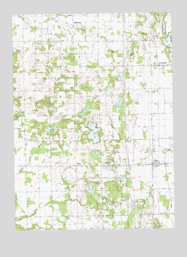
Martin, MI USGS Topographic Map
Click on map above to begin viewing in our Map Viewer.

This topographic map contains these locations and features:
Feature Name Type Latitude Longitude GNIS ID View Map
Big LakeLakeN42.5529°W85.6874°621325View Map
Buskirk LakeLakeN42.6011°W85.6587°2109192View Map
Butternut CreekStreamN42.5783°W85.6797°2109191View Map
Caruthers LakeLakeN42.5282°W85.6643°622818View Map
Country Meadows Mobile Home CommunityPopulated PlaceN42.5381°W85.6686°2574356View Map
Fisk Station (historical)LocaleN42.5300°W85.7011°2574102View Map
Geneva LakeLakeN42.6175°W85.6316°626724View Map
Goldspring DrainCanalN42.5292°W85.7106°2109190View Map
Hicks CemeteryCemeteryN42.5439°W85.6808°628198View Map
Hicks LakeLakeN42.5445°W85.6864°628200View Map
Hidden Ridge RV ResortLocaleN42.5881°W85.6667°2574330View Map
Hidden Valley Golf CourseLocaleN42.6100°W85.6500°2574240View Map
Hopkins Fire Department Station 2BuildingN42.5519°W85.7321°2636056View Map
HopkinsburgPopulated PlaceN42.6189°W85.7028°628581View Map
Hughes SchoolSchoolN42.5145°W85.7003°628784View Map
Ingerson CemeteryCemeteryN42.6167°W85.6933°629034View Map
Ingerson LakeLakeN42.6047°W85.7493°629035View Map
Interchange 55CrossingN42.5367°W85.6597°2574065View Map
Interchange 59CrossingN42.5947°W85.6617°2574064View Map
Little Gem Mobile Home CourtPopulated PlaceN42.5436°W85.6417°2574355View Map
MartinPopulated PlaceN42.5370°W85.6417°631648View Map
Martin Fire DepartmentBuildingN42.5355°W85.6413°2636058View Map
Martin High SchoolSchoolN42.5361°W85.6378°2574331View Map
Martin Post OfficePost OfficeN42.5367°W85.6417°2574328View Map
Martin Reformed ChurchChurchN42.5381°W85.6489°2574326View Map
Martin StationLocaleN42.5372°W85.6319°2574354View Map
Martin Township LibraryBuildingN42.5350°W85.6414°2574329View Map
Martin United Methodist ChurchChurchN42.5375°W85.6389°2574325View Map
Martin US 131 RacewayLocaleN42.5139°W85.6600°2109189View Map
Miller LakeLakeN42.5723°W85.6675°632379View Map
Miller Lake CampgroundLocaleN42.5764°W85.6633°2574343View Map
Miner CemeteryCemeteryN42.5497°W85.7422°632447View Map
Monteith Post Office (historical)Post OfficeN42.5222°W85.6389°2574125View Map
Monteith StationPopulated PlaceN42.5222°W85.6389°2574104View Map
Monteith Station (historical)LocaleN42.5222°W85.6389°2574097View Map
Osborn SchoolSchoolN42.5364°W85.7411°634128View Map
Pickerel LakeLakeN42.5655°W85.6955°634780View Map
River of Life ChurchChurchN42.5444°W85.6628°2574327View Map
Sacred Heart Catholic CemeteryCemeteryN42.5694°W85.7417°2574056View Map
Sacred Heart ChurchChurchN42.5684°W85.7422°636463View Map
Schnable LakeLakeN42.5235°W85.6908°637352View Map
School Section LakeLakeN42.5584°W85.7227°637415View Map
Selkirk LakeLakeN42.6096°W85.6268°637567View Map
Shagnasty LakeLakeN42.5689°W85.6946°637643View Map
ShelbyvillePopulated PlaceN42.5942°W85.6372°637713View Map
Shelbyville Post OfficePost OfficeN42.5950°W85.6350°2574236View Map
Shelbyville StationLocaleN42.5944°W85.6367°2574238View Map
Shelbyville United Methodist ChurchChurchN42.5944°W85.6347°2574237View Map
South Martin CemeteryCemeteryN42.5195°W85.6422°638387View Map
Spring Run DrainCanalN42.6097°W85.7019°2109193View Map
Township of WatsonCivilN42.5514°W85.7214°1627226View Map
Village of MartinCivilN42.5370°W85.6389°2399264View Map
WatsonPopulated PlaceN42.5370°W85.7017°1615871View Map
Watson Bible ChurchChurchN42.5372°W85.6994°2574318View Map
Watson Post Office (historical)Post OfficeN42.5369°W85.7017°2574106View Map
Wayland Area Ambulance ServiceBuildingN42.5355°W85.6413°2661939View Map
Wetheral LakeLakeN42.5375°W85.6787°1616240View Map

Note: Coordinates in the location and feature list above are referenced to NAD83 datum.


Copyright (C) 2008-2024 Ryan Niemi / Sunset Dynamics ... All Rights Reserved