TopoQuest Logo
Do you find TopoQuest useful?
Help keep TopoQuest running and adding new maps/features by donating!
Bitcoin:  19c7KJd3qBynnjoSw5npx9KScwjBe4ifkT
Litecoin:  LXs6TkuXGGXo1vDsWCkWVdjQX94eUKd6ui
Home View Maps Find Maps Find Places Resources & Links


Merson, Michigan Topographic Map

USGS Map Title: Merson, MI
USGS Map MRC: 42085D7
DRG (GeoTIFF) Download: o42085d7.tif


Neighboring USGS Topographic Map Quads:


  Millgrove, MI  
42085E8
 

  Allegan, MI  
42085E7
 

  Martin, MI  
42085E6
 

  Bloomingdale, MI  
42085D8
 

  Merson, MI  
42085D7
 

  Otsego, MI  
42085D6
 

  Gobles West, MI  
42085C8
 

  Gobles East, MI  
42085C7
 

  Kalamazoo SW, MI  
42085C6


Map MRC Location:

N43°
W86°
N43°
W85°
H8 H7 H6 H5 H4 H3 H2 H1
G8 G7 G6 G5 G4 G3 G2 G1
F8 F7 F6 F5 F4 F3 F2 F1
E8 E7 E6 E5 E4 E3 E2 E1
D8 D7 D6 D5 D4 D3 D2 D1
C8 C7 C6 C5 C4 C3 C2 C1
B8 B7 B6 B5 B4 B3 B2 B1
A8 A7 A6 A5 A4 A3 A2 A1
N42°
W86°
N42°
W85°

Merson, MI USGS 1:24K Topographic Map Preview:
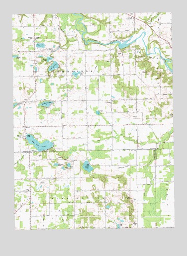
Merson, MI USGS Topographic Map
Click on map above to begin viewing in our Map Viewer.

This topographic map contains these locations and features:
Feature Name Type Latitude Longitude GNIS ID View Map
Base Line CreekStreamN42.4253°W85.7597°620671View Map
Base Line LakeLakeN42.4249°W85.8550°620672View Map
Becker SchoolSchoolN42.4014°W85.7786°620968View Map
Bittersweet Ski ResortLocaleN42.4639°W85.7625°2574161View Map
Blackman CemeteryCemeteryN42.4861°W85.8583°2109212View Map
Buell LakeLakeN42.4122°W85.8322°622205View Map
Clear LakeLakeN42.4111°W85.8176°623410View Map
Clifford SchoolSchoolN42.4792°W85.8320°623468View Map
Eagle Creek Golf ClubLocaleN42.4975°W85.7819°2109211View Map
Earl CemeteryCemeteryN42.3972°W85.8239°2112784View Map
Foster LakeLakeN42.4682°W85.8570°626314View Map
Foster SchoolSchoolN42.4545°W85.8575°626319View Map
Gobles Junior AcademySchoolN42.3978°W85.8636°2112786View Map
Har-Lou Golf CourseLocaleN42.4028°W85.8528°2112785View Map
Harper SchoolSchoolN42.4389°W85.8167°627820View Map
Hart SchoolSchoolN42.4523°W85.7586°627878View Map
Hicks SchoolSchoolN42.4428°W85.7970°628204View Map
Hillman LakeLakeN42.4126°W85.8421°632417View Map
Hodge LakeLakeN42.4424°W85.8090°628369View Map
Lake SixteenLakeN42.4696°W85.8430°638034View Map
Long LakeLakeN42.3762°W85.7942°630971View Map
Lynx Golf CourseLocaleN42.4792°W85.7667°2574168View Map
Mallery CemeteryCemeteryN42.4859°W85.8561°631357View Map
MersonPopulated PlaceN42.4348°W85.8661°1617718View Map
Merson ChurchChurchN42.4353°W85.8669°2574927View Map
Merson Post Office (historical)Post OfficeN42.4347°W85.8661°2573907View Map
Middle LakeLakeN42.4739°W85.8466°632259View Map
Minkler LakeLakeN42.4479°W85.8494°632457View Map
North Point HallLocaleN42.4048°W85.8622°633629View Map
Osgood DrainStreamN42.4820°W85.7928°634136View Map
Osgood LakeLakeN42.4650°W85.8258°634137View Map
Otto SchoolSchoolN42.4361°W85.7528°634199View Map
Pike LakeLakeN42.4818°W85.8531°634867View Map
Pine Grove SchoolSchoolN42.4175°W85.7786°634938View Map
Prouty SchoolSchoolN42.4939°W85.8664°635497View Map
Quail Trap SchoolSchoolN42.3761°W85.8034°635537View Map
Ross SchoolSchoolN42.4636°W85.7989°636255View Map
Schnable BrookStreamN42.4945°W85.7656°637351View Map
Sheffer LakeLakeN42.4757°W85.8732°637710View Map
Timber Ridge Ski AreaLocaleN42.3917°W85.7811°2112783View Map
Township of Pine GroveCivilN42.3766°W85.8210°1626904View Map
Township of TrowbridgeCivilN42.4637°W85.8371°1627174View Map
Trow Bridge ChurchChurchN42.4478°W85.7984°1615121View Map
Trowbridge DamLocaleN42.4828°W85.7964°1615122View Map
Trowbridge Methodist CemeteryCemeteryN42.4467°W85.7983°2574034View Map
Veley DrainCanalN42.3961°W85.8333°2112782View Map

Note: Coordinates in the location and feature list above are referenced to NAD83 datum.


Copyright (C) 2008-2025 Ryan Niemi / Sunset Dynamics ... All Rights Reserved