TopoQuest Logo
Do you find TopoQuest useful?
Help keep TopoQuest running and adding new maps/features by donating!
Bitcoin:  19c7KJd3qBynnjoSw5npx9KScwjBe4ifkT
Litecoin:  LXs6TkuXGGXo1vDsWCkWVdjQX94eUKd6ui
Home View Maps Find Maps Find Places Resources & Links


Otsego, Michigan Topographic Map

USGS Map Title: Otsego, MI
USGS Map MRC: 42085D6
DRG (GeoTIFF) Download: o42085d6.tif


Neighboring USGS Topographic Map Quads:


  Allegan, MI  
42085E7
 

  Martin, MI  
42085E6
 

  Orangeville, MI  
42085E5
 

  Merson, MI  
42085D7
 

  Otsego, MI  
42085D6
 

  Kalamazoo NE, MI  
42085D5
 

  Gobles East, MI  
42085C7
 

  Kalamazoo SW, MI  
42085C6
 

  Kalamazoo, MI  
42085C5


Map MRC Location:

N43°
W86°
N43°
W85°
H8 H7 H6 H5 H4 H3 H2 H1
G8 G7 G6 G5 G4 G3 G2 G1
F8 F7 F6 F5 F4 F3 F2 F1
E8 E7 E6 E5 E4 E3 E2 E1
D8 D7 D6 D5 D4 D3 D2 D1
C8 C7 C6 C5 C4 C3 C2 C1
B8 B7 B6 B5 B4 B3 B2 B1
A8 A7 A6 A5 A4 A3 A2 A1
N42°
W86°
N42°
W85°

Otsego, MI USGS 1:24K Topographic Map Preview:
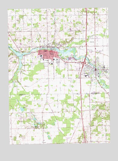
Otsego, MI USGS Topographic Map
Click on map above to begin viewing in our Map Viewer.

This topographic map contains these locations and features:
Feature Name Type Latitude Longitude GNIS ID View Map
AlamoPopulated PlaceN42.3753°W85.7078°619888View Map
Alamo Post Office (historical)Post OfficeN42.3753°W85.7078°2612234View Map
Allegan Street Elementary SchoolSchoolN42.4608°W85.7031°2574317View Map
American CampgroundsLocaleN42.3906°W85.7169°2627726View Map
Barbour LakeLakeN42.3923°W85.7173°620588View Map
Borgess Family MedicineHospitalN42.4464°W85.6525°2574297View Map
Borgess Pipp HospitalHospitalN42.4470°W85.6539°2574298View Map
Calvary ChurchChurchN42.4442°W85.6608°622486View Map
Church of ChristChurchN42.4394°W85.6328°2574283View Map
City of OtsegoCivilN42.4570°W85.6975°1626868View Map
City of PlainwellCivilN42.4458°W85.6434°1626913View Map
Dent Post Office (historical)Post OfficeN42.4786°W85.7489°2573941View Map
Dix Street SchoolSchoolN42.4534°W85.6889°624708View Map
Faith ChurchChurchN42.3767°W85.6489°625798View Map
Fannie Pell ParkParkN42.4450°W85.6417°2576222View Map
First Baptist ChurchChurchN42.4431°W85.6467°2574285View Map
First Baptist ChurchChurchN42.4600°W85.6928°2574306View Map
First Congregational ChurchChurchN42.4578°W85.6981°2574309View Map
First Presbyterian ChurchChurchN42.4433°W85.6389°2574284View Map
First United Methodist ChurchChurchN42.4417°W85.6439°2574286View Map
Friendship Wesleyan ChurchChurchN42.4356°W85.6667°2574281View Map
Gilkey Elementary SchoolSchoolN42.4394°W85.6381°2574295View Map
Good Shepherd Nazarene ChurchChurchN42.4606°W85.7108°2574307View Map
Green Bower CemeteryCemeteryN42.3975°W85.6606°627284View Map
Gun RiverStreamN42.4609°W85.6808°627536View Map
Gun River Mobile EstatesPopulated PlaceN42.4722°W85.6378°2574300View Map
Gun River West Mobile Home ParkPopulated PlaceN42.4600°W85.6486°2574299View Map
Hicks ParkParkN42.4431°W85.6431°2576225View Map
Hipps LakeLakeN42.3945°W85.7129°628350View Map
Hope Lutheran ChurchChurchN42.4417°W85.6625°2574280View Map
Interchange 44CrossingN42.3764°W85.6564°2611898View Map
Interchange 49CrossingN42.4494°W85.6561°2574066View Map
Interchange 50CrossingN42.4644°W85.6528°2574067View Map
Jehovah's Witness CongregationChurchN42.4356°W85.6444°2574279View Map
Michigan Department of Natural Resources Plainwell AreaBuildingN42.4656°W85.6414°2636147View Map
Mountain Home CemeteryCemeteryN42.4672°W85.6925°632851View Map
Murry LakeLakeN42.3982°W85.7184°633158View Map
North Side ParkParkN42.4661°W85.7003°633658View Map
OtsegoPopulated PlaceN42.4606°W85.6964°634156View Map
Otsego Church of GodChurchN42.4603°W85.6992°2574303View Map
Otsego DamDamN42.4653°W85.7489°634158View Map
Otsego Fire Department and RescueBuildingN42.4596°W85.6969°2574315View Map
Otsego High SchoolSchoolN42.4519°W85.7083°2574316View Map
Otsego Medical CenterHospitalN42.4506°W85.6847°2574314View Map
Otsego Methodist Church Historical MarkerParkN42.4600°W85.6947°2562428View Map
Otsego Police DepartmentBuildingN42.4615°W85.6953°2574313View Map
Otsego Post OfficePost OfficeN42.4609°W85.6946°2574311View Map
Otsego Public LibraryBuildingN42.4525°W85.6919°2574312View Map
Otsego StationLocaleN42.4653°W85.7000°2574302View Map
Peace ChurchChurchN42.4498°W85.6778°634505View Map
Pine CreekStreamN42.4564°W85.7353°634911View Map
Pine Creek CemeteryCemeteryN42.4555°W85.7306°2574037View Map
PlainwellPopulated PlaceN42.4400°W85.6489°635077View Map
Plainwell Assembly of God ChurchChurchN42.4411°W85.6342°2574287View Map
Plainwell City HallBuildingN42.4444°W85.6422°2574296View Map
Plainwell City Police DepartmentBuildingN42.4435°W85.6421°2574290View Map
Plainwell DamDamN42.4559°W85.6681°635078View Map
Plainwell High SchoolSchoolN42.4375°W85.6542°2574294View Map
Plainwell Middle SchoolSchoolN42.4383°W85.6514°2574292View Map
Plainwell Municipal AirportAirportN42.4668°W85.6432°1624108View Map
Plainwell Post OfficePost OfficeN42.4431°W85.6350°2576227View Map
Plainwell Public Safety Department Fire StationBuildingN42.4427°W85.6424°2576226View Map
Plainwell StationLocaleN42.4375°W85.6319°2574301View Map
Prairiewood Golf CourseLocaleN42.4478°W85.7181°2574319View Map
Ransom District LibraryBuildingN42.4419°W85.6347°2574291View Map
Royal Estates Mobile Home ParkPopulated PlaceN42.3800°W85.6767°2627725View Map
Ruppert LakeLakeN42.4074°W85.7338°636382View Map
Saint Margaret CemeteryCemeteryN42.4525°W85.6822°636846View Map
Saint Margaret SchoolSchoolN42.4520°W85.7009°636849View Map
Saint Margaret's Catholic ChurchChurchN42.4525°W85.7006°2574304View Map
Saint Stephen's Episcopal ChurchChurchN42.4444°W85.6475°2574288View Map
Selkirk Mobile Home ParkPopulated PlaceN42.3903°W85.6300°2627724View Map
Seventh Day Adventist ChurchChurchN42.4586°W85.6981°2574308View Map
Sherwood ParkParkN42.4436°W85.6367°2576223View Map
Starr Elementary SchoolSchoolN42.4361°W85.6500°2574293View Map
Thurl Cook ParkParkN42.4456°W85.6364°2576224View Map
Township of AlamoCivilN42.3762°W85.7071°1625810View Map
Township of OtsegoCivilN42.4650°W85.7216°1626869View Map
United Methodist ChurchChurchN42.4603°W85.6939°2574305View Map
Watson's Mobile Home ParkPopulated PlaceN42.4486°W85.6792°2574310View Map
Woodside CemeteryCemeteryN42.4595°W85.6370°1616802View Map
WQXC-AM (Otsego)TowerN42.4592°W85.7328°1625622View Map

Note: Coordinates in the location and feature list above are referenced to NAD83 datum.


Copyright (C) 2008-2024 Ryan Niemi / Sunset Dynamics ... All Rights Reserved