TopoQuest Logo
Do you find TopoQuest useful?
Help keep TopoQuest running and adding new maps/features by donating!
Bitcoin:  19c7KJd3qBynnjoSw5npx9KScwjBe4ifkT
Litecoin:  LXs6TkuXGGXo1vDsWCkWVdjQX94eUKd6ui
Home View Maps Find Maps Find Places Resources & Links


Orangeville, Michigan Topographic Map

USGS Map Title: Orangeville, MI
USGS Map MRC: 42085E5
DRG (GeoTIFF) Download: o42085e5.tif


Neighboring USGS Topographic Map Quads:


  Wayland, MI  
42085F6
 

  Bowens Mill, MI  
42085F5
 

  Middleville, MI  
42085F4
 

  Martin, MI  
42085E6
 

  Orangeville, MI  
42085E5
 

  Cloverdale, MI  
42085E4
 

  Otsego, MI  
42085D6
 

  Kalamazoo NE, MI  
42085D5
 

  Delton, MI  
42085D4


Map MRC Location:

N43°
W86°
N43°
W85°
H8 H7 H6 H5 H4 H3 H2 H1
G8 G7 G6 G5 G4 G3 G2 G1
F8 F7 F6 F5 F4 F3 F2 F1
E8 E7 E6 E5 E4 E3 E2 E1
D8 D7 D6 D5 D4 D3 D2 D1
C8 C7 C6 C5 C4 C3 C2 C1
B8 B7 B6 B5 B4 B3 B2 B1
A8 A7 A6 A5 A4 A3 A2 A1
N42°
W86°
N42°
W85°

Orangeville, MI USGS 1:24K Topographic Map Preview:
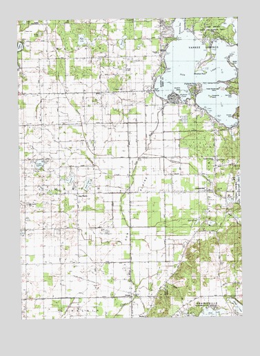
Orangeville, MI USGS Topographic Map
Click on map above to begin viewing in our Map Viewer.

This topographic map contains these locations and features:
Feature Name Type Latitude Longitude GNIS ID View Map
Angel LakeLakeN42.6036°W85.5643°620121View Map
Apostolic Assembly ChurchChurchN42.5653°W85.5150°2109237View Map
Bairds CoveBayN42.6069°W85.5039°2109244View Map
Blackbird IslandIslandN42.5945°W85.5336°621538View Map
Boot LakeLakeN42.6164°W85.5885°621727View Map
Bradley ChurchChurchN42.6236°W85.6134°621847View Map
Bradley Indian Mission CemeteryCemeteryN42.6203°W85.6214°628956View Map
Brown CemeteryCemeteryN42.5222°W85.5131°622067View Map
Chicago PointCapeN42.5833°W85.5033°2109238View Map
Duffeys PointCapeN42.6083°W85.5053°2109245View Map
East MartinPopulated PlaceN42.5517°W85.5919°2109188View Map
East Martin CemeteryCemeteryN42.5478°W85.6211°625230View Map
East Martin Christian High SchoolSchoolN42.5517°W85.5939°2574332View Map
East Martin Christian Reformed ChurchChurchN42.5514°W85.5931°2574333View Map
England LakeLakeN42.5403°W85.5247°625595View Map
Englands PointCapeN42.5958°W85.5250°2109240View Map
Fenner CreekStreamN42.5592°W85.5617°625889View Map
Fenner LakeLakeN42.5583°W85.5962°625890View Map
Germond CemeteryCemeteryN42.6095°W85.5743°626751View Map
Greggs BrookStreamN42.5670°W85.5581°627402View Map
Gun LakeLakeN42.6020°W85.5209°627533View Map
Gun Lake ChapelChurchN42.6106°W85.5456°627534View Map
Gun PlainsFlatN42.5478°W85.5583°627535View Map
Gunlake Post Office (historical)Post OfficeN42.5972°W85.5486°2573917View Map
Hastings PointCapeN42.5978°W85.5114°2109242View Map
Hermitage PointCapeN42.5931°W85.5047°2109241View Map
HooperPopulated PlaceN42.5103°W85.5628°628543View Map
Hooper Post Office (historical)Post OfficeN42.5103°W85.5628°2573913View Map
Hooper Station (historical)LocaleN42.5097°W85.5631°2574270View Map
House of Prayer ChurchChurchN42.5653°W85.5139°2109236View Map
Indian LakeLakeN42.6250°W85.6206°628999View Map
Lake SixteenLakeN42.5649°W85.6134°638035View Map
Lindsey CemeteryCemeteryN42.5083°W85.5117°2572218View Map
Long LakeLakeN42.6205°W85.5023°630973View Map
Messer CemeteryCemeteryN42.5956°W85.5652°632156View Map
Mill PondLakeN42.5484°W85.5059°632335View Map
Moore LakeLakeN42.6193°W85.6120°632645View Map
Murphys PointCapeN42.6042°W85.5228°2109243View Map
NeeleyPopulated PlaceN42.5000°W85.5545°633258View Map
North Pine Lake SchoolSchoolN42.5081°W85.5117°633624View Map
Oak Hill CemeteryCemeteryN42.5522°W85.5122°2109235View Map
OrangevillePopulated PlaceN42.5528°W85.5192°634079View Map
Orangeville Baptist ChurchChurchN42.5528°W85.5153°2574289View Map
Orangeville CreekStreamN42.5681°W85.5547°634080View Map
Orangeville IslandIslandN42.5923°W85.5170°634081View Map
Orangeville Post Office (historical)Post OfficeN42.5528°W85.5192°2572368View Map
Orangeville Township Volunteer Fire DepartmentBuildingN42.5534°W85.5193°2636086View Map
Orchard Hills Golf CourseLocaleN42.6042°W85.6133°2574239View Map
Parkside Park CampgroundLocaleN42.6186°W85.5142°2572777View Map
Pickerel CoveBayN42.5914°W85.5317°2109239View Map
Pratt LakeLakeN42.5562°W85.5866°635401View Map
Round LakeLakeN42.6153°W85.5656°636284View Map
Saint Francis ChurchChurchN42.5525°W85.5217°2574235View Map
Selkirk CemeteryCemeteryN42.6164°W85.6222°2574057View Map
Shelp LakeLakeN42.5037°W85.5023°637731View Map
Township of MartinCivilN42.5516°W85.6027°1626701View Map
Veterans Vocational SchoolSchoolN42.5042°W85.5186°1615568View Map
Yankee Springs IslandIslandN42.5953°W85.5120°1616869View Map

Note: Coordinates in the location and feature list above are referenced to NAD83 datum.


Copyright (C) 2008-2024 Ryan Niemi / Sunset Dynamics ... All Rights Reserved