TopoQuest Logo
Do you find TopoQuest useful?
Help keep TopoQuest running and adding new maps/features by donating!
Bitcoin:  19c7KJd3qBynnjoSw5npx9KScwjBe4ifkT
Litecoin:  LXs6TkuXGGXo1vDsWCkWVdjQX94eUKd6ui
Home View Maps Find Maps Find Places Resources & Links


Martin Mountain, Arizona Topographic Map

USGS Map Title: Martin Mountain, AZ
USGS Map MRC: 34112E7
DRG (GeoTIFF) Download: o34112e7.tif


Neighboring USGS Topographic Map Quads:


  Sheridan Mountain, AZ  
34112F8
 

  Smith Mesa, AZ  
34112F7
 

  Mount Josh, AZ  
34112F6
 

  Muleshoe Ranch, AZ  
34112E8
 

  Martin Mountain, AZ  
34112E7
 

  Skull Valley, AZ  
34112E6
 

  Hillside, AZ  
34112D8
 

  Bismarck Mesa, AZ  
34112D7
 

  Kirkland, AZ  
34112D6


Map MRC Location:

N35°
W113°
N35°
W112°
H8 H7 H6 H5 H4 H3 H2 H1
G8 G7 G6 G5 G4 G3 G2 G1
F8 F7 F6 F5 F4 F3 F2 F1
E8 E7 E6 E5 E4 E3 E2 E1
D8 D7 D6 D5 D4 D3 D2 D1
C8 C7 C6 C5 C4 C3 C2 C1
B8 B7 B6 B5 B4 B3 B2 B1
A8 A7 A6 A5 A4 A3 A2 A1
N34°
W113°
N34°
W112°

Martin Mountain, AZ USGS 1:24K Topographic Map Preview:
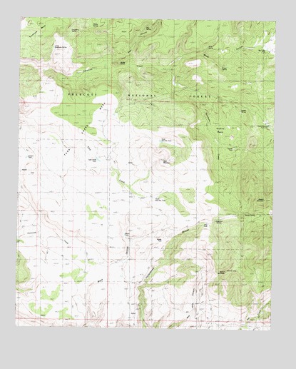
Martin Mountain, AZ USGS Topographic Map
Click on map above to begin viewing in our Map Viewer.

This topographic map contains these locations and features:
Feature Name Type Latitude Longitude GNIS ID View Map
Bald MountainSummitN34.5684°W112.8049°38237View Map
Bar U Bar RanchLocaleN34.6134°W112.7510°25967View Map
Bar U Bar TankReservoirN34.6131°W112.7553°38241View Map
Brushy MountainSummitN34.5528°W112.7549°26838View Map
Brushy Mountain Number 1 TankReservoirN34.5539°W112.7582°42683View Map
Brushy Mountain Number 2 TankReservoirN34.5634°W112.7555°42682View Map
Brushy SpringSpringN34.5466°W112.7645°38277View Map
Bubby ButtesSummitN34.6072°W112.8280°35616View Map
Dougherty CanyonValleyN34.6045°W112.8460°38417View Map
Dougherty SpringSpringN34.6200°W112.8508°28575View Map
Draper SpringReservoirN34.6061°W112.7771°2040031View Map
First TankReservoirN34.5428°W112.7825°38445View Map
Granite BasinBasinN34.5886°W112.7766°29471View Map
Granite TankReservoirN34.5733°W112.7706°38477View Map
Grapevine SpringsSpringN34.5456°W112.7738°38479View Map
Hidden SpringSpringN34.5881°W112.7671°29943View Map
Hog CanyonValleyN34.6072°W112.8318°38506View Map
Hog SpringSpringN34.6192°W112.8157°38507View Map
Hudson TankReservoirN34.5685°W112.8714°2040030View Map
Lower Dougherty SpringSpringN34.6133°W112.8593°38593View Map
Martin MountainSummitN34.5234°W112.7730°31542View Map
Martin Mountain TankReservoirN34.5378°W112.8230°38608View Map
Middle TankReservoirN34.5347°W112.8057°38626View Map
North Bald Mountain TankReservoirN34.5758°W112.8062°38661View Map
Powerline TankReservoirN34.5969°W112.7503°41100View Map
South Bald Mountain TankReservoirN34.5553°W112.8038°38820View Map
Stevens TankReservoirN34.5681°W112.8367°42686View Map
Sycamore CorralLocaleN34.6081°W112.8302°42681View Map
Tank Creek MesaSummitN34.5731°W112.8496°35133View Map
Tank Creek TankReservoirN34.5681°W112.8367°38861View Map
Tank Water TankReservoirN34.5802°W112.8583°38862View Map
Webb WindmillWellN34.5778°W112.7793°38931View Map
Weed CanyonValleyN34.6047°W112.8038°35943View Map
Willow SpringSpringN34.6224°W112.8403°38960View Map
Wood SpringSpringN34.6142°W112.7837°38970View Map
Wood TrapPopulated PlaceN34.6078°W112.7996°38972View Map
Young Mountain Number Two TankReservoirN34.5867°W112.7541°38989View Map

Note: Coordinates in the location and feature list above are referenced to NAD83 datum.


Copyright (C) 2008-2025 Ryan Niemi / Sunset Dynamics ... All Rights Reserved