TopoQuest Logo
Do you find TopoQuest useful?
Help keep TopoQuest running and adding new maps/features by donating!
Bitcoin:  19c7KJd3qBynnjoSw5npx9KScwjBe4ifkT
Litecoin:  LXs6TkuXGGXo1vDsWCkWVdjQX94eUKd6ui
Home View Maps Find Maps Find Places Resources & Links


Mount Josh, Arizona Topographic Map

USGS Map Title: Mount Josh, AZ
USGS Map MRC: 34112F6
DRG (GeoTIFF) Download: o34112f6.tif


Neighboring USGS Topographic Map Quads:


  Seepage Mountain, AZ  
34112G7
 

  Simmons, AZ  
34112G6
 

  Sullivan Buttes, AZ  
34112G5
 

  Smith Mesa, AZ  
34112F7
 

  Mount Josh, AZ  
34112F6
 

  Jerome Canyon, AZ  
34112F5
 

  Martin Mountain, AZ  
34112E7
 

  Skull Valley, AZ  
34112E6
 

  Iron Springs, AZ  
34112E5


Map MRC Location:

N35°
W113°
N35°
W112°
H8 H7 H6 H5 H4 H3 H2 H1
G8 G7 G6 G5 G4 G3 G2 G1
F8 F7 F6 F5 F4 F3 F2 F1
E8 E7 E6 E5 E4 E3 E2 E1
D8 D7 D6 D5 D4 D3 D2 D1
C8 C7 C6 C5 C4 C3 C2 C1
B8 B7 B6 B5 B4 B3 B2 B1
A8 A7 A6 A5 A4 A3 A2 A1
N34°
W113°
N34°
W112°

Mount Josh, AZ USGS 1:24K Topographic Map Preview:
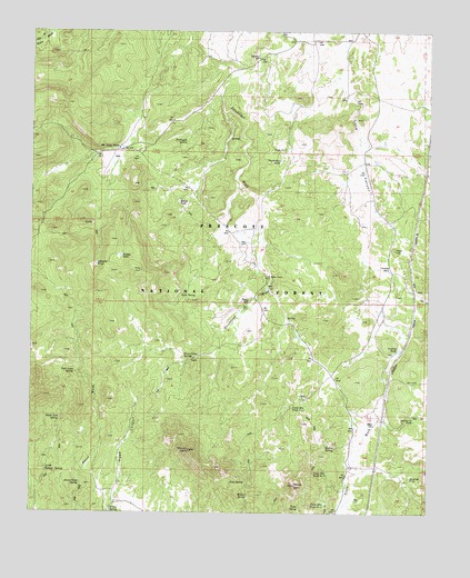
Mount Josh, AZ USGS Topographic Map
Click on map above to begin viewing in our Map Viewer.

This topographic map contains these locations and features:
Feature Name Type Latitude Longitude GNIS ID View Map
Black Jack SpringSpringN34.6497°W112.7412°26399View Map
Bootlegger SpringSpringN34.7213°W112.7023°26619View Map
Burnt Wash Number One SpringSpringN34.6658°W112.7364°38296View Map
Burnt Wash SpringSpringN34.6329°W112.7348°27038View Map
Cowboy TankReservoirN34.6673°W112.6351°28099View Map
D-One SpringSpringN34.6263°W112.7254°28236View Map
Driveway WellWellN34.6886°W112.6382°28610View Map
Holden SpringSpringN34.6294°W112.6823°30049View Map
Jack Jones SpringSpringN34.6614°W112.7368°30458View Map
Josh SpringSpringN34.6330°W112.6877°30623View Map
Josh TankReservoirN34.6291°W112.7052°40960View Map
Left Hand SpringSpringN34.6999°W112.7316°38565View Map
Lefthand TankReservoirN34.6895°W112.7302°30937View Map
Long Canyon CorralLocaleN34.6822°W112.6282°2040028View Map
Moana RanchLocaleN34.6861°W112.6757°31939View Map
Moana TankReservoirN34.7060°W112.7045°31940View Map
Mount JoshSummitN34.6411°W112.7005°30624View Map
Mullen SpringSpringN34.6419°W112.6549°32179View Map
North Pasture SpringSpringN34.6363°W112.7457°32386View Map
Old Camp FarmLocaleN34.7197°W112.7235°8934View Map
Old Camp SpringSpringN34.7162°W112.7355°38671View Map
Pemberton TankReservoirN34.7163°W112.6728°32779View Map
Rock SpringSpringN34.6814°W112.7037°33728View Map
Section Thirteen TankReservoirN34.6493°W112.6301°34204View Map
Sheep Camp SpringsSpringN34.6653°W112.7027°34323View Map
Stephens WellWellN34.7434°W112.6799°34829View Map
Strickland SpringSpringN34.6792°W112.6808°42755View Map
Strickland TankReservoirN34.7195°W112.6902°38847View Map
Surprise TankReservoirN34.6343°W112.6312°34987View Map
Tank Number OneReservoirN34.7195°W112.6707°35136View Map
Tonto MountainSummitN34.6322°W112.6674°35377View Map
Tonto Mountain Tank Number OneReservoirN34.6524°W112.6685°35378View Map
Tonto Mountain Tank Number ThreeReservoirN34.6271°W112.6580°35380View Map
Tonto Mountain Tank Number TwoReservoirN34.6353°W112.6570°35379View Map
Tonto SpringSpringN34.6265°W112.6660°35386View Map
Toohey TankReservoirN34.6917°W112.7229°35396View Map
Toohey Trick TankReservoirN34.6536°W112.6668°40954View Map
Toohey WellWellN34.6886°W112.6282°2040026View Map
Tract 38ReserveN34.6878°W112.6668°40985View Map
Tract 39ReserveN34.6875°W112.6774°40984View Map
Tract 40ReserveN34.6442°W112.6463°41121View Map
Tract 42ReserveN34.6275°W112.7216°41114View Map
Tract 43ReserveN34.6253°W112.6646°41115View Map
Tract 44ReserveN34.6270°W112.6466°41116View Map
Walker TankReservoirN34.7163°W112.6422°38921View Map
Willow SpringSpringN34.6485°W112.7420°38959View Map
Willow TanksReservoirN34.6575°W112.7096°38962View Map

Note: Coordinates in the location and feature list above are referenced to NAD83 datum.


Copyright (C) 2008-2025 Ryan Niemi / Sunset Dynamics ... All Rights Reserved