TopoQuest Logo
Do you find TopoQuest useful?
Help keep TopoQuest running and adding new maps/features by donating!
Bitcoin:  19c7KJd3qBynnjoSw5npx9KScwjBe4ifkT
Litecoin:  LXs6TkuXGGXo1vDsWCkWVdjQX94eUKd6ui
Home View Maps Find Maps Find Places Resources & Links


Sheridan Mountain, Arizona Topographic Map

USGS Map Title: Sheridan Mountain, AZ
USGS Map MRC: 34112F8
DRG (GeoTIFF) Download: o34112f8.tif


Neighboring USGS Topographic Map Quads:


  Scratch Canyon, AZ  
34113G1
 

  Camp Wood, AZ  
34112G8
 

  Seepage Mountain, AZ  
34112G7
 

  Behm Mesa, AZ  
34113F1
 

  Sheridan Mountain, AZ  
34112F8
 

  Smith Mesa, AZ  
34112F7
 

  Big Shipp Mountain, AZ  
34113E1
 

  Muleshoe Ranch, AZ  
34112E8
 

  Martin Mountain, AZ  
34112E7


Map MRC Location:

N35°
W113°
N35°
W112°
H8 H7 H6 H5 H4 H3 H2 H1
G8 G7 G6 G5 G4 G3 G2 G1
F8 F7 F6 F5 F4 F3 F2 F1
E8 E7 E6 E5 E4 E3 E2 E1
D8 D7 D6 D5 D4 D3 D2 D1
C8 C7 C6 C5 C4 C3 C2 C1
B8 B7 B6 B5 B4 B3 B2 B1
A8 A7 A6 A5 A4 A3 A2 A1
N34°
W113°
N34°
W112°

Sheridan Mountain, AZ USGS 1:24K Topographic Map Preview:
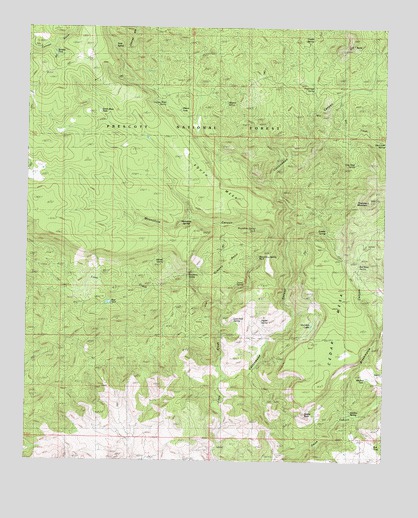
Sheridan Mountain, AZ USGS Topographic Map
Click on map above to begin viewing in our Map Viewer.

This topographic map contains these locations and features:
Feature Name Type Latitude Longitude GNIS ID View Map
Alkaline SpringSpringN34.6391°W112.8870°38208View Map
Alkaline TankReservoirN34.6478°W112.8832°38209View Map
Alligator SpringSpringN34.7283°W112.9314°38210View Map
Barney WellWellN34.6767°W112.9807°38242View Map
Blue DamDamN34.6742°W112.9710°38259View Map
Blue TankReservoirN34.6705°W112.9720°41139View Map
Boulder TankReservoirN34.7424°W112.9913°38266View Map
Boundary SpringSpringN34.6790°W112.9441°38268View Map
Brockmonte CanyonValleyN34.6384°W112.8885°26752View Map
BT ButteSummitN34.7447°W112.8885°25861View Map
Bull SpringSpringN34.6795°W112.8860°38292View Map
Bull TankReservoirN34.6295°W112.8786°38290View Map
Burro SpringSpringN34.7492°W112.9494°38298View Map
Castle RockSummitN34.6384°W112.9032°27352View Map
Cedar MesaSummitN34.6822°W112.8924°27422View Map
Clay Seep SpringSpringN34.7111°W112.8861°38343View Map
Conger SpringSpringN34.7281°W112.9524°38357View Map
Corral Spring TankReservoirN34.7347°W112.9541°41142View Map
Corral TankReservoirN34.7206°W112.9430°41141View Map
Cottonwood CabinLocaleN34.7311°W112.8935°38373View Map
Cottonwood WashStreamN34.7050°W112.9141°40983View Map
Cottonwood WellWellN34.7309°W112.8930°41145View Map
Dry CreekStreamN34.7297°W112.8910°38992View Map
Dry Creek SpringSpringN34.7171°W112.8759°38420View Map
Granite SpringSpringN34.7467°W112.9045°41140View Map
Granite SpringSpringN34.6917°W112.8960°41143View Map
Jackass SpringSpringN34.6826°W112.9526°38533View Map
Laurel SpringSpringN34.6756°W112.9255°38563View Map
Loco Pool SpringSpringN34.6654°W112.9282°38585View Map
Metote Pit TankReservoirN34.7245°W112.9457°38623View Map
Moonshine CanyonValleyN34.6925°W112.9160°31993View Map
Moonshine Spring Number ThreeSpringN34.6839°W112.9198°38642View Map
Moonshine Spring Number TwoSpringN34.6925°W112.9185°38643View Map
Moonshine SpringsSpringN34.6945°W112.9425°38644View Map
Orejano BasinBasinN34.6792°W112.9319°32551View Map
Pine CanyonValleyN34.7264°W112.9007°38691View Map
Pine Creek SpringSpringN34.7319°W112.9010°38694View Map
Pine Flat TankReservoirN34.7450°W112.9994°38696View Map
Poplar SpringSpringN34.6647°W112.9202°38711View Map
Section Twenty Nine TankReservoirN34.7347°W112.9163°38791View Map
Seep SpringSpringN34.7486°W112.9730°38795View Map
Sheridan LakeLakeN34.6642°W112.9009°38805View Map
Sheridan MountainSummitN34.7006°W112.8810°34368View Map
Smith CanyonValleyN34.6320°W112.8927°34551View Map
South MesaSummitN34.7059°W112.9438°34675View Map
South Mesa TankReservoirN34.7245°W112.9719°38826View Map
Yolo Trick TankReservoirN34.7359°W112.9766°41090View Map

Note: Coordinates in the location and feature list above are referenced to NAD83 datum.


Copyright (C) 2008-2025 Ryan Niemi / Sunset Dynamics ... All Rights Reserved