TopoQuest Logo
Do you find TopoQuest useful?
Help keep TopoQuest running and adding new maps/features by donating!
Bitcoin:  19c7KJd3qBynnjoSw5npx9KScwjBe4ifkT
Litecoin:  LXs6TkuXGGXo1vDsWCkWVdjQX94eUKd6ui
Home View Maps Find Maps Find Places Resources & Links


Beanblossom, Indiana Topographic Map

USGS Map Title: Beanblossom, IN
USGS Map MRC: 39086C2
DRG (GeoTIFF) Download: o39086c2.tif


Neighboring USGS Topographic Map Quads:


  Cope, IN  
39086D3
 

  Trafalgar, IN  
39086D2
 

  Franklin, IN  
39086D1
 

  Morgantown, IN  
39086C3
 

  Beanblossom, IN  
39086C2
 

  Nineveh, IN  
39086C1
 

  Belmont, IN  
39086B3
 

  Nashville, IN  
39086B2
 

  New Bellsville, IN  
39086B1


Map MRC Location:

N40°
W87°
N40°
W86°
H8 H7 H6 H5 H4 H3 H2 H1
G8 G7 G6 G5 G4 G3 G2 G1
F8 F7 F6 F5 F4 F3 F2 F1
E8 E7 E6 E5 E4 E3 E2 E1
D8 D7 D6 D5 D4 D3 D2 D1
C8 C7 C6 C5 C4 C3 C2 C1
B8 B7 B6 B5 B4 B3 B2 B1
A8 A7 A6 A5 A4 A3 A2 A1
N39°
W87°
N39°
W86°

Beanblossom, IN USGS 1:24K Topographic Map Preview:
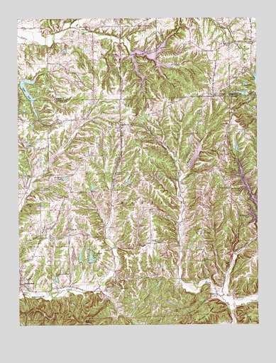
Beanblossom, IN USGS Topographic Map
Click on map above to begin viewing in our Map Viewer.

This topographic map contains these locations and features:
Feature Name Type Latitude Longitude GNIS ID View Map
Barnes CreekStreamN39.3687°W86.2308°430503View Map
BeanblossomPopulated PlaceN39.2670°W86.2492°430609View Map
Bearwallow HillSummitN39.2509°W86.2164°430655View Map
Bethel ChurchChurchN39.2895°W86.2233°430924View Map
Bethlehem ChurchChurchN39.3714°W86.2133°430980View Map
Bittersweet LakeReservoirN39.3210°W86.1768°447705View Map
Bittersweet Lake DamDamN39.3209°W86.1753°447704View Map
Blossom HollowValleyN39.3554°W86.1760°431209View Map
Boyd LakeReservoirN39.2617°W86.1717°447716View Map
Boyd Lake DamDamN39.2617°W86.1717°447717View Map
Brown County ChurchChurchN39.3059°W86.1392°431609View Map
Callon HollowValleyN39.3601°W86.1902°431969View Map
Calvin CemeteryCemeteryN39.3386°W86.1847°431995View Map
Colonial Reality DamDamN39.2734°W86.1750°447703View Map
Crain LakeReservoirN39.2784°W86.1731°447707View Map
Crain Lake DamDamN39.2784°W86.1717°447708View Map
Crestview LakeReservoirN39.3100°W86.2257°433122View Map
Crestview Lake DamDamN39.3084°W86.2267°447709View Map
Dearmin LakeReservoirN39.3481°W86.1312°433397View Map
Deerskin Lake DamDamN39.3200°W86.1367°448547View Map
Duncan CemeteryCemeteryN39.3353°W86.1539°433771View Map
Earlham LakeReservoirN39.3481°W86.1852°448401View Map
Earlham Lake DamDamN39.3517°W86.1833°448400View Map
East Branch Sweetwater CreekStreamN39.2781°W86.1361°433869View Map
East Fork Beanblossom CreekStreamN39.2556°W86.1392°433881View Map
East Fork Salt CreekStreamN39.2550°W86.1394°433897View Map
Fowler LakeReservoirN39.3326°W86.2285°447712View Map
Fowler Lake DamDamN39.3334°W86.2292°447713View Map
Friendship ChurchChurchN39.3720°W86.1844°434867View Map
GatesvillePopulated PlaceN39.2617°W86.1464°434995View Map
Goose CreekStreamN39.3714°W86.2225°435193View Map
Goshen ChurchChurchN39.2648°W86.1969°435229View Map
Green LakeReservoirN39.3180°W86.1576°447298View Map
Green Lake DamDamN39.3139°W86.1603°447299View Map
Hamblen Township Volunteer Fire DepartmentBuildingN39.2637°W86.1448°2625919View Map
Happy Landing LakeReservoirN39.2686°W86.2304°435716View Map
Hood LakeReservoirN39.3498°W86.1252°436401View Map
Lamb LakeReservoirN39.3591°W86.1818°437574View Map
Lamb Lake DamDamN39.3484°W86.2483°448399View Map
Lamb Lake Estates DamDamN39.3500°W86.2417°448908View Map
Lick Spring ChurchChurchN39.3650°W86.1275°437873View Map
Little Fox LakeReservoirN39.2788°W86.2215°448530View Map
Little Fox Lake DamDamN39.2767°W86.2217°448531View Map
Mount Carmel ChurchChurchN39.3642°W86.1392°439549View Map
Mount Olive ChurchChurchN39.3428°W86.1478°439626View Map
Panther Lick HollowValleyN39.2617°W86.1479°440854View Map
Panther Lick RidgeRidgeN39.2520°W86.1533°440855View Map
Parker LakeReservoirN39.3333°W86.1847°447711View Map
Parker Lake DamDamN39.3317°W86.1833°447710View Map
Pence HollowValleyN39.3175°W86.1674°440988View Map
PeogaPopulated PlaceN39.3431°W86.1442°441007View Map
Peoga LakeReservoirN39.3442°W86.1322°441008View Map
Peoga Lake DamDamN39.3434°W86.1300°448402View Map
Pitcher HollowValleyN39.3584°W86.1788°441203View Map
Ramelton Post Office (historical)Post OfficeN39.2698°W86.1836°452990View Map
Rhude HollowValleyN39.3103°W86.1640°453068View Map
Roger Young LakeReservoirN39.3435°W86.1403°448840View Map
Roger Young Lake DamDamN39.3434°W86.1400°448841View Map
Smith LakeReservoirN39.2779°W86.2179°447706View Map
Smith Lake DamDamN39.2767°W86.2183°447718View Map
SpearsvillePopulated PlaceN39.3306°W86.1964°443925View Map
Sprunica ChurchChurchN39.2834°W86.1786°444022View Map
Sprunica SchoolSchoolN39.2825°W86.1844°444023View Map
Steiger LakeReservoirN39.3220°W86.1355°448839View Map
Steiger Lake DamDamN39.3200°W86.1350°448838View Map
Sweetwater CreekStreamN39.2609°W86.1439°444486View Map
Sweetwater LakePopulated PlaceN39.3000°W86.1292°447629View Map
Sweetwater LakeReservoirN39.3010°W86.1273°447415View Map
Sweetwater Lake DamDamN39.2917°W86.1253°447416View Map
TaggartPopulated PlaceN39.2617°W86.1389°444544View Map
Taylor CemeteryCemeteryN39.2743°W86.1396°444584View Map
Township of HamblenCivilN39.2842°W86.1583°453363View Map
Unity ChurchChurchN39.3023°W86.2258°445145View Map
Waymires LakeReservoirN39.2667°W86.1770°447714View Map
Waymires Lake DamDamN39.2684°W86.1750°447715View Map
Weeping Willow CemeteryCemeteryN39.2682°W86.2469°435028View Map
Wolfpen HollowValleyN39.2704°W86.1420°446264View Map
Woodland LakeReservoirN39.2775°W86.2123°448598View Map
Woodland Lake DamDamN39.2750°W86.2133°448597View Map
Zion Church CemeteryCemeteryN39.2763°W86.1537°446472View Map
Zion HillSummitN39.2720°W86.1519°446475View Map

Note: Coordinates in the location and feature list above are referenced to NAD83 datum.


Copyright (C) 2008-2024 Ryan Niemi / Sunset Dynamics ... All Rights Reserved