TopoQuest Logo
Do you find TopoQuest useful?
Help keep TopoQuest running and adding new maps/features by donating!
Bitcoin:  19c7KJd3qBynnjoSw5npx9KScwjBe4ifkT
Litecoin:  LXs6TkuXGGXo1vDsWCkWVdjQX94eUKd6ui
Home View Maps Find Maps Find Places Resources & Links


Mason, Michigan Topographic Map

USGS Map Title: Mason, MI
USGS Map MRC: 42084E4
DRG (GeoTIFF) Download: o42084e4.tif


Neighboring USGS Topographic Map Quads:


  Lansing South, MI  
42084F5
 

  East Lansing, MI  
42084F4
 

  Williamston, MI  
42084F3
 

  Aurelius, MI  
42084E5
 

  Mason, MI  
42084E4
 

  Dansville, MI  
42084E3
 

  Onondaga, MI  
42084D5
 

  Leslie, MI  
42084D4
 

  Pleasant Lake, MI  
42084D3


Map MRC Location:

N43°
W85°
N43°
W84°
H8 H7 H6 H5 H4 H3 H2 H1
G8 G7 G6 G5 G4 G3 G2 G1
F8 F7 F6 F5 F4 F3 F2 F1
E8 E7 E6 E5 E4 E3 E2 E1
D8 D7 D6 D5 D4 D3 D2 D1
C8 C7 C6 C5 C4 C3 C2 C1
B8 B7 B6 B5 B4 B3 B2 B1
A8 A7 A6 A5 A4 A3 A2 A1
N42°
W85°
N42°
W84°

Mason, MI USGS 1:24K Topographic Map Preview:
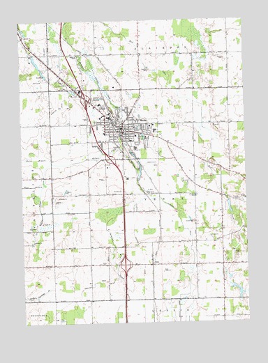
Mason, MI USGS Topographic Map
Click on map above to begin viewing in our Map Viewer.

This topographic map contains these locations and features:
Feature Name Type Latitude Longitude GNIS ID View Map
All Saints Lutheran ChurchChurchN42.5756°W84.4558°2634963View Map
Aurelius and Vevay DrainCanalN42.5931°W84.4747°620352View Map
Bicentennial ParkParkN42.5783°W84.4550°2634993View Map
Bond ParkParkN42.5833°W84.4406°2634997View Map
Capital Area Career CenterSchoolN42.6005°W84.4459°2083829View Map
Cedar Street Elementary SchoolSchoolN42.5783°W84.4531°2634991View Map
Church of ChristChurchN42.6058°W84.4832°2634961View Map
City of MasonCivilN42.5805°W84.4427°1626706View Map
Cross Roads Baptist ChurchChurchN42.5017°W84.3889°2635013View Map
Dubois CemeteryCemeteryN42.6092°W84.3861°624910View Map
Eagle View Golf ClubLocaleN42.5547°W84.4458°2634986View Map
EdenPopulated PlaceN42.5239°W84.4283°625348View Map
Eden CemeteryCemeteryN42.5211°W84.4191°625349View Map
Eden Post Office (historical)Post OfficeN42.5239°W84.4283°2634303View Map
Eden United Brethren ChurchChurchN42.5258°W84.4291°2634984View Map
Eichmeier FieldAirportN42.6012°W84.4320°1624031View Map
Eldorado Golf CourseLocaleN42.6008°W84.4889°2634985View Map
Fellowship Bible ChurchChurchN42.5754°W84.4624°2634962View Map
First Presbyterian Church of MasonChurchN42.5806°W84.4417°2634967View Map
Griffin ParkParkN42.5758°W84.4435°2634995View Map
Hawley CemeteryCemeteryN42.5509°W84.3791°627963View Map
Hayes ParkParkN42.5811°W84.4589°2634994View Map
Hazelton DrainCanalN42.5167°W84.4580°628020View Map
Heartwood SchoolSchoolN42.5994°W84.4467°2634990View Map
Ingham County CourthouseBuildingN42.5797°W84.4422°2634981View Map
Ingham County Courthouse Historical MarkerParkN42.5794°W84.4429°2633748View Map
Ingham County FairgroundsLocaleN42.5750°W84.4292°2634980View Map
Ingham County Sheriff's OfficeBuildingN42.5906°W84.4559°2634979View Map
Jehovah's WitnessesChurchN42.6172°W84.4839°2634971View Map
John Rayner House Historical MarkerParkN42.5781°W84.4311°2633750View Map
Lansing - Mason Area Ambulance ServiceBuildingN42.5944°W84.4687°2661923View Map
Laylin ParkParkN42.5808°W84.4339°2634992View Map
Lee Austin ParkParkN42.5797°W84.4475°2634996View Map
Maple Grove CemeteryCemeteryN42.5856°W84.4458°631434View Map
MasonPopulated PlaceN42.5792°W84.4436°631694View Map
Mason Area Historical MuseumBuildingN42.5779°W84.4411°2634978View Map
Mason Assemblies of God ChurchChurchN42.5757°W84.4357°2634968View Map
Mason City HallBuildingN42.5789°W84.4450°2634975View Map
Mason Community ChurchChurchN42.5817°W84.4261°2634970View Map
Mason Fire DepartmentBuildingN42.5789°W84.4457°2634977View Map
Mason Fire Department Fire Station 1BuildingN42.5790°W84.4457°2635979View Map
Mason Fire Department Station 2BuildingN42.5892°W84.4540°2636079View Map
Mason First Church of NazareneChurchN42.5806°W84.4367°2634969View Map
Mason First United Methodist ChurchChurchN42.5794°W84.4411°2634966View Map
Mason High SchoolSchoolN42.5722°W84.4361°2634989View Map
Mason Jewett FieldAirportN42.5638°W84.4239°1624029View Map
Mason LibraryBuildingN42.5790°W84.4444°2634974View Map
Mason Manor Mobile Home CommunityPopulated PlaceN42.5228°W84.4389°2634983View Map
Mason Middle SchoolSchoolN42.5794°W84.4257°2634988View Map
Mason Police DepartmentBuildingN42.5784°W84.4451°2634976View Map
Mason Post OfficePost OfficeN42.5794°W84.4443°2634973View Map
Mason Station (historical)LocaleN42.5828°W84.4483°2634972View Map
New Life Community ChurchChurchN42.5806°W84.4533°2634960View Map
North Branch Willow CreekStreamN42.5664°W84.4830°633546View Map
Rayner ParkParkN42.5800°W84.4319°2634998View Map
Rolfe CemeteryCemeteryN42.5245°W84.4569°636131View Map
Saint Augustine of Canterbury ChurchChurchN42.5754°W84.4525°2634964View Map
Saint James Catholic ChurchChurchN42.5708°W84.4442°2634965View Map
Sawyer FieldAirportN42.6174°W84.4558°1624032View Map
Steele Street Elementary SchoolSchoolN42.5775°W84.4358°2634987View Map
Sycamore Village Mobile Home ParkPopulated PlaceN42.5833°W84.4625°2634982View Map
Talmadge DrainCanalN42.5386°W84.4102°1614555View Map
Township of VevayCivilN42.5490°W84.4209°1627198View Map
West Branch Willow CreekStreamN42.5570°W84.4883°1616084View Map
Willow CreekStreamN42.5734°W84.4441°1616530View Map
WUNN-AM (Mason)TowerN42.5511°W84.4041°1625267View Map

Note: Coordinates in the location and feature list above are referenced to NAD83 datum.


Copyright (C) 2008-2025 Ryan Niemi / Sunset Dynamics ... All Rights Reserved