TopoQuest Logo
Do you find TopoQuest useful?
Help keep TopoQuest running and adding new maps/features by donating!
Bitcoin:  19c7KJd3qBynnjoSw5npx9KScwjBe4ifkT
Litecoin:  LXs6TkuXGGXo1vDsWCkWVdjQX94eUKd6ui
Home View Maps Find Maps Find Places Resources & Links


Pleasant Lake, Michigan Topographic Map

USGS Map Title: Pleasant Lake, MI
USGS Map MRC: 42084D3
DRG (GeoTIFF) Download: o42084d3.tif


Neighboring USGS Topographic Map Quads:


  Mason, MI  
42084E4
 

  Dansville, MI  
42084E3
 

  Millville, MI  
42084E2
 

  Leslie, MI  
42084D4
 

  Pleasant Lake, MI  
42084D3
 

  Stockbridge, MI  
42084D2
 

  Jackson North, MI  
42084C4
 

  Gilletts Lake, MI  
42084C3
 

  Grass Lake, MI  
42084C2


Map MRC Location:

N43°
W85°
N43°
W84°
H8 H7 H6 H5 H4 H3 H2 H1
G8 G7 G6 G5 G4 G3 G2 G1
F8 F7 F6 F5 F4 F3 F2 F1
E8 E7 E6 E5 E4 E3 E2 E1
D8 D7 D6 D5 D4 D3 D2 D1
C8 C7 C6 C5 C4 C3 C2 C1
B8 B7 B6 B5 B4 B3 B2 B1
A8 A7 A6 A5 A4 A3 A2 A1
N42°
W85°
N42°
W84°

Pleasant Lake, MI USGS 1:24K Topographic Map Preview:
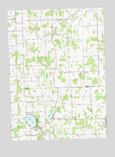
Pleasant Lake, MI USGS Topographic Map
Click on map above to begin viewing in our Map Viewer.

This topographic map contains these locations and features:
Feature Name Type Latitude Longitude GNIS ID View Map
Batteese LakeLakeN42.3992°W84.3238°620752View Map
Bunker HillPopulated PlaceN42.4756°W84.3175°622257View Map
Bunker Hill Center CemeteryCemeteryN42.4722°W84.3172°2633610View Map
Bunker Hill Seventh Day ChurchChurchN42.4727°W84.3173°2635027View Map
Bunkerhill Post Office (historical)Post OfficeN42.4756°W84.3175°2634306View Map
Cahaogan CreekStreamN42.3950°W84.2641°622443View Map
Christ Episcopal ChurchChurchN42.3792°W84.3494°2632946View Map
Church of Jesus ChristChurchN42.4498°W84.2572°623293View Map
Felt Plains CemeteryCemeteryN42.4875°W84.3586°625883View Map
Felt Plains ChurchChurchN42.4825°W84.3558°625884View Map
Felt's Post Office (historical)Post OfficeN42.4903°W84.3556°2634302View Map
FitchburgPopulated PlaceN42.4392°W84.2777°626096View Map
Fitchburg CemeteryCemeteryN42.4389°W84.3008°626097View Map
Fitchburg Post Office (historical)Post OfficeN42.4392°W84.2778°2634301View Map
Hankerd Hills Golf CourseLocaleN42.3894°W84.3375°2632945View Map
Henrietta Post Office (historical)Post OfficeN42.3797°W84.3494°2631482View Map
Henrietta SchoolSchoolN42.3834°W84.3508°628110View Map
Henrietta Township Fire DepartmentBuildingN42.3818°W84.3251°2635943View Map
Holy Bible Church of GodChurchN42.4992°W84.2757°2633599View Map
Jackson District Library-Pleasant Lake BranchBuildingN42.4011°W84.3164°2632944View Map
Katz Elementary SchoolSchoolN42.3983°W84.2503°2087441View Map
Mud LakeLakeN42.3817°W84.3327°632915View Map
MunithPopulated PlaceN42.3906°W84.2505°633123View Map
Munith Post OfficePost OfficeN42.3913°W84.2513°2632973View Map
Munith Station (historical)LocaleN42.3903°W84.2506°2632972View Map
Munith United Methodist ChurchChurchN42.3908°W84.2503°2632969View Map
Nims CemeteryCemeteryN42.4170°W84.3344°633416View Map
P J Family CampgroundLocaleN42.4310°W84.3208°2634958View Map
Pleasant Grove CemeteryCemeteryN42.3784°W84.2891°635087View Map
Pleasant LakeLakeN42.3937°W84.3482°635100View Map
Pleasant LakePopulated PlaceN42.3800°W84.3491°635107View Map
Pleasant Lake CampgroundLocaleN42.4008°W84.3472°2632942View Map
Pleasant Lake ChurchChurchN42.3870°W84.3394°635108View Map
Pleasant Lake ChurchChurchN42.4117°W84.3491°635109View Map
Pleasant Lake Mobile Home CourtPopulated PlaceN42.3806°W84.3228°2632150View Map
Pleasant Lake Post OfficePost OfficeN42.4000°W84.3172°2632943View Map
Saint Cornelius and Cyprian's Catholic CemeteryCemeteryN42.4903°W84.3061°2633611View Map
Saints Cornelius and Cyprian ChurchChurchN42.4894°W84.3067°2635028View Map
Saints Cornelius and Cyprian SchoolSchoolN42.4895°W84.3072°636447View Map
Township of Bunker HillCivilN42.4686°W84.3115°1626001View Map
Township of HenriettaCivilN42.3779°W84.3119°1626465View Map
Trinity Pentecostal ChurchChurchN42.4400°W84.2775°2634959View Map
Waterloo Township Police DepartmentBuildingN42.3953°W84.2510°2737447View Map
Wheel Inn CampgroundLocaleN42.4709°W84.3492°2635026View Map
Wilderness ParkParkN42.4359°W84.2791°1616453View Map

Note: Coordinates in the location and feature list above are referenced to NAD83 datum.


Copyright (C) 2008-2024 Ryan Niemi / Sunset Dynamics ... All Rights Reserved