TopoQuest Logo
Do you find TopoQuest useful?
Help keep TopoQuest running and adding new maps/features by donating!
Bitcoin:  19c7KJd3qBynnjoSw5npx9KScwjBe4ifkT
Litecoin:  LXs6TkuXGGXo1vDsWCkWVdjQX94eUKd6ui
Home View Maps Find Maps Find Places Resources & Links


Leslie, Michigan Topographic Map

USGS Map Title: Leslie, MI
USGS Map MRC: 42084D4
DRG (GeoTIFF) Download: o42084d4.tif


Neighboring USGS Topographic Map Quads:


  Aurelius, MI  
42084E5
 

  Mason, MI  
42084E4
 

  Dansville, MI  
42084E3
 

  Onondaga, MI  
42084D5
 

  Leslie, MI  
42084D4
 

  Pleasant Lake, MI  
42084D3
 

  Parma, MI  
42084C5
 

  Jackson North, MI  
42084C4
 

  Gilletts Lake, MI  
42084C3


Map MRC Location:

N43°
W85°
N43°
W84°
H8 H7 H6 H5 H4 H3 H2 H1
G8 G7 G6 G5 G4 G3 G2 G1
F8 F7 F6 F5 F4 F3 F2 F1
E8 E7 E6 E5 E4 E3 E2 E1
D8 D7 D6 D5 D4 D3 D2 D1
C8 C7 C6 C5 C4 C3 C2 C1
B8 B7 B6 B5 B4 B3 B2 B1
A8 A7 A6 A5 A4 A3 A2 A1
N42°
W85°
N42°
W84°

Leslie, MI USGS 1:24K Topographic Map Preview:
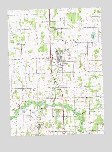
Leslie, MI USGS Topographic Map
Click on map above to begin viewing in our Map Viewer.

This topographic map contains these locations and features:
Feature Name Type Latitude Longitude GNIS ID View Map
Albrow CreekStreamN42.4042°W84.4622°619911View Map
Allen LakeLakeN42.3802°W84.3794°619977View Map
Berry BridgeBridgeN42.3786°W84.4086°1623236View Map
BerryvillePopulated PlaceN42.4053°W84.4872°1617441View Map
Bible Baptist ChurchChurchN42.4451°W84.4424°2635006View Map
City of LeslieCivilN42.4506°W84.4332°1626610View Map
Congregational United ChurchChurchN42.4514°W84.4333°2635007View Map
Craddock DrainCanalN42.4489°W84.3955°623945View Map
East Rives CemeteryCemeteryN42.3867°W84.3933°625249View Map
Faith Assembly of God ChurchChurchN42.4644°W84.4403°2635010View Map
First Baptist Church Historical MarkerParkN42.4511°W84.4334°2633747View Map
Foote Family Medical CenterHospitalN42.4522°W84.4394°2635024View Map
Fox LakeLakeN42.4026°W84.4613°626376View Map
Grace Lutheran ChurchChurchN42.4489°W84.4404°2635009View Map
Grand River Community ChurchChurchN42.4363°W84.4417°2635005View Map
Hunton CreekStreamN42.4036°W84.4427°628844View Map
Hunton LakeLakeN42.4726°W84.3855°628845View Map
Kingdom Hall of Jehovah's WitnessesChurchN42.4283°W84.4433°2635012View Map
LesliePopulated PlaceN42.4514°W84.4325°630326View Map
Leslie Ambulance ServiceBuildingN42.4514°W84.4300°2661930View Map
Leslie City HallBuildingN42.4514°W84.4314°2635017View Map
Leslie City LibraryBuildingN42.4533°W84.4339°2635023View Map
Leslie Estates Mobile Home ParkPopulated PlaceN42.4490°W84.4223°2635022View Map
Leslie Fire DepartmentBuildingN42.4570°W84.4272°2635960View Map
Leslie Fire DepartmentBuildingN42.4570°W84.4272°2635021View Map
Leslie First Baptist ChurchChurchN42.4516°W84.4305°2635011View Map
Leslie High SchoolSchoolN42.4605°W84.4415°2635020View Map
Leslie Middle SchoolSchoolN42.4572°W84.4361°2635019View Map
Leslie Police DepartmentBuildingN42.4502°W84.4310°2635015View Map
Leslie Post OfficePost OfficeN42.4497°W84.4322°2635014View Map
Leslie StationLocaleN42.4514°W84.4292°2635004View Map
Leslie United Methodist ChurchChurchN42.4471°W84.4319°2635008View Map
Long LakeLakeN42.3850°W84.3841°630923View Map
Mud LakeLakeN42.3847°W84.3788°632917View Map
North LesliePopulated PlaceN42.4806°W84.4441°1617747View Map
North Leslie Post Office (historical)Post OfficeN42.4806°W84.4442°2634292View Map
Perry CreekStreamN42.4086°W84.4730°634668View Map
Pleasant Lake DrainStreamN42.4025°W84.3827°635111View Map
Rives / Tompkins Fire Department Station 1 HeadquartersBuildingN42.3862°W84.4627°2636108View Map
Rives / Tompkins Fire Department Station 3BuildingN42.3806°W84.4142°2636223View Map
Rives Baptist ChurchChurchN42.3797°W84.4392°2632941View Map
Rives JunctionPopulated PlaceN42.3859°W84.4616°636023View Map
Rives Junction Memorial CemeteryCemeteryN42.4000°W84.4730°2633106View Map
Rives Junction Post OfficePost OfficeN42.3900°W84.4596°2632940View Map
Rives Junction StationLocaleN42.3864°W84.4639°2632938View Map
Rives Wesleyan ChurchChurchN42.3861°W84.4617°2632939View Map
Royston DrainCanalN42.4489°W84.4452°636357View Map
Shaw BranchStreamN42.4031°W84.3830°637685View Map
Teaspoon HillSummitN42.4803°W84.4394°1614649View Map
Township of LeslieCivilN42.4664°W84.4232°1626611View Map
Township of RivesCivilN42.3784°W84.4236°1626987View Map
Walker CemeteryCemeteryN42.4217°W84.4819°1615691View Map
Western CreekStreamN42.3961°W84.4086°1616204View Map
White Pine AcademySchoolN42.4448°W84.4293°2635016View Map
Whitney DrainStreamN42.3995°W84.4147°1616394View Map
Woodlawn CemeteryCemeteryN42.4578°W84.4294°2633606View Map
Woodworth Elementary SchoolSchoolN42.4536°W84.4353°2635018View Map

Note: Coordinates in the location and feature list above are referenced to NAD83 datum.


Copyright (C) 2008-2025 Ryan Niemi / Sunset Dynamics ... All Rights Reserved