TopoQuest Logo
Do you find TopoQuest useful?
Help keep TopoQuest running and adding new maps/features by donating!
Bitcoin:  19c7KJd3qBynnjoSw5npx9KScwjBe4ifkT
Litecoin:  LXs6TkuXGGXo1vDsWCkWVdjQX94eUKd6ui
Home View Maps Find Maps Find Places Resources & Links


Mayer, Minnesota Topographic Map

USGS Map Title: Mayer, MN
USGS Map MRC: 44093H8
DRG (GeoTIFF) Download: o44093h8.tif


Neighboring USGS Topographic Map Quads:


  Howard Lake, MN  
45094A1
 

  Waverly, MN  
45093A8
 

  Delano, MN  
45093A7
 

  Winsted, MN  
44094H1
 

  Mayer, MN  
44093H8
 

  Watertown, MN  
44093H7
 

  Plato, MN  
44094G1
 

  Norwood, MN  
44093G8
 

  Waconia, MN  
44093G7


Map MRC Location:

N45°
W94°
N45°
W93°
H8 H7 H6 H5 H4 H3 H2 H1
G8 G7 G6 G5 G4 G3 G2 G1
F8 F7 F6 F5 F4 F3 F2 F1
E8 E7 E6 E5 E4 E3 E2 E1
D8 D7 D6 D5 D4 D3 D2 D1
C8 C7 C6 C5 C4 C3 C2 C1
B8 B7 B6 B5 B4 B3 B2 B1
A8 A7 A6 A5 A4 A3 A2 A1
N44°
W94°
N44°
W93°

Mayer, MN USGS 1:24K Topographic Map Preview:
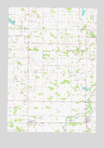
Mayer, MN USGS Topographic Map
Click on map above to begin viewing in our Map Viewer.

This topographic map contains these locations and features:
Feature Name Type Latitude Longitude GNIS ID View Map
City of MayerCivilN44.8869°W93.8903°2395049View Map
City of New GermanyCivilN44.8802°W93.9723°2395195View Map
Cobble Crest LakeLakeN44.9503°W93.8931°2101702View Map
Connally SchoolLocaleN44.9650°W93.9611°641446View Map
County Ditch Number NineCanalN44.8944°W93.9319°1815280View Map
Dobraty SchoolLocaleN44.9283°W93.9830°642858View Map
HazeltonPopulated PlaceN44.9566°W93.9516°654749View Map
HollywoodPopulated PlaceN44.9058°W93.9714°645098View Map
Hollywood Post Office (historical)Post OfficeN44.9058°W93.9711°2092715View Map
Hollywood SchoolSchoolN44.9419°W93.9316°645099View Map
Judicial Ditch Number FourCanalN44.9605°W93.9414°1815279View Map
Judicial Ditch Number OneCanalN44.9272°W93.9780°1815287View Map
Lake IdaLakeN44.9855°W93.9959°645335View Map
Lake Ida SchoolSchoolN44.9864°W93.9916°646366View Map
Lippert LakeLakeN44.9189°W93.8915°646740View Map
MayerPopulated PlaceN44.8850°W93.8877°647629View Map
Mayer City HallBuildingN44.8894°W93.8894°2094333View Map
Mayer Fire DepartmentBuildingN44.8882°W93.8875°2094335View Map
Mayer Lutheran High SchoolSchoolN44.8899°W93.8851°2094334View Map
Mayer Post OfficePost OfficeN44.8857°W93.8882°2094343View Map
McClelland SchoolLocaleN44.9905°W93.9516°647663View Map
McGrath SchoolLocaleN44.9964°W93.9208°647682View Map
Neaton SchoolSchoolN44.9705°W93.8905°648440View Map
New GermanyPopulated PlaceN44.8841°W93.9705°648507View Map
New GermanyLocaleN44.8903°W93.9669°2094321View Map
New Germany Fire DepartmentBuildingN44.8846°W93.9667°2666456View Map
New Germany Post OfficePost OfficeN44.8846°W93.9684°2094345View Map
OsterPopulated PlaceN44.9800°W93.9822°654864View Map
Oster Post Office (historical)Post OfficeN44.9800°W93.9819°2067336View Map
Pooles LakeLakeN44.9959°W93.8948°1815363View Map
Saint John Lutheran ChurchChurchN44.9064°W93.9744°2094322View Map
Saint John's Lutheran Church CemeteryCemeteryN44.9068°W93.9715°2094260View Map
Saint Mark CemeteryCemeteryN44.8910°W93.9757°650815View Map
Saint Mark Lutheran SchoolSchoolN44.8831°W93.9650°2432972View Map
Saint Mark's Lutheran ChurchChurchN44.8847°W93.9631°2094320View Map
Schumacher AirportAirportN44.9844°W93.9361°2676821View Map
Sells Flying Field (historical)AirportN44.8789°W93.8855°660283View Map
Top Dog Country ClubLocaleN44.9125°W93.9542°2094319View Map
Township of HollywoodCivilN44.9352°W93.9509°664502View Map
Ziermann AirportAirportN44.8771°W93.8891°660282View Map
Zion CemeteryCemeteryN44.9000°W93.8885°654448View Map
Zion Lutheran ChurchChurchN44.8858°W93.8894°2094336View Map
Zion Lutheran SchoolSchoolN44.8865°W93.8897°2094337View Map

Note: Coordinates in the location and feature list above are referenced to NAD83 datum.


Copyright (C) 2008-2025 Ryan Niemi / Sunset Dynamics ... All Rights Reserved