TopoQuest Logo
Do you find TopoQuest useful?
Help keep TopoQuest running and adding new maps/features by donating!
Bitcoin:  19c7KJd3qBynnjoSw5npx9KScwjBe4ifkT
Litecoin:  LXs6TkuXGGXo1vDsWCkWVdjQX94eUKd6ui
Home View Maps Find Maps Find Places Resources & Links


Plato, Minnesota Topographic Map

USGS Map Title: Plato, MN
USGS Map MRC: 44094G1
DRG (GeoTIFF) Download: o44094g1.tif


Neighboring USGS Topographic Map Quads:


  Silver Lake, MN  
44094H2
 

  Winsted, MN  
44094H1
 

  Mayer, MN  
44093H8
 

  Glencoe, MN  
44094G2
 

  Plato, MN  
44094G1
 

  Norwood, MN  
44093G8
 

  New Auburn, MN  
44094F2
 

  Green Isle, MN  
44094F1
 

  Hamburg, MN  
44093F8


Map MRC Location:

N45°
W95°
N45°
W94°
H8 H7 H6 H5 H4 H3 H2 H1
G8 G7 G6 G5 G4 G3 G2 G1
F8 F7 F6 F5 F4 F3 F2 F1
E8 E7 E6 E5 E4 E3 E2 E1
D8 D7 D6 D5 D4 D3 D2 D1
C8 C7 C6 C5 C4 C3 C2 C1
B8 B7 B6 B5 B4 B3 B2 B1
A8 A7 A6 A5 A4 A3 A2 A1
N44°
W95°
N44°
W94°

Plato, MN USGS 1:24K Topographic Map Preview:
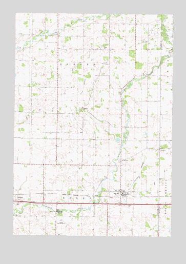
Plato, MN USGS Topographic Map
Click on map above to begin viewing in our Map Viewer.

This topographic map contains these locations and features:
Feature Name Type Latitude Longitude GNIS ID View Map
Bergan Township CemeteryCemeteryN44.8217°W94.0694°2065273View Map
Bergen SchoolSchoolN44.8219°W94.0708°639960View Map
Brush LakebedFlatN44.8333°W94.0711°1817789View Map
Buffalo Creek County ParkParkN44.7633°W94.0891°1817787View Map
Church of GodChurchN44.8594°W94.0202°1817790View Map
Church of God CemeteryCemeteryN44.8599°W94.0204°2065276View Map
City of PlatoCivilN44.7725°W94.0398°2396225View Map
County Ditch Number Fifteen ACanalN44.7927°W94.0811°1817781View Map
County Ditch Number FiveCanalN44.8500°W94.0619°1817783View Map
County Ditch Number ThirteenCanalN44.8133°W94.1247°1817784View Map
County Ditch Number TwentyeightCanalN44.7816°W94.0277°1817779View Map
County Ditch Number TwentynineCanalN44.8086°W94.0714°1817782View Map
Crane CreekStreamN44.8727°W94.0069°642425View Map
Friedens ChurchChurchN44.7986°W94.0094°643958View Map
Glencoe Catholic CemeteryCemeteryN44.7684°W94.1187°2065272View Map
Glencoe Municipal AirportAirportN44.7560°W94.0812°660182View Map
Judicial Ditch Number EightCanalN44.7505°W94.0903°1817778View Map
Kennison LakebedFlatN44.7861°W94.0252°1817785View Map
Lutheran CemeteryCemeteryN44.8417°W94.0611°2065274View Map
PlatoPopulated PlaceN44.7744°W94.0400°649540View Map
Plato Baseball FieldParkN44.7750°W94.0458°2065225View Map
Plato Fire DepartmentBuildingN44.7742°W94.0383°2065223View Map
Plato Post OfficePost OfficeN44.7732°W94.0381°2065222View Map
Plato SidingLocaleN44.7722°W94.0364°2065224View Map
Saint John's Lutheran ChurchChurchN44.7756°W94.0411°2065227View Map
Saint Johns CemeteryCemeteryN44.7926°W94.0403°1817786View Map
Saint Johns SchoolSchoolN44.7936°W94.0402°650737View Map
Saint Paul CemeteryCemeteryN44.7677°W94.0330°650959View Map
Saint Paul's United Church of ChristChurchN44.7739°W94.0358°2065226View Map
School Number 993SchoolN44.8183°W94.0941°651770View Map
Silver CreekStreamN44.8616°W94.0058°652027View Map
Swedish ChurchChurchN44.8469°W94.0544°652932View Map
Swedish Lutheran CemeteryCemeteryN44.8472°W94.0549°2065275View Map
Township CemeteryCemeteryN44.8217°W94.0715°1817788View Map
Township of BergenCivilN44.8471°W94.0714°663574View Map
Township of HelenCivilN44.7605°W94.0708°664442View Map

Note: Coordinates in the location and feature list above are referenced to NAD83 datum.


Copyright (C) 2008-2025 Ryan Niemi / Sunset Dynamics ... All Rights Reserved