TopoQuest Logo
Do you find TopoQuest useful?
Help keep TopoQuest running and adding new maps/features by donating!
Bitcoin:  19c7KJd3qBynnjoSw5npx9KScwjBe4ifkT
Litecoin:  LXs6TkuXGGXo1vDsWCkWVdjQX94eUKd6ui
Home View Maps Find Maps Find Places Resources & Links


Norwood, Minnesota Topographic Map

USGS Map Title: Norwood, MN
USGS Map MRC: 44093G8
DRG (GeoTIFF) Download: o44093g8.tif


Neighboring USGS Topographic Map Quads:


  Winsted, MN  
44094H1
 

  Mayer, MN  
44093H8
 

  Watertown, MN  
44093H7
 

  Plato, MN  
44094G1
 

  Norwood, MN  
44093G8
 

  Waconia, MN  
44093G7
 

  Green Isle, MN  
44094F1
 

  Hamburg, MN  
44093F8
 

  Belle Plaine North, MN  
44093F7


Map MRC Location:

N45°
W94°
N45°
W93°
H8 H7 H6 H5 H4 H3 H2 H1
G8 G7 G6 G5 G4 G3 G2 G1
F8 F7 F6 F5 F4 F3 F2 F1
E8 E7 E6 E5 E4 E3 E2 E1
D8 D7 D6 D5 D4 D3 D2 D1
C8 C7 C6 C5 C4 C3 C2 C1
B8 B7 B6 B5 B4 B3 B2 B1
A8 A7 A6 A5 A4 A3 A2 A1
N44°
W94°
N44°
W93°

Norwood, MN USGS 1:24K Topographic Map Preview:
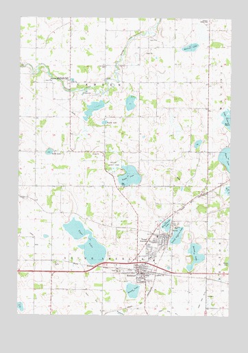
Norwood, MN USGS Topographic Map
Click on map above to begin viewing in our Map Viewer.

This topographic map contains these locations and features:
Feature Name Type Latitude Longitude GNIS ID View Map
All Saints Lutheran ChurchChurchN44.7728°W93.9214°2094240View Map
Barnes LakeLakeN44.7751°W93.8956°639633View Map
Baylor County ParkParkN44.8139°W93.9433°1815273View Map
Baylor LakeLakeN44.8311°W93.9483°639746View Map
Berliner LakeLakeN44.8628°W93.8990°639969View Map
Brand LakeLakeN44.7605°W93.9321°640433View Map
Braunworth LakeLakeN44.7878°W93.9124°640444View Map
Buffalo CreekStreamN44.8544°W93.9977°663168View Map
Central Elementary SchoolSchoolN44.7744°W93.9274°2094255View Map
Central High SchoolSchoolN44.7744°W93.9221°2094256View Map
Central Middle SchoolSchoolN44.7740°W93.9228°2432909View Map
Church of PeaceChurchN44.7703°W93.9256°2094241View Map
Church of the AscensionChannelN44.7711°W93.9300°2094243View Map
Church of the Ascension Catholic CemeteryCemeteryN44.7709°W93.9306°2094317View Map
City of Norwood (historical)CivilN44.7680°W93.9275°2395277View Map
City of Norwood Young AmericaCivilN44.7722°W93.9196°2395278View Map
City of Young America (historical)CivilN44.7827°W93.9136°2397395View Map
County Ditch Number FiveCanalN44.7505°W93.9383°1815268View Map
Crow River / Saint Paul's Lutheran CemeteryCemeteryN44.8547°W93.9493°642503View Map
Eagle LakeLakeN44.8084°W93.9344°643016View Map
Faxon CourtPopulated PlaceN44.7708°W93.9186°2094252View Map
Ferguson CemeteryCemeteryN44.7991°W93.9958°643606View Map
Forest Hills CemeteryCemeteryN44.7684°W93.9396°1815272View Map
Fox FieldAirportN44.8038°W93.9518°2676833View Map
Friendship ParkParkN44.7806°W93.9217°2094246View Map
Gravel Pit State Wildlife Management AreaParkN44.8480°W93.9711°1815274View Map
Judicial Ditch Number FiveCanalN44.7794°W93.9902°1815269View Map
Lakeview ClinicHospitalN44.7703°W93.9189°2094253View Map
Mau CemeteryCemeteryN44.7861°W93.9094°1815270View Map
Mielke SchoolLocaleN44.8586°W93.9505°647829View Map
NorwoodLocaleN44.7692°W93.9278°2094244View Map
Norwood Young America Post OfficePost OfficeN44.7709°W93.9214°2094254View Map
Norwood - Young America Fire Department North StationBuildingN44.7823°W93.9124°2666458View Map
Norwood - Young America Fire Department South StationBuildingN44.7677°W93.9292°2666448View Map
Norwood (historical)Populated PlaceN44.7680°W93.9275°648764View Map
Norwood Young AmericaPopulated PlaceN44.7736°W93.9216°1764916View Map
Norwood Young America Post OfficePost OfficeN44.7709°W93.9214°2094251View Map
Reformed Church CemeteryCemeteryN44.7667°W93.9805°2094267View Map
Saint John's Lutheran ChurchChurchN44.7822°W93.9136°2094249View Map
Saint John's Lutheran SchoolSchoolN44.7834°W93.9178°2094247View Map
Saint Johns CemeteryCemeteryN44.7869°W93.9086°1815271View Map
Smith LakeLakeN44.8183°W93.9820°652170View Map
Tacoma West Industrial ParkLocaleN44.7654°W93.9128°2098280View Map
Tiger LakeLakeN44.7822°W93.9575°653199View Map
Township of CamdenCivilN44.8462°W93.9500°663731View Map
Township of Young AmericaCivilN44.7601°W93.9513°666069View Map
United Methodist ChurchChurchN44.7706°W93.9289°2094242View Map
Wilkommen ParkParkN44.7825°W93.9158°2094245View Map
Young America (historical)Populated PlaceN44.7827°W93.9136°654422View Map
Young America City HallBuildingN44.7835°W93.9148°2098282View Map
Young America Industrial ParkLocaleN44.7737°W93.9166°2098281View Map
Young America LakeLakeN44.7834°W93.9061°654423View Map
Young America LibraryBuildingN44.7831°W93.9161°2094248View Map
Young America Public CemeteryCemeteryN44.7872°W93.9079°2094316View Map

Note: Coordinates in the location and feature list above are referenced to NAD83 datum.


Copyright (C) 2008-2024 Ryan Niemi / Sunset Dynamics ... All Rights Reserved