TopoQuest Logo
Do you find TopoQuest useful?
Help keep TopoQuest running and adding new maps/features by donating!
Bitcoin:  19c7KJd3qBynnjoSw5npx9KScwjBe4ifkT
Litecoin:  LXs6TkuXGGXo1vDsWCkWVdjQX94eUKd6ui
Home View Maps Find Maps Find Places Resources & Links


McArthur, Arkansas Topographic Map

USGS Map Title: McArthur, AR
USGS Map MRC: 33091F3
DRG (GeoTIFF) Download: o33091f3.tif


Neighboring USGS Topographic Map Quads:


  Winchester, AR  
33091G4
 

  Kelso, AR  
33091G3
 

  Lake Cheatham, AR  
33091G2
 

  McGehee North, AR  
33091F4
 

  McArthur, AR  
33091F3
 

  Catfish Point, MS  
33091F2
 

  McGehee South, AR  
33091E4
 

  Halley, AR  
33091E3
 

  Arkansas City, AR  
33091E2


Map MRC Location:

N34°
W92°
N34°
W91°
H8 H7 H6 H5 H4 H3 H2 H1
G8 G7 G6 G5 G4 G3 G2 G1
F8 F7 F6 F5 F4 F3 F2 F1
E8 E7 E6 E5 E4 E3 E2 E1
D8 D7 D6 D5 D4 D3 D2 D1
C8 C7 C6 C5 C4 C3 C2 C1
B8 B7 B6 B5 B4 B3 B2 B1
A8 A7 A6 A5 A4 A3 A2 A1
N33°
W92°
N33°
W91°

McArthur, AR USGS 1:24K Topographic Map Preview:
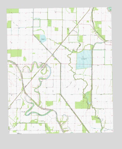
McArthur, AR USGS Topographic Map
Click on map above to begin viewing in our Map Viewer.

This topographic map contains these locations and features:
Feature Name Type Latitude Longitude GNIS ID View Map
Big SloughGutN33.6732°W91.3018°46598View Map
Boggy BayouGutN33.6490°W91.2721°46798View Map
Bogota (historical)Populated PlaceN33.6818°W91.3437°63845View Map
Canal Number 16CanalN33.6637°W91.3587°81987View Map
Canal Number 43CanalN33.6354°W91.2879°81993View Map
Lake IsaacsLakeN33.7143°W91.2676°75746View Map
Macedonia ChurchChurchN33.6868°W91.3462°51563View Map
McArthurPopulated PlaceN33.6896°W91.3348°58138View Map
McArthur CemeteryCemeteryN33.6929°W91.3296°63846View Map
McArthurs Friends ChurchChurchN33.6787°W91.3329°51776View Map
Middle Coon BayouGutN33.7351°W91.3112°51927View Map
Mount Zion ChurchChurchN33.6434°W91.3393°52459View Map
Opossum ForkStreamN33.7168°W91.2529°53060View Map
Palestine CemeteryCemeteryN33.6473°W91.3568°63844View Map
Palestine ChurchChurchN33.6471°W91.3562°53134View Map
Sims ChapelChurchN33.6421°W91.3037°54870View Map
Township of ClaytonCivilN33.6928°W91.3666°66498View Map
Warrington CemeteryCemeteryN33.6954°W91.3326°56068View Map
Wolff Project SchoolSchoolN33.6643°W91.3704°56505View Map

Note: Coordinates in the location and feature list above are referenced to NAD83 datum.


Copyright (C) 2008-2024 Ryan Niemi / Sunset Dynamics ... All Rights Reserved