TopoQuest Logo
Do you find TopoQuest useful?
Help keep TopoQuest running and adding new maps/features by donating!
Bitcoin:  19c7KJd3qBynnjoSw5npx9KScwjBe4ifkT
Litecoin:  LXs6TkuXGGXo1vDsWCkWVdjQX94eUKd6ui
Home View Maps Find Maps Find Places Resources & Links


McGehee North, Arkansas Topographic Map

USGS Map Title: McGehee North, AR
USGS Map MRC: 33091F4
DRG (GeoTIFF) Download: o33091f4.tif


Neighboring USGS Topographic Map Quads:


  Gourd, AR  
33091G5
 

  Winchester, AR  
33091G4
 

  Kelso, AR  
33091G3
 

  Selma, AR  
33091F5
 

  McGehee North, AR  
33091F4
 

  McArthur, AR  
33091F3
 

  Collins, AR  
33091E5
 

  McGehee South, AR  
33091E4
 

  Halley, AR  
33091E3


Map MRC Location:

N34°
W92°
N34°
W91°
H8 H7 H6 H5 H4 H3 H2 H1
G8 G7 G6 G5 G4 G3 G2 G1
F8 F7 F6 F5 F4 F3 F2 F1
E8 E7 E6 E5 E4 E3 E2 E1
D8 D7 D6 D5 D4 D3 D2 D1
C8 C7 C6 C5 C4 C3 C2 C1
B8 B7 B6 B5 B4 B3 B2 B1
A8 A7 A6 A5 A4 A3 A2 A1
N33°
W92°
N33°
W91°

McGehee North, AR USGS 1:24K Topographic Map Preview:
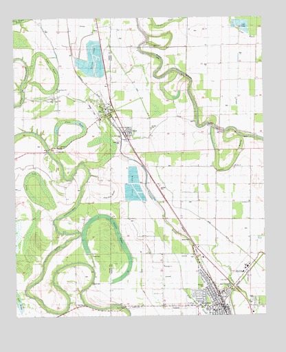
McGehee North, AR USGS Topographic Map
Click on map above to begin viewing in our Map Viewer.

This topographic map contains these locations and features:
Feature Name Type Latitude Longitude GNIS ID View Map
Austin BrakeLakeN33.6667°W91.4542°76212View Map
Austin CemeteryCemeteryN33.6386°W91.4615°45980View Map
Austin CemeteryCemeteryN33.6511°W91.4615°45981View Map
B C Prewitt Elementary SchoolSchoolN33.7084°W91.4490°63835View Map
Bailey Chapel Baptist ChurchChurchN33.6526°W91.4643°78961View Map
Bailey SchoolSchoolN33.6526°W91.4643°46021View Map
Bogue Pilgrim CemeteryCemeteryN33.7382°W91.4301°63837View Map
Bogue Pilgrim ChurchChurchN33.7376°W91.4296°63836View Map
Bogue Pilgrim SchoolSchoolN33.7365°W91.4207°46807View Map
Chickasaw Baptist ChurchChurchN33.6454°W91.4254°76601View Map
City of McGeheeCivilN33.6280°W91.3956°2405049View Map
City of TillarCivilN33.7109°W91.4522°2405591View Map
Cypress BrakeSwampN33.6983°W91.4598°78993View Map
First Baptist ChurchChurchN33.6273°W91.3985°63781View Map
Flying G Ranch AirportAirportN33.6935°W91.3802°83848View Map
Great Rivers Voc-Tech SchoolSchoolN33.6432°W91.3862°63842View Map
Isaac Chapel Baptist ChurchChurchN33.6298°W91.4654°77353View Map
Jerden BrakeSwampN33.6577°W91.4980°79021View Map
Jerusalem Baptist ChurchChurchN33.6959°W91.4768°77374View Map
Little Bayou MaconGutN33.6296°W91.3782°51188View Map
Loggy BayouSwampN33.7168°W91.4849°77536View Map
Loggy Bayou Baptist ChurchChurchN33.7198°W91.4773°77537View Map
Loggy Bayou CemeteryCemeteryN33.7168°W91.4787°79031View Map
Loggy Bayou School (historical)SchoolN33.7162°W91.4798°79032View Map
McCool CemeteryCemeteryN33.6579°W91.4126°51801View Map
McGeheePopulated PlaceN33.6290°W91.3996°58148View Map
McGehee Elementary SchoolSchoolN33.6270°W91.4009°63839View Map
McGehee Fire DepartmentBuildingN33.6288°W91.4051°2116783View Map
McGehee Fire Department AmbulanceBuildingN33.6288°W91.4051°2119049View Map
McGehee High SchoolSchoolN33.6455°W91.3840°63843View Map
McGehee Police DepartmentBuildingN33.6298°W91.3827°2118714View Map
Mount Olive ChurchChurchN33.6879°W91.3896°52338View Map
New Bethel Baptist ChurchChurchN33.7159°W91.4804°79053View Map
New Hope ChurchChurchN33.7048°W91.4032°63838View Map
New Hope SchoolSchoolN33.7040°W91.4021°52703View Map
New Salem ChurchChurchN33.7382°W91.4507°52738View Map
Open LakeSwampN33.6752°W91.4916°79063View Map
Paw Paw BrakeSwampN33.6754°W91.4523°53231View Map
ReedPopulated PlaceN33.7021°W91.4432°63833View Map
Reed Police DepartmentBuildingN33.7006°W91.4434°2118715View Map
Reed Volunteer Fire DepartmentBuildingN33.7002°W91.4432°2625427View Map
Saint Andrew ChurchChurchN33.6718°W91.3821°54307View Map
Saint Paul CemeteryCemeteryN33.7034°W91.4315°63834View Map
Seven Star CemeteryCemeteryN33.6979°W91.4473°63832View Map
Seven Star ChurchChurchN33.6993°W91.4465°54676View Map
Stephens ParkParkN33.6379°W91.4054°63840View Map
TillarPopulated PlaceN33.7123°W91.4529°58746View Map
Tillar AirportAirportN33.7147°W91.4640°83847View Map
Tillar Baptist ChurchChurchN33.7115°W91.4557°79100View Map
Tillar BrakeSwampN33.6991°W91.4724°78557View Map
Tillar CemeteryCemeteryN33.6937°W91.4782°55573View Map
Tillar Fire Department Main StationBuildingN33.7123°W91.4546°2117210View Map
Tillar Fire Department SubstationBuildingN33.7134°W91.4526°2117211View Map
Tillar United Methodist ChurchChurchN33.7104°W91.4540°79101View Map
Town of ReedCivilN33.7019°W91.4461°2407192View Map
Union ChapelChurchN33.6407°W91.3935°55786View Map
Wiley A McGehee ParkParkN33.6376°W91.3926°63841View Map

Note: Coordinates in the location and feature list above are referenced to NAD83 datum.


Copyright (C) 2008-2024 Ryan Niemi / Sunset Dynamics ... All Rights Reserved