TopoQuest Logo
Do you find TopoQuest useful?
Help keep TopoQuest running and adding new maps/features by donating!
Bitcoin:  19c7KJd3qBynnjoSw5npx9KScwjBe4ifkT
Litecoin:  LXs6TkuXGGXo1vDsWCkWVdjQX94eUKd6ui
Home View Maps Find Maps Find Places Resources & Links


McCabe East, Montana Topographic Map

USGS Map Title: McCabe East, MT
USGS Map MRC: 48104B3
DRG (GeoTIFF) Download: o48104b3.tif


Neighboring USGS Topographic Map Quads:


  Froid, MT  
48104C4
 

  Froid SE, MT  
48104C3
 

  Brush Mountain SW, MT  
48104C2
 

  McCabe West, MT  
48104B4
 

  McCabe East, MT  
48104B3
 

  Bainville, MT  
48104B2
 

  Three Buttes, MT  
48104A4
 

  Cedar Coulee, MT  
48104A3
 

  Bainville SW, MT  
48104A2


Map MRC Location:

N49°
W105°
N49°
W104°
H8 H7 H6 H5 H4 H3 H2 H1
G8 G7 G6 G5 G4 G3 G2 G1
F8 F7 F6 F5 F4 F3 F2 F1
E8 E7 E6 E5 E4 E3 E2 E1
D8 D7 D6 D5 D4 D3 D2 D1
C8 C7 C6 C5 C4 C3 C2 C1
B8 B7 B6 B5 B4 B3 B2 B1
A8 A7 A6 A5 A4 A3 A2 A1
N48°
W105°
N48°
W104°

McCabe East, MT USGS 1:24K Topographic Map Preview:
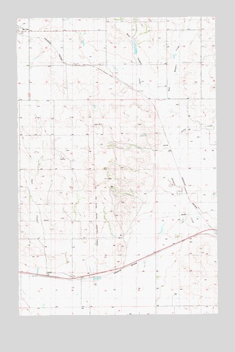
McCabe East, MT USGS Topographic Map
Click on map above to begin viewing in our Map Viewer.

This topographic map contains these locations and features:
Feature Name Type Latitude Longitude GNIS ID View Map
27N57E02AA__01 WellWellN48.1259°W104.3141°826478View Map
27N57E04AB__01 WellWellN48.1259°W104.3622°826479View Map
27N58E06BB__01 WellWellN48.1261°W104.2861°826485View Map
28N41E36ADDB01 WellWellN48.1406°W104.3624°826623View Map
28N57E04AB__01 WellWellN48.2136°W104.3627°1634175View Map
28N57E04BD__01 WellWellN48.2100°W104.3680°1634140View Map
28N57E04DC__01 WellWellN48.2028°W104.3627°1634083View Map
28N57E09CC__01 WellWellN48.1884°W104.3733°1633970View Map
28N57E10BB__01 WellWellN48.1992°W104.3519°1634047View Map
28N57E13DA__01 WellWellN48.1775°W104.2933°1633862View Map
28N57E13DA__02 WellWellN48.1775°W104.2933°1633863View Map
28N57E13DA__03 WellWellN48.1775°W104.2933°1633864View Map
28N57E16CD__01 WellWellN48.1739°W104.3680°1633839View Map
28N57E16CD__02 WellWellN48.1739°W104.3680°1633840View Map
28N57E25BA__01 WellWellN48.1556°W104.3038°826811View Map
28N57E25CB__01 WellWellN48.1484°W104.3091°826716View Map
28N57E25CC__01 WellWellN48.1447°W104.3091°826680View Map
28N57E25CC__02 WellWellN48.1447°W104.3091°826681View Map
28N57E26CA__01 WellWellN48.1484°W104.3252°826717View Map
28N57E26CA__02 WellWellN48.1484°W104.3252°826718View Map
28N57E28CD__01 WellWellN48.1447°W104.3680°826683View Map
28N57E28DC__01 WellWellN48.1447°W104.3627°826682View Map
28N57E28DD__01 WellWellN48.1445°W104.3616°826673View Map
28N57E33AA__01 WellWellN48.1411°W104.3574°826638View Map
28N57E33AB__01 WellWellN48.1411°W104.3627°826639View Map
28N57E33CB__01 WellWellN48.1339°W104.3733°826563View Map
28N57E34DD__01 WellWellN48.1303°W104.3361°826523View Map
28N57E35AB__01 WellWellN48.1411°W104.3199°826637View Map
28N57E36AB__01 WellWellN48.1411°W104.2986°826636View Map
28N57E36DD__01 WellWellN48.1303°W104.2933°826522View Map
28N58E07BC__01 WellWellN48.1950°W104.2849°1634005View Map
28N58E07BC__02 WellWellN48.1950°W104.2849°1634006View Map
28N58E17CA__01 WellWellN48.1770°W104.2583°1633856View Map
28N58E17CA__02 WellWellN48.1770°W104.2583°1633857View Map
28N58E18DB__01 WellWellN48.1770°W104.2744°1633858View Map
28N58E19DC__01 WellWellN48.1592°W104.2744°826842View Map
28N58E19DCDC01 WellWellN48.1584°W104.2758°826829View Map
28N58E19DD__01 WellWellN48.1592°W104.2688°826841View Map
28N58E31BB__01 WellWellN48.1411°W104.2849°826633View Map
28N58E31BB__02 WellWellN48.1411°W104.2849°826634View Map
28N58E31BB__03 WellWellN48.1411°W104.2849°826635View Map
28N58E31DB__01 WellWellN48.1339°W104.2744°826562View Map
29N57E30BCBB01 WellWellN48.2395°W104.3663°1634351View Map
29N57E32BBBC01 WellWellN48.2289°W104.3444°1634287View Map
East Roosevelt DivisionCivilN48.2260°W104.3286°1940605View Map
East Shotgun CreekStreamN48.2134°W104.2811°771110View Map
First Baptist ChurchChurchN48.2467°W104.3733°1669193View Map
Hansen DamDamN48.2167°W104.3238°797626View Map
Harvey School (historical)SchoolN48.2250°W104.2805°1669279View Map
LanarkPopulated PlaceN48.1431°W104.3574°773205View Map
Lanark (historical)LocaleN48.1431°W104.3574°1669379View Map
Lanark Post Office (historical)Post OfficeN48.1431°W104.3574°1669380View Map
Lanark School (historical)SchoolN48.1445°W104.3602°1669284View Map
McCabe School (historical)SchoolN48.2436°W104.3727°1669313View Map
Shell CreekStreamN48.1439°W104.3447°799167View Map
Snake CreekStreamN48.1995°W104.2758°799158View Map
Ward Reservoir DamDamN48.2334°W104.2988°796307View Map
West Shotgun CreekStreamN48.2134°W104.2811°778311View Map

Note: Coordinates in the location and feature list above are referenced to NAD83 datum.


Copyright (C) 2008-2024 Ryan Niemi / Sunset Dynamics ... All Rights Reserved