TopoQuest Logo
Do you find TopoQuest useful?
Help keep TopoQuest running and adding new maps/features by donating!
Bitcoin:  19c7KJd3qBynnjoSw5npx9KScwjBe4ifkT
Litecoin:  LXs6TkuXGGXo1vDsWCkWVdjQX94eUKd6ui
Home View Maps Find Maps Find Places Resources & Links


Three Buttes, Montana Topographic Map

USGS Map Title: Three Buttes, MT
USGS Map MRC: 48104A4
DRG (GeoTIFF) Download: o48104a4.tif


Neighboring USGS Topographic Map Quads:


  Culbertson, MT  
48104B5
 

  McCabe West, MT  
48104B4
 

  McCabe East, MT  
48104B3
 

  Dugout Creek, MT  
48104A5
 

  Three Buttes, MT  
48104A4
 

  Cedar Coulee, MT  
48104A3
 

  Andes, MT  
47104H5
 

  Blue Hill, MT  
47104H4
 

  Sioux Pass, MT  
47104H3


Map MRC Location:

N49°
W105°
N49°
W104°
H8 H7 H6 H5 H4 H3 H2 H1
G8 G7 G6 G5 G4 G3 G2 G1
F8 F7 F6 F5 F4 F3 F2 F1
E8 E7 E6 E5 E4 E3 E2 E1
D8 D7 D6 D5 D4 D3 D2 D1
C8 C7 C6 C5 C4 C3 C2 C1
B8 B7 B6 B5 B4 B3 B2 B1
A8 A7 A6 A5 A4 A3 A2 A1
N48°
W105°
N48°
W104°

Three Buttes, MT USGS 1:24K Topographic Map Preview:
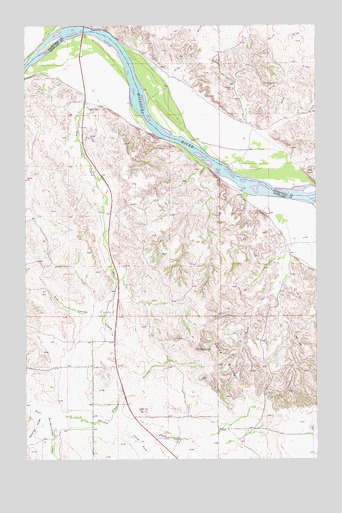
Three Buttes, MT USGS Topographic Map
Click on map above to begin viewing in our Map Viewer.

This topographic map contains these locations and features:
Feature Name Type Latitude Longitude GNIS ID View Map
26N56E16AADA01 WellWellN48.0097°W104.4838°825500View Map
26N57E17ADAA01 WellWellN48.0084°W104.3772°825486View Map
27N56E03CCA_01 WellWellN48.1203°W104.4811°826429View Map
27N56E10CC__01 WellWellN48.1014°W104.4786°826233View Map
27N56E15BB__01 WellWellN48.0978°W104.4786°826204View Map
27N56E22BB__01 WellWellN48.0831°W104.4786°826088View Map
27N56E22DC__01 WellWellN48.0722°W104.4680°826016View Map
27N56E22DC__02 WellWellN48.0722°W104.4680°826017View Map
27N56E22DCBD01 WellWellN48.0722°W104.4694°826018View Map
27N56E22DD__01 WellWellN48.0722°W104.4625°826015View Map
27N56E34AABC01 WellWellN48.0542°W104.4644°825858View Map
27N57E07BDCA01 WellWellN48.1078°W104.4097°826300View Map
27N57E18AB__01 WellWellN48.0970°W104.4047°826198View Map
27N57E19DC__01 WellWellN48.0714°W104.4047°826007View Map
27N57E19DCBD01 WellWellN48.0731°W104.4044°826027View Map
27N57E29AD__01 WellWellN48.0642°W104.3780°825936View Map
27N57E32BACD01 WellWellN48.0531°W104.3877°825853View Map
27N57E32BACD02 WellWellN48.0531°W104.3874°825852View Map
27N57E32BC__01 WellWellN48.0497°W104.3941°825825View Map
27N57E32BC__02 WellWellN48.0497°W104.3941°825826View Map
Cherry CreekStreamN48.0120°W104.4883°769784View Map
Culbertson Bridge Fishing Access SiteLocaleN48.1222°W104.4752°1744262View Map
Culbertson Missouri River BridgeBridgeN48.1234°W104.4750°1669332View Map
Day CreekStreamN48.1039°W104.4733°770492View Map
Devil CreekStreamN48.1028°W104.4727°1715251View Map
Elm CouleeValleyN48.0425°W104.4661°771206View Map
Goodman CouleeValleyN48.0125°W104.4927°771856View Map
Shaw CouleeValleyN48.0134°W104.4633°776410View Map
South Fork Cherry CreekStreamN48.0078°W104.4561°776801View Map
The PointCliffN48.0820°W104.3783°777531View Map
Three ButtesSummitN48.0314°W104.4255°777598View Map

Note: Coordinates in the location and feature list above are referenced to NAD83 datum.


Copyright (C) 2008-2025 Ryan Niemi / Sunset Dynamics ... All Rights Reserved