TopoQuest Logo
Do you find TopoQuest useful?
Help keep TopoQuest running and adding new maps/features by donating!
Bitcoin:  19c7KJd3qBynnjoSw5npx9KScwjBe4ifkT
Litecoin:  LXs6TkuXGGXo1vDsWCkWVdjQX94eUKd6ui
Home View Maps Find Maps Find Places Resources & Links


McCabe West, Montana Topographic Map

USGS Map Title: McCabe West, MT
USGS Map MRC: 48104B4
DRG (GeoTIFF) Download: o48104b4.tif


Neighboring USGS Topographic Map Quads:


  Johnson Lake, MT  
48104C5
 

  Froid, MT  
48104C4
 

  Froid SE, MT  
48104C3
 

  Culbertson, MT  
48104B5
 

  McCabe West, MT  
48104B4
 

  McCabe East, MT  
48104B3
 

  Dugout Creek, MT  
48104A5
 

  Three Buttes, MT  
48104A4
 

  Cedar Coulee, MT  
48104A3


Map MRC Location:

N49°
W105°
N49°
W104°
H8 H7 H6 H5 H4 H3 H2 H1
G8 G7 G6 G5 G4 G3 G2 G1
F8 F7 F6 F5 F4 F3 F2 F1
E8 E7 E6 E5 E4 E3 E2 E1
D8 D7 D6 D5 D4 D3 D2 D1
C8 C7 C6 C5 C4 C3 C2 C1
B8 B7 B6 B5 B4 B3 B2 B1
A8 A7 A6 A5 A4 A3 A2 A1
N48°
W105°
N48°
W104°

McCabe West, MT USGS 1:24K Topographic Map Preview:
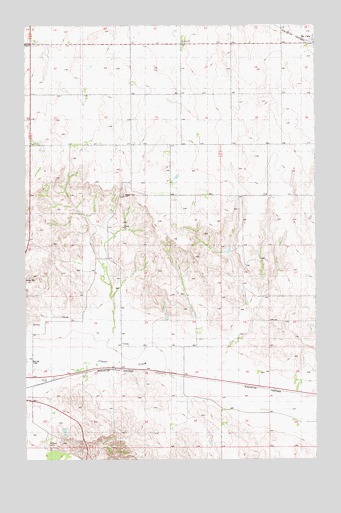
McCabe West, MT USGS Topographic Map
Click on map above to begin viewing in our Map Viewer.

This topographic map contains these locations and features:
Feature Name Type Latitude Longitude GNIS ID View Map
27N56E01AA__01 WellWellN48.1267°W104.4197°826494View Map
28N56E01AA__01 WellWellN48.2142°W104.4216°1634176View Map
28N56E01CB__02 WellWellN48.2070°W104.4380°1634109View Map
28N56E02AA__01 WellWellN48.2142°W104.4433°1634177View Map
28N56E02CA__01 WellWellN48.2070°W104.4541°1634111View Map
28N56E02CA__02 WellWellN48.2070°W104.4541°1634112View Map
28N56E02DA__01 WellWellN48.2070°W104.4433°1634110View Map
28N56E03AA__01 WellWellN48.2142°W104.4650°1634178View Map
28N56E03BB__01 WellWellN48.2142°W104.4811°1634179View Map
28N56E04BA__01 WellWellN48.2142°W104.4975°1634180View Map
28N56E04DA__01 WellWellN48.2070°W104.4866°1634113View Map
28N56E10CA__01 WellWellN48.1925°W104.4758°1633999View Map
28N56E11CB__01 WellWellN48.1925°W104.4594°1633998View Map
28N56E12AB__01 WellWellN48.1997°W104.4272°1634050View Map
28N56E12AB__02 WellWellN48.1997°W104.4272°1634051View Map
28N56E12BA__01 WellWellN48.1997°W104.4325°1634052View Map
28N56E12BADD01 WellWellN48.1981°W104.4277°1634030View Map
28N56E12CB__01 WellWellN48.1925°W104.4380°1633997View Map
28N56E12DB__01 WellWellN48.1925°W104.4272°1633995View Map
28N56E12DB__02 WellWellN48.1925°W104.4272°1633996View Map
28N56E14CB__01 WellWellN48.1781°W104.4594°1633866View Map
28N56E15CA__01 WellWellN48.1781°W104.4758°1633867View Map
28N56E16AD__01 WellWellN48.1817°W104.4866°1633898View Map
28N56E21AC__01 WellWellN48.1670°W104.4919°1633784View Map
28N56E21CA__01 WellWellN48.1634°W104.4975°826876View Map
28N56E23DB__01 WellWellN48.1634°W104.4488°826875View Map
28N56E24DB__01 WellWellN48.1634°W104.4272°826874View Map
28N56E24DBCC01 WellWellN48.1622°W104.4263°826865View Map
28N56E24DD__01 WellWellN48.1597°W104.4216°826845View Map
28N56E25BD__01 WellWellN48.1525°W104.4325°826765View Map
28N56E26CB__01 WellWellN48.1489°W104.4594°826724View Map
28N56E26DB__01 WellWellN48.1489°W104.4488°826723View Map
28N56E27AD__01 WellWellN48.1525°W104.4650°826766View Map
28N56E27BD__01 WellWellN48.1525°W104.4758°826767View Map
28N56E27BD__02 WellWellN48.1525°W104.4758°826768View Map
28N56E27BD__03 WellWellN48.1525°W104.4758°826769View Map
28N56E27CA__01 WellWellN48.1489°W104.4758°826725View Map
28N56E28BD__01 WellWellN48.1525°W104.4975°826770View Map
28N56E28BD__02 WellWellN48.1525°W104.4975°826771View Map
28N56E33AB__01 WellWellN48.1417°W104.4919°826641View Map
28N56E33AD__01 WellWellN48.1381°W104.4866°826600View Map
28N56E33CD__01 WellWellN48.1309°W104.4975°826526View Map
28N56E36CB__01 WellWellN48.1345°W104.4380°826570View Map
28N56E36CB__02 WellWellN48.1345°W104.4380°826571View Map
28N57E05AC__01 WellWellN48.2100°W104.3841°1634141View Map
28N57E06DD__01 WellWellN48.2028°W104.4002°1634084View Map
28N57E07CC__01 WellWellN48.1884°W104.4161°1633972View Map
28N57E08BB__01 WellWellN48.1992°W104.3947°1634048View Map
28N57E08DD__01 WellWellN48.1884°W104.3788°1633971View Map
28N57E19CD__01 WellWellN48.1592°W104.4108°826843View Map
28N57E20AA__01 WellWellN48.1700°W104.3788°1633805View Map
28N57E29DB__01 WellWellN48.1484°W104.3841°826719View Map
28N57E30BB__01 WellWellN48.1556°W104.4161°826812View Map
28N57E31AD__01 WellWellN48.1375°W104.4002°826598View Map
28N57E31AD__02 WellWellN48.1375°W104.4002°826599View Map
28N57E31CB__01 WellWellN48.1339°W104.4161°826567View Map
28N57E31CB__02 WellWellN48.1339°W104.4161°826568View Map
28N57E32DB__01 WellWellN48.1339°W104.3841°826564View Map
28N57E32DB__02 WellWellN48.1339°W104.3841°826565View Map
28N57E32DB__03 WellWellN48.1339°W104.3841°826566View Map
Clover (historical)LocaleN48.1506°W104.4591°1669405View Map
Culbertson MuseumBuildingN48.1486°W104.4927°1669327View Map
Dane Valley Post Office (historical)Post OfficeN48.2361°W104.4311°1669400View Map
Dane Valley School (historical)SchoolN48.2306°W104.4555°1669289View Map
Ebenezer ChurchChurchN48.2450°W104.4325°799155View Map
McCabeLocaleN48.2436°W104.3777°1669378View Map
McCabePopulated PlaceN48.2436°W104.3777°773961View Map
McCabe Brothers Elevator (historical)LocaleN48.2436°W104.3777°1669173View Map
McCabe Post Office (historical)Post OfficeN48.2436°W104.3777°1669377View Map
Montana - Dakota Grain Company Elevator (historical)LocaleN48.2436°W104.3777°1669172View Map
Moothart School (historical)SchoolN48.1950°W104.4052°1669285View Map
Sugar Top HillSummitN48.2009°W104.4591°799156View Map
Tawopa (historical)LocaleN48.1442°W104.3802°1669369View Map
Tawopa Post Office (historical)Post OfficeN48.1442°W104.3802°1669368View Map
Thomsen School (historical)SchoolN48.2147°W104.4616°1669290View Map

Note: Coordinates in the location and feature list above are referenced to NAD83 datum.


Copyright (C) 2008-2025 Ryan Niemi / Sunset Dynamics ... All Rights Reserved