TopoQuest Logo
Do you find TopoQuest useful?
Help keep TopoQuest running and adding new maps/features by donating!
Bitcoin:  19c7KJd3qBynnjoSw5npx9KScwjBe4ifkT
Litecoin:  LXs6TkuXGGXo1vDsWCkWVdjQX94eUKd6ui
Home View Maps Find Maps Find Places Resources & Links


Cedar Coulee, Montana Topographic Map

USGS Map Title: Cedar Coulee, MT
USGS Map MRC: 48104A3
DRG (GeoTIFF) Download: o48104a3.tif


Neighboring USGS Topographic Map Quads:


  McCabe West, MT  
48104B4
 

  McCabe East, MT  
48104B3
 

  Bainville, MT  
48104B2
 

  Three Buttes, MT  
48104A4
 

  Cedar Coulee, MT  
48104A3
 

  Bainville SW, MT  
48104A2
 

  Blue Hill, MT  
47104H4
 

  Sioux Pass, MT  
47104H3
 

  Fairview NW, MT  
47104H2


Map MRC Location:

N49°
W105°
N49°
W104°
H8 H7 H6 H5 H4 H3 H2 H1
G8 G7 G6 G5 G4 G3 G2 G1
F8 F7 F6 F5 F4 F3 F2 F1
E8 E7 E6 E5 E4 E3 E2 E1
D8 D7 D6 D5 D4 D3 D2 D1
C8 C7 C6 C5 C4 C3 C2 C1
B8 B7 B6 B5 B4 B3 B2 B1
A8 A7 A6 A5 A4 A3 A2 A1
N48°
W105°
N48°
W104°

Cedar Coulee, MT USGS 1:24K Topographic Map Preview:
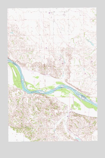
Cedar Coulee, MT USGS Topographic Map
Click on map above to begin viewing in our Map Viewer.

This topographic map contains these locations and features:
Feature Name Type Latitude Longitude GNIS ID View Map
26N57E01BB__01 WellWellN48.0389°W104.3102°825735View Map
26N57E01DD__01 WellWellN48.0281°W104.2941°825639View Map
26N58E05AB__01 WellWellN48.0386°W104.2547°825732View Map
26N58E06CC__01 WellWellN48.0278°W104.2869°825635View Map
27N57E01BC__01 WellWellN48.1222°W104.3088°826444View Map
27N57E01BC__02 WellWellN48.1222°W104.3088°826445View Map
27N57E01BC__03 WellWellN48.1222°W104.3088°826446View Map
27N57E02CB__01 WellWellN48.1186°W104.3302°826418View Map
27N57E03DB__01 WellWellN48.1186°W104.3408°826419View Map
27N57E10BA__01 WellWellN48.1114°W104.3461°826342View Map
27N57E10BA__02 WellWellN48.1114°W104.3461°826343View Map
27N57E12BB__01 WellWellN48.1114°W104.3088°826341View Map
27N57E13CB__01 WellWellN48.0897°W104.3088°826129View Map
27N57E14AA__01 WellWellN48.0970°W104.3141°826196View Map
27N57E14AA__02 WellWellN48.0970°W104.3141°826197View Map
27N57E24ACBA01 WellWellN48.0809°W104.2983°826066View Map
27N57E26DB__01 WellWellN48.0606°W104.3194°825908View Map
27N57E28BDA_01 WellWellN48.0667°W104.3672°825957View Map
27N57E36CD__01 WellWellN48.0425°W104.3036°825772View Map
27N58E06BC__01 WellWellN48.1225°W104.2861°826448View Map
27N58E07BB__01 WellWellN48.1117°W104.2861°826345View Map
27N58E07BB__02 WellWellN48.1117°W104.2861°826346View Map
Becker School (historical)SchoolN48.0689°W104.3144°1669277View Map
Cedar CouleeValleyN48.0131°W104.3116°769698View Map
Coal CouleeValleyN48.0039°W104.3058°769962View Map
Deep CouleeValleyN48.0447°W104.3422°770545View Map
Gettin' High DamDamN48.1017°W104.3705°798310View Map
Harmon ReservoirReservoirN48.0918°W104.2582°795512View Map
Harmon Reservoir DamDamN48.0917°W104.2572°795511View Map
Leeson School (historical)SchoolN48.1222°W104.2997°1669278View Map
Otis CreekStreamN48.0309°W104.2866°774993View Map
Rocky Point CouleeValleyN48.0472°W104.3533°775895View Map
Star CouleeValleyN48.0609°W104.2980°777159View Map
Trudell Number 1 DamDamN48.0034°W104.2805°797563View Map
Wells CouleeValleyN48.0211°W104.2977°778181View Map

Note: Coordinates in the location and feature list above are referenced to NAD83 datum.


Copyright (C) 2008-2025 Ryan Niemi / Sunset Dynamics ... All Rights Reserved