TopoQuest Logo
Do you find TopoQuest useful?
Help keep TopoQuest running and adding new maps/features by donating!
Bitcoin:  19c7KJd3qBynnjoSw5npx9KScwjBe4ifkT
Litecoin:  LXs6TkuXGGXo1vDsWCkWVdjQX94eUKd6ui
Home View Maps Find Maps Find Places Resources & Links


McConville Peak, Oregon Topographic Map

USGS Map Title: McConville Peak, OR
USGS Map MRC: 42123E1
DRG (GeoTIFF) Download: o42123e1.tif


Neighboring USGS Topographic Map Quads:


  King Mountain, OR  
42123F2
 

  Skeleton Mountain, OR  
42123F1
 

  Cleveland Ridge, OR  
42122F8
 

  Wimer, OR  
42123E2
 

  McConville Peak, OR  
42123E1
 

  Boswell Mountain, OR  
42122E8
 

  Rogue River, OR  
42123D2
 

  Gold Hill, OR  
42123D1
 

  Sams Valley, OR  
42122D8


Map MRC Location:

N43°
W124°
N43°
W123°
H8 H7 H6 H5 H4 H3 H2 H1
G8 G7 G6 G5 G4 G3 G2 G1
F8 F7 F6 F5 F4 F3 F2 F1
E8 E7 E6 E5 E4 E3 E2 E1
D8 D7 D6 D5 D4 D3 D2 D1
C8 C7 C6 C5 C4 C3 C2 C1
B8 B7 B6 B5 B4 B3 B2 B1
A8 A7 A6 A5 A4 A3 A2 A1
N42°
W124°
N42°
W123°

McConville Peak, OR USGS 1:24K Topographic Map Preview:
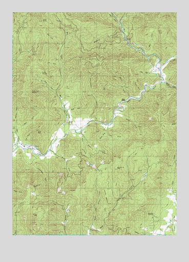
McConville Peak, OR USGS Topographic Map
Click on map above to begin viewing in our Map Viewer.

This topographic map contains these locations and features:
Feature Name Type Latitude Longitude GNIS ID View Map
Albright CreekStreamN42.5373°W123.1081°1132715View Map
Albright GulchValleyN42.5373°W123.1081°1130352View Map
Bald MountainSummitN42.5998°W123.0643°1136026View Map
Battle CreekStreamN42.6193°W123.0437°1137583View Map
Bear Trap GulchValleyN42.6082°W123.0901°1135396View Map
Big GulchValleyN42.5540°W123.0887°1130353View Map
Black ButteSummitN42.6204°W123.1048°1136072View Map
Blair ReservoirReservoirN42.5707°W123.0831°1135404View Map
Bokel GulchValleyN42.5915°W123.0206°1135401View Map
Braton HollowValleyN42.5604°W123.0539°1118044View Map
Bybee SpringsLocaleN42.5746°W123.0445°1136112View Map
Carter GulchValleyN42.5568°W123.0539°1135408View Map
Cherry FlatFlatN42.5915°W123.0234°1135402View Map
Davies GulchValleyN42.5701°W123.0831°1119705View Map
Devils GardenAreaN42.6101°W123.0387°1135400View Map
Elkhorn ButteSummitN42.5623°W123.0056°1136256View Map
False Face MountainSummitN42.5786°W123.1093°1120616View Map
Fawn CreekStreamN42.5812°W123.0928°1135406View Map
Fawn SpringSpringN42.5912°W123.1039°1135405View Map
Gregory ReservoirReservoirN42.5068°W123.0214°1130351View Map
Hillis PeakSummitN42.5263°W123.1100°1158291View Map
Holcomb SpringsSpringN42.5107°W123.0190°1121892View Map
Homestead GulchValleyN42.5426°W123.1081°1121945View Map
Lover GulchValleyN42.5526°W123.1162°1135407View Map
Lover PeakSummitN42.5583°W123.1075°1135403View Map
Magerly GulchValleyN42.5612°W123.1248°1158368View Map
Maple GulchValleyN42.5773°W123.0370°1123742View Map
May CreekStreamN42.5587°W123.0828°1123865View Map
McConville GulchValleyN42.5568°W123.0737°1123919View Map
McConville PeakSummitN42.5343°W123.0474°1136520View Map
Middle Fork Sardine CreekStreamN42.5037°W123.0653°1124117View Map
Miller GulchValleyN42.5812°W123.0289°1135399View Map
Mineral CreekStreamN42.5429°W123.0023°1135441View Map
Murphy GulchValleyN42.5457°W123.0945°1124552View Map
Neathammer CreekStreamN42.5640°W123.0662°1124617View Map
Neathammer GulchValleyN42.5665°W123.0651°1135398View Map
Northwest Jackson DivisionCivilN42.6094°W123.1115°1938082View Map
Oak GulchValleyN42.5957°W123.0914°1135397View Map
Ramsey CanyonValleyN42.5854°W123.0109°1125796View Map
Raspberry CreekStreamN42.6135°W123.0409°1125810View Map
Sardine MountainSummitN42.5246°W123.0542°1126606View Map
Stein GulchValleyN42.5598°W123.1214°1127580View Map
Sykes CreekStreamN42.5487°W123.1231°1127843View Map
Sypher GulchValleyN42.5682°W123.0464°1127847View Map
Taylor GulchValleyN42.5537°W123.0720°1133153View Map
Wells CreekStreamN42.6012°W123.0251°1128797View Map
West Fork Evans CreekStreamN42.5935°W123.0145°1152074View Map
Wilcox PeakSummitN42.5109°W123.1067°1136907View Map

Note: Coordinates in the location and feature list above are referenced to NAD83 datum.


Copyright (C) 2008-2024 Ryan Niemi / Sunset Dynamics ... All Rights Reserved