TopoQuest Logo
Do you find TopoQuest useful?
Help keep TopoQuest running and adding new maps/features by donating!
Bitcoin:  19c7KJd3qBynnjoSw5npx9KScwjBe4ifkT
Litecoin:  LXs6TkuXGGXo1vDsWCkWVdjQX94eUKd6ui
Home View Maps Find Maps Find Places Resources & Links


McCool, Mississippi Topographic Map

USGS Map Title: McCool, MS
USGS Map MRC: 33089B3
DRG (GeoTIFF) Download: o33089b3.tif


Neighboring USGS Topographic Map Quads:


  French Camp, MS  
33089C4
 

  Weir, MS  
33089C3
 

  Ackerman, MS  
33089C2
 

  Ethel North, MS  
33089B4
 

  McCool, MS  
33089B3
 

  Highpoint, MS  
33089B2
 

  Ethel South, MS  
33089A4
 

  Ethel SE, MS  
33089A3
 

  Louisville SW, MS  
33089A2


Map MRC Location:

N34°
W90°
N34°
W89°
H8 H7 H6 H5 H4 H3 H2 H1
G8 G7 G6 G5 G4 G3 G2 G1
F8 F7 F6 F5 F4 F3 F2 F1
E8 E7 E6 E5 E4 E3 E2 E1
D8 D7 D6 D5 D4 D3 D2 D1
C8 C7 C6 C5 C4 C3 C2 C1
B8 B7 B6 B5 B4 B3 B2 B1
A8 A7 A6 A5 A4 A3 A2 A1
N33°
W90°
N33°
W89°

McCool, MS USGS 1:24K Topographic Map Preview:
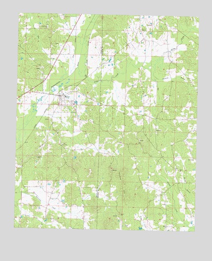
McCool, MS USGS Topographic Map
Click on map above to begin viewing in our Map Viewer.

This topographic map contains these locations and features:
Feature Name Type Latitude Longitude GNIS ID View Map
Alex Faulkner Lake DamDamN33.2251°W89.3084°681939View Map
Allen Springs School (historical)SchoolN33.1662°W89.3606°710821View Map
Antioch (historical)Populated PlaceN33.1668°W89.3598°710822View Map
Antioch Baptist ChurchChurchN33.1668°W89.3595°710823View Map
Ashfordville School (historical)SchoolN33.1907°W89.3003°685828View Map
Ballard CemeteryCemeteryN33.1340°W89.3015°666493View Map
Bear CreekStreamN33.2104°W89.3453°666645View Map
Bear Creek (historical)Populated PlaceN33.2412°W89.3556°710828View Map
Bear Creek CemeteryCemeteryN33.2426°W89.3545°691045View Map
Bear Creek Missionary Baptist ChurchChurchN33.2421°W89.3553°666650View Map
Bear Creek School (historical)SchoolN33.2429°W89.3556°710829View Map
Beulah Baptist ChurchChurchN33.2418°W89.2892°667048View Map
Beulah CemeteryCemeteryN33.2421°W89.2901°707494View Map
Bloomingburg CemeteryCemeteryN33.1598°W89.3726°710838View Map
Bowie Chapel CemeteryCemeteryN33.1746°W89.3426°691047View Map
Bowie Chapel Methodist ChurchChurchN33.1740°W89.3431°690907View Map
Bowie School (historical)SchoolN33.1740°W89.3431°710841View Map
Bowies ChapelPopulated PlaceN33.1751°W89.3437°710840View Map
Church of GodChurchN33.1671°W89.2520°668465View Map
Conly Mills (historical)LocaleN33.2126°W89.3265°690014View Map
Dry CreekStreamN33.2151°W89.3373°669443View Map
Egg CreekStreamN33.2212°W89.2956°669692View Map
Hobson School (historical)SchoolN33.1326°W89.3028°685855View Map
Hopewell CemeteryCemeteryN33.1837°W89.2790°707509View Map
Hopewell ChurchChurchN33.1835°W89.2778°671430View Map
Ironstone HillsSummitN33.1518°W89.2998°671719View Map
KerrPopulated PlaceN33.1273°W89.2698°672112View Map
Lignite SpringSpringN33.1332°W89.3040°685860View Map
McCoolPopulated PlaceN33.2021°W89.3451°673311View Map
McCool CemeteryCemeteryN33.1993°W89.3384°673312View Map
McCool Fire DepartmentBuildingN33.2023°W89.3464°2665870View Map
McCool Post OfficePost OfficeN33.2026°W89.3457°2768656View Map
Mount Pilgrim CemeteryCemeteryN33.1971°W89.3359°674184View Map
Mount Zion CemeteryCemeteryN33.1593°W89.2615°707518View Map
Mount Zion ChurchChurchN33.1596°W89.2615°674376View Map
Old Bowie CemeteryCemeteryN33.1660°W89.3601°690928View Map
Rawhide BranchStreamN33.2196°W89.2862°676488View Map
Simmons Lake DamDamN33.1535°W89.3384°681883View Map
Steele (historical)Populated PlaceN33.2154°W89.3265°711017View Map
Supervisor District 4CivilN33.1998°W89.2519°711806View Map
Tibby CreekStreamN33.2193°W89.3334°694977View Map
Town of McCoolCivilN33.1995°W89.3418°2406126View Map
Vowell School (historical)SchoolN33.1454°W89.2592°685885View Map

Note: Coordinates in the location and feature list above are referenced to NAD83 datum.


Copyright (C) 2008-2024 Ryan Niemi / Sunset Dynamics ... All Rights Reserved