TopoQuest Logo
Do you find TopoQuest useful?
Help keep TopoQuest running and adding new maps/features by donating!
Bitcoin:  19c7KJd3qBynnjoSw5npx9KScwjBe4ifkT
Litecoin:  LXs6TkuXGGXo1vDsWCkWVdjQX94eUKd6ui
Home View Maps Find Maps Find Places Resources & Links


Ethel SE, Mississippi Topographic Map

USGS Map Title: Ethel SE, MS
USGS Map MRC: 33089A3
DRG (GeoTIFF) Download: o33089a3.tif


Neighboring USGS Topographic Map Quads:


  Ethel North, MS  
33089B4
 

  McCool, MS  
33089B3
 

  Highpoint, MS  
33089B2
 

  Ethel South, MS  
33089A4
 

  Ethel SE, MS  
33089A3
 

  Louisville SW, MS  
33089A2
 

  Zama, MS  
32089H4
 

  Four Corners, MS  
32089H3
 

  Plattsburg, MS  
32089H2


Map MRC Location:

N34°
W90°
N34°
W89°
H8 H7 H6 H5 H4 H3 H2 H1
G8 G7 G6 G5 G4 G3 G2 G1
F8 F7 F6 F5 F4 F3 F2 F1
E8 E7 E6 E5 E4 E3 E2 E1
D8 D7 D6 D5 D4 D3 D2 D1
C8 C7 C6 C5 C4 C3 C2 C1
B8 B7 B6 B5 B4 B3 B2 B1
A8 A7 A6 A5 A4 A3 A2 A1
N33°
W90°
N33°
W89°

Ethel SE, MS USGS 1:24K Topographic Map Preview:
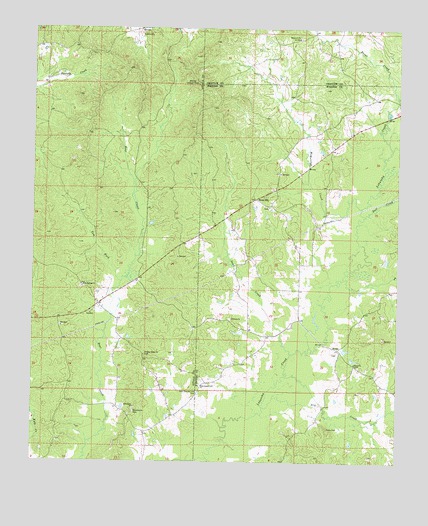
Ethel SE, MS USGS Topographic Map
Click on map above to begin viewing in our Map Viewer.

This topographic map contains these locations and features:
Feature Name Type Latitude Longitude GNIS ID View Map
Ball CreekStreamN33.0715°W89.2612°666489View Map
Briar CreekStreamN33.1054°W89.2506°667551View Map
Commodore Post Office (historical)Post OfficeN33.0224°W89.3473°713042View Map
Doty Springs (historical)Populated PlaceN33.0529°W89.3598°710867View Map
Doty Springs Baptist ChurchChurchN33.0504°W89.3581°669340View Map
Doty Springs CemeteryCemeteryN33.0504°W89.3584°710868View Map
Doty Springs School (historical)SchoolN33.0504°W89.3576°710869View Map
Dry CreekStreamN33.0160°W89.2962°669440View Map
East County Line CemeteryCemeteryN33.0204°W89.3190°669566View Map
East County Line ChurchChurchN33.0221°W89.3178°669567View Map
East MacedoniaPopulated PlaceN33.0157°W89.3459°710871View Map
East Macedonia Methodist ChurchChurchN33.0160°W89.3403°690952View Map
Edgefield (historical)Populated PlaceN33.1246°W89.3376°710875View Map
Edgefield Baptist ChurchChurchN33.1243°W89.3381°669668View Map
Edgefield CemeteryCemeteryN33.1237°W89.3387°710876View Map
Edgefield School (historical)SchoolN33.1235°W89.3262°710877View Map
Edwards Mill (historical)LocaleN33.0143°W89.2967°687697View Map
Glendale (historical)Populated PlaceN33.0321°W89.3376°710885View Map
Glendale School (historical)SchoolN33.0401°W89.3451°710886View Map
HinzePopulated PlaceN33.0329°W89.2703°691936View Map
Hinze CemeteryCemeteryN33.0285°W89.2642°710040View Map
Hinze ChurchChurchN33.0287°W89.2645°671244View Map
Hopewell CemeteryCemeteryN33.1223°W89.2840°707508View Map
Hopewell ChurchChurchN33.1226°W89.2845°671429View Map
Leachs Mill (historical)LocaleN33.0879°W89.2548°687702View Map
Little CreekStreamN33.0012°W89.3153°672593View Map
Lobutcha (historical)Populated PlaceN33.1057°W89.2551°710048View Map
Macedonia CemeteryCemeteryN33.0146°W89.3406°690921View Map
McCool Lookout TowerTowerN33.1093°W89.3192°711274View Map
McQuirter CreekStreamN33.0737°W89.2628°673433View Map
Nebo CemeteryCemeteryN33.0101°W89.2742°674531View Map
Pleasant Ridge CemeteryCemeteryN33.0310°W89.3362°691055View Map
Pleasant Ridge Primitive Baptist ChurchChurchN33.0310°W89.3370°676113View Map
Rural HillPopulated PlaceN33.0762°W89.2990°692195View Map
Rural Hill CemeteryCemeteryN33.0732°W89.2940°710071View Map
Rural Hill Methodist ChurchChurchN33.0737°W89.2940°710072View Map
Saint Pauls ChurchChurchN33.0415°W89.3070°677213View Map
Sand CreekStreamN33.0315°W89.2867°677329View Map
Tom ForkStreamN33.0518°W89.3448°678805View Map
Vowell CemeteryCemeteryN33.0315°W89.2703°710081View Map

Note: Coordinates in the location and feature list above are referenced to NAD83 datum.


Copyright (C) 2008-2025 Ryan Niemi / Sunset Dynamics ... All Rights Reserved