TopoQuest Logo
Do you find TopoQuest useful?
Help keep TopoQuest running and adding new maps/features by donating!
Bitcoin:  19c7KJd3qBynnjoSw5npx9KScwjBe4ifkT
Litecoin:  LXs6TkuXGGXo1vDsWCkWVdjQX94eUKd6ui
Home View Maps Find Maps Find Places Resources & Links


Weir, Mississippi Topographic Map

USGS Map Title: Weir, MS
USGS Map MRC: 33089C3
DRG (GeoTIFF) Download: o33089c3.tif


Neighboring USGS Topographic Map Quads:


  Stewart, MS  
33089D4
 

  Tomnolen, MS  
33089D3
 

  Reform, MS  
33089D2
 

  French Camp, MS  
33089C4
 

  Weir, MS  
33089C3
 

  Ackerman, MS  
33089C2
 

  Ethel North, MS  
33089B4
 

  McCool, MS  
33089B3
 

  Highpoint, MS  
33089B2


Map MRC Location:

N34°
W90°
N34°
W89°
H8 H7 H6 H5 H4 H3 H2 H1
G8 G7 G6 G5 G4 G3 G2 G1
F8 F7 F6 F5 F4 F3 F2 F1
E8 E7 E6 E5 E4 E3 E2 E1
D8 D7 D6 D5 D4 D3 D2 D1
C8 C7 C6 C5 C4 C3 C2 C1
B8 B7 B6 B5 B4 B3 B2 B1
A8 A7 A6 A5 A4 A3 A2 A1
N33°
W90°
N33°
W89°

Weir, MS USGS 1:24K Topographic Map Preview:
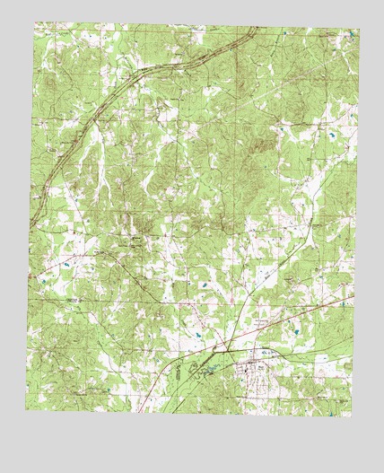
Weir, MS USGS Topographic Map
Click on map above to begin viewing in our Map Viewer.

This topographic map contains these locations and features:
Feature Name Type Latitude Longitude GNIS ID View Map
Besa Chitto CreekStreamN33.2704°W89.2984°692544View Map
Bethlehem CemeteryCemeteryN33.3429°W89.3703°707491View Map
Bethlehem ChurchChurchN33.3423°W89.3709°667007View Map
Bywy OverlookLocaleN33.3748°W89.2895°667898View Map
Centerville School (historical)SchoolN33.3007°W89.3487°685841View Map
Dry CreekStreamN33.3648°W89.3401°669421View Map
Dry Creek School (historical)SchoolN33.3432°W89.3456°685847View Map
Fairview School (historical)SchoolN33.2960°W89.2648°685851View Map
Fancher Hill Baptist ChurchChurchN33.2554°W89.3562°669907View Map
Fancher Hill School (historical)SchoolN33.2554°W89.3562°710880View Map
Grahamsville (historical)LocaleN33.3098°W89.3001°685852View Map
Grange Hall School (historical)SchoolN33.3087°W89.2862°685853View Map
Jenkinsville School (historical)SchoolN33.3696°W89.2756°685857View Map
Kenago (historical)LocaleN33.3479°W89.3231°685858View Map
Killough School (historical)SchoolN33.3154°W89.3001°685859View Map
King BranchStreamN33.3604°W89.3367°672143View Map
Malloxville School (historical)SchoolN33.3318°W89.2673°685892View Map
Mike CreekStreamN33.2629°W89.3112°673559View Map
Mill Springs CemeteryCemeteryN33.3065°W89.3362°707515View Map
Miller School (historical)SchoolN33.3187°W89.3217°685861View Map
Millsprings ChurchChurchN33.3060°W89.3356°673660View Map
Mount Moriah CemeteryCemeteryN33.3010°W89.3453°707517View Map
Mount Moriah ChurchChurchN33.3010°W89.3462°674071View Map
Myatt Creek School (historical)SchoolN33.2932°W89.3217°685862View Map
New Haven CemeteryCemeteryN33.3748°W89.3670°674640View Map
New Zion CemeteryCemeteryN33.3446°W89.2873°707521View Map
New Zion ChurchChurchN33.3110°W89.2659°674888View Map
New Zion Church (historical)ChurchN33.3440°W89.2881°685863View Map
Penderville CemeteryCemeteryN33.2554°W89.2551°675586View Map
Penderville ChurchChurchN33.2562°W89.2631°675587View Map
Pine Grove School (historical)SchoolN33.3560°W89.3028°685869View Map
Pisgah CemeteryCemeteryN33.3515°W89.3184°707523View Map
Pisgah ChurchChurchN33.3512°W89.3190°675940View Map
Pleasant Valley Church (historical)ChurchN33.3693°W89.3217°685871View Map
Salem CemeteryCemeteryN33.3715°W89.2615°707525View Map
Salem ChurchChurchN33.3723°W89.2620°677284View Map
Simpson School (historical)SchoolN33.3673°W89.3534°685880View Map
Simpson Volunteer Fire DepartmentBuildingN33.3708°W89.3592°2665872View Map
Supervisor District 1CivilN33.3642°W89.2660°711803View Map
Town of WeirCivilN33.2634°W89.2906°2406852View Map
WeirPopulated PlaceN33.2668°W89.2909°679425View Map
Weir Attendance CenterSchoolN33.2646°W89.2909°707530View Map
Weir CemeteryCemeteryN33.2635°W89.2948°707531View Map
Weir Chapel CemeteryCemeteryN33.2801°W89.2828°679426View Map
Weir Elementary SchoolSchoolN33.2640°W89.2909°707532View Map
Weir Lagoon DamDamN33.2701°W89.3001°681964View Map
Weir Lookout TowerTowerN33.3035°W89.3365°711332View Map
Weir Police DepartmentBuildingN33.2682°W89.2877°2754234View Map
Weir Post OfficePost OfficeN33.2663°W89.2888°2768772View Map
Weir Volunteer Fire DepartmentBuildingN33.2670°W89.2874°2665789View Map
Wilcox (historical)LocaleN33.3001°W89.3537°692356View Map
Winters BranchStreamN33.3710°W89.3678°685889View Map

Note: Coordinates in the location and feature list above are referenced to NAD83 datum.


Copyright (C) 2008-2025 Ryan Niemi / Sunset Dynamics ... All Rights Reserved