TopoQuest Logo
Do you find TopoQuest useful?
Help keep TopoQuest running and adding new maps/features by donating!
Bitcoin:  19c7KJd3qBynnjoSw5npx9KScwjBe4ifkT
Litecoin:  LXs6TkuXGGXo1vDsWCkWVdjQX94eUKd6ui
Home View Maps Find Maps Find Places Resources & Links


Bear Springs Peak, New Mexico Topographic Map

USGS Map Title: Bear Springs Peak, NM
USGS Map MRC: 35106F5
DRG (GeoTIFF) Download: o35106f5.tif


Neighboring USGS Topographic Map Quads:


  Jemez Springs, NM  
35106G6
 

  Redondo Peak, NM  
35106G5
 

  Bland, NM  
35106G4
 

  Ponderosa, NM  
35106F6
 

  Bear Springs Peak, NM  
35106F5
 

  Canada, NM  
35106F4
 

  Jemez Pueblo, NM  
35106E6
 

  Loma Creston, NM  
35106E5
 

  Santo Domingo Pueblo SW, NM  
35106E4


Map MRC Location:

N36°
W107°
N36°
W106°
H8 H7 H6 H5 H4 H3 H2 H1
G8 G7 G6 G5 G4 G3 G2 G1
F8 F7 F6 F5 F4 F3 F2 F1
E8 E7 E6 E5 E4 E3 E2 E1
D8 D7 D6 D5 D4 D3 D2 D1
C8 C7 C6 C5 C4 C3 C2 C1
B8 B7 B6 B5 B4 B3 B2 B1
A8 A7 A6 A5 A4 A3 A2 A1
N35°
W107°
N35°
W106°

Bear Springs Peak, NM USGS 1:24K Topographic Map Preview:
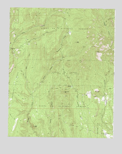
Bear Springs Peak, NM USGS Topographic Map
Click on map above to begin viewing in our Map Viewer.

This topographic map contains these locations and features:
Feature Name Type Latitude Longitude GNIS ID View Map
Bear Springs Guard StationLocaleN35.6742°W106.5500°903678View Map
Bear Springs PeakSummitN35.6689°W106.5584°903679View Map
Bland Bear Springs TrailTrailN35.7228°W106.5009°918079View Map
Borrego DomeSummitN35.6353°W106.5936°904016View Map
Borrego MesaSummitN35.6914°W106.6189°904017View Map
Canovas Number 13 GroupMineN35.6459°W106.5689°916275View Map
Cerrito YeloSummitN35.6698°W106.5203°918131View Map
Cerro la JaraSummitN35.7081°W106.5209°918141View Map
Chamisal TankReservoirN35.6326°W106.6184°936799View Map
Elza Seligman CampLocaleN35.7103°W106.6228°906144View Map
Guacamalla CanyonValleyN35.6884°W106.5781°906754View Map
Hondo CanyonValleyN35.6659°W106.5970°907059View Map
Loma CanovasSummitN35.6317°W106.5609°908127View Map
Mont de Lion GroupMineN35.7178°W106.5014°915596View Map
Peralta Lion GroupMineN35.7097°W106.5056°915619View Map
Ponderosa CampLocaleN35.7122°W106.6228°936798View Map
Ruiz PeakSummitN35.7172°W106.5442°910473View Map
Strip MineMineN35.7228°W106.6192°916350View Map
Tres CerrosSummitN35.6970°W106.5436°911802View Map
West Fork Borrego CanyonStreamN35.6661°W106.5970°912225View Map

Note: Coordinates in the location and feature list above are referenced to NAD83 datum.


Copyright (C) 2008-2025 Ryan Niemi / Sunset Dynamics ... All Rights Reserved