TopoQuest Logo
Do you find TopoQuest useful?
Help keep TopoQuest running and adding new maps/features by donating!
Bitcoin:  19c7KJd3qBynnjoSw5npx9KScwjBe4ifkT
Litecoin:  LXs6TkuXGGXo1vDsWCkWVdjQX94eUKd6ui
Home View Maps Find Maps Find Places Resources & Links


Meeks Bay, California Topographic Map

USGS Map Title: Meeks Bay, CA
USGS Map MRC: 39120A1
DRG (GeoTIFF) Download: o39120a1.tif


Neighboring USGS Topographic Map Quads:


  Tahoe City, CA  
39120B2
 

  Kings Beach, CA  
39120B1
 

  Marlette Lake, NV  
39119B8
 

  Homewood, CA  
39120A2
 

  Meeks Bay, CA  
39120A1
 

  Glenbrook, NV  
39119A8
 

  Rockbound Valley, CA  
38120H2
 

  Emerald Bay, CA  
38120H1
 

  South Lake Tahoe, CA  
38119H8


Map MRC Location:

N40°
W121°
N40°
W120°
H8 H7 H6 H5 H4 H3 H2 H1
G8 G7 G6 G5 G4 G3 G2 G1
F8 F7 F6 F5 F4 F3 F2 F1
E8 E7 E6 E5 E4 E3 E2 E1
D8 D7 D6 D5 D4 D3 D2 D1
C8 C7 C6 C5 C4 C3 C2 C1
B8 B7 B6 B5 B4 B3 B2 B1
A8 A7 A6 A5 A4 A3 A2 A1
N39°
W121°
N39°
W120°

Meeks Bay, CA USGS 1:24K Topographic Map Preview:
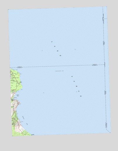
Meeks Bay, CA USGS Topographic Map
Click on map above to begin viewing in our Map Viewer.

This topographic map contains these locations and features:
Feature Name Type Latitude Longitude GNIS ID View Map
Childrens HouseBuildingN39.0524°W120.1135°1733742View Map
Ed Z'berg Sugar Pine Point State ParkParkN39.0574°W120.1224°267850View Map
Edward F Dolder Nature TrailTrailN39.0627°W120.1188°1733746View Map
Edwin L. Z'Berg Natural PreserveReserveN39.0585°W120.1171°1733747View Map
Ehrman MansionBuildingN39.0532°W120.1138°1733748View Map
Frosts (historical)Populated PlaceN39.0007°W120.1044°1701132View Map
General CreekStreamN39.0552°W120.1132°260516View Map
General Creek CampgroundLocaleN39.0505°W120.1230°1733755View Map
General Creek Ranger StationLocaleN39.0516°W120.1185°1733756View Map
General Creek Recreation SiteLocaleN39.0588°W120.1221°1662427View Map
General Creek StationLocaleN39.0507°W120.1191°1662428View Map
General Phipps CabinBuildingN39.0544°W120.1132°1733758View Map
Glenridge ParkPopulated PlaceN39.0444°W120.1244°1733763View Map
Ice HouseBuildingN39.0538°W120.1146°1733767View Map
Lake TahoeReservoirN39.0960°W120.0334°1654975View Map
Lester BeachBeachN39.0005°W120.1010°1733773View Map
Lonely GulchValleyN39.0191°W120.1182°266937View Map
Meeks BayPopulated PlaceN39.0344°W120.1241°1659750View Map
Meeks BayBayN39.0396°W120.1169°263440View Map
Meeks Bay CampgroundLocaleN39.0357°W120.1232°274941View Map
Meeks Bay Fire Protection District Station 61BuildingN39.0352°W120.1249°2623977View Map
Meeks Bay Post Office (historical)Post OfficeN39.0391°W120.1238°1781967View Map
Meeks CreekStreamN39.0369°W120.1227°263441View Map
North Boat HouseBuildingN39.0546°W120.1132°1733778View Map
Paradise FlatFlatN39.0007°W120.1074°267110View Map
Rod Beaudry TrailTrailN39.0541°W120.1160°1733786View Map
Rubicon BayBayN39.0141°W120.1085°265644View Map
Rubicon CreekStreamN39.0013°W120.1027°265645View Map
Rubicon PropertiesPopulated PlaceN39.0138°W120.1177°1733787View Map
South Boat HouseBuildingN39.0499°W120.1121°1733792View Map
Sugar Pine PointCapeN39.0610°W120.1138°267846View Map
Sugar Pine Point LighthouseLocaleN39.0613°W120.1141°1733799View Map

Note: Coordinates in the location and feature list above are referenced to NAD83 datum.


Copyright (C) 2008-2025 Ryan Niemi / Sunset Dynamics ... All Rights Reserved