TopoQuest Logo
Do you find TopoQuest useful?
Help keep TopoQuest running and adding new maps/features by donating!
Bitcoin:  19c7KJd3qBynnjoSw5npx9KScwjBe4ifkT
Litecoin:  LXs6TkuXGGXo1vDsWCkWVdjQX94eUKd6ui
Home View Maps Find Maps Find Places Resources & Links


Melcher-Dallas, Iowa Topographic Map

USGS Map Title: Melcher-Dallas, IA
USGS Map MRC: 41093B2
DRG (GeoTIFF) Download: o41093b2.tif


Neighboring USGS Topographic Map Quads:


  Beech, IA  
41093C3
 

  Knoxville SW, IA  
41093C2
 

  Knoxville, IA  
41093C1
 

  Newbern, IA  
41093B3
 

  Melcher-Dallas, IA  
41093B2
 

  Attica, IA  
41093B1
 

  Chariton, IA  
41093A3
 

  Olmitz, IA  
41093A2
 

  Weller, IA  
41093A1


Map MRC Location:

N42°
W94°
N42°
W93°
H8 H7 H6 H5 H4 H3 H2 H1
G8 G7 G6 G5 G4 G3 G2 G1
F8 F7 F6 F5 F4 F3 F2 F1
E8 E7 E6 E5 E4 E3 E2 E1
D8 D7 D6 D5 D4 D3 D2 D1
C8 C7 C6 C5 C4 C3 C2 C1
B8 B7 B6 B5 B4 B3 B2 B1
A8 A7 A6 A5 A4 A3 A2 A1
N41°
W94°
N41°
W93°

Melcher-Dallas, IA USGS 1:24K Topographic Map Preview:
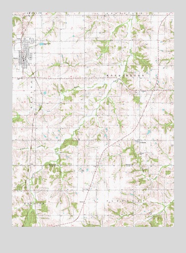
Melcher-Dallas, IA USGS Topographic Map
Click on map above to begin viewing in our Map Viewer.

This topographic map contains these locations and features:
Feature Name Type Latitude Longitude GNIS ID View Map
1865 Memorial for "40 Boys" Historical MarkerParkN41.2056°W93.1516°2047427View Map
BelindaPopulated PlaceN41.1389°W93.1924°454487View Map
Belinda ChurchChurchN41.1608°W93.1849°1823414View Map
Belinda Post Office (historical)Post OfficeN41.1408°W93.1441°466556View Map
Belinda Toy and Antique MuseumBuildingN41.1394°W93.1947°1970614View Map
Brush College SchoolSchoolN41.1461°W93.2266°454878View Map
City of Melcher-DallasCivilN41.2274°W93.2411°2395087View Map
Clear CemeteryCemeteryN41.1589°W93.1451°1970659View Map
CloudPopulated PlaceN41.1750°W93.2352°464265View Map
Cloud (historical)LocaleN41.1750°W93.2352°1975706View Map
Cloud Post Office (historical)Post OfficeN41.1750°W93.2352°1975705View Map
ColumbiaPopulated PlaceN41.1753°W93.1499°455541View Map
Columbia CemeteryCemeteryN41.1680°W93.1532°1823412View Map
Columbia Fire DepartmentBuildingN41.1753°W93.1519°2371690View Map
Columbia Methodist ChurchChurchN41.1753°W93.1499°1975930View Map
Columbia Post OfficePost OfficeN41.1753°W93.1499°1975931View Map
Crow CreekStreamN41.2439°W93.1594°455736View Map
Dallas Christian ChurchChurchN41.2325°W93.2424°1975842View Map
Dallas Post OfficePost OfficeN41.2328°W93.2419°1975841View Map
E J McKeever Medical CenterHospitalN41.2236°W93.2419°1975839View Map
Freedom SchoolSchoolN41.2047°W93.2299°456759View Map
GosportPopulated PlaceN41.2047°W93.1508°464567View Map
Gosport CemeteryCemeteryN41.2033°W93.1544°1975963View Map
Gosport Post Office (historical)Post OfficeN41.2047°W93.1508°1975704View Map
Liberty SchoolSchoolN41.1753°W93.2124°458329View Map
Long BranchStreamN41.2078°W93.1738°458589View Map
Marion County Chiropractic CenterHospitalN41.2236°W93.2419°1975838View Map
MelcherLocaleN41.2231°W93.2394°1975849View Map
Melcher - Dallas Elementary SchoolSchoolN41.2348°W93.2368°1975850View Map
Melcher - Dallas High SchoolSchoolN41.2218°W93.2416°1975846View Map
Melcher - Dallas Junior High SchoolSchoolN41.2214°W93.2416°2719780View Map
Melcher Post OfficePost OfficeN41.2236°W93.2419°1975837View Map
Melcher-DallasPopulated PlaceN41.2250°W93.2413°458955View Map
Melcher-Dallas City HallBuildingN41.2250°W93.2413°1975844View Map
Melcher-Dallas Coal Mining and Heritage MuseumBuildingN41.2236°W93.2419°1975836View Map
Melcher-Dallas Fire and Rescue DepartmentBuildingN41.2240°W93.2406°1975843View Map
Melcher-Dallas Museum of Military HistoryBuildingN41.2236°W93.2419°1975835View Map
Melcher-Dallas Public LibraryBuildingN41.2239°W93.2416°1975845View Map
New Albany SchoolSchoolN41.2311°W93.1352°459463View Map
New Hope United Methodist ChurchChurchN41.2242°W93.2444°1975847View Map
Pleasant Hill SchoolSchoolN41.1461°W93.1544°460268View Map
Pleasant Prairie ChurchChurchN41.1464°W93.1913°1823413View Map
Pleasant Prairie SchoolSchoolN41.1464°W93.1888°460281View Map
PurdyPopulated PlaceN41.1606°W93.2333°464708View Map
Purdy (historical)LocaleN41.1606°W93.2333°1970579View Map
Purdy Post Office (historical)Post OfficeN41.1606°W93.2333°1970578View Map
Sacred Heart CemeteryCemeteryN41.2111°W93.2465°1823416View Map
Sacred Heart ChurchChurchN41.2183°W93.2266°1975848View Map
Saint John Lutheran ChurchChurchN41.2236°W93.2419°1975840View Map
StarLocaleN41.2417°W93.2127°466023View Map
Stotts CemeteryCemeteryN41.1718°W93.1272°1823411View Map
Strong CemeteryCemeteryN41.1577°W93.1943°1823415View Map
Township of WashingtonCivilN41.2046°W93.1563°468929View Map
Union SchoolSchoolN41.2042°W93.1938°462468View Map
Washington SchoolSchoolN41.2333°W93.1935°462709View Map
Wildcat CreekStreamN41.1708°W93.2152°463036View Map

Note: Coordinates in the location and feature list above are referenced to NAD83 datum.


Copyright (C) 2008-2025 Ryan Niemi / Sunset Dynamics ... All Rights Reserved