TopoQuest Logo
Do you find TopoQuest useful?
Help keep TopoQuest running and adding new maps/features by donating!
Bitcoin:  19c7KJd3qBynnjoSw5npx9KScwjBe4ifkT
Litecoin:  LXs6TkuXGGXo1vDsWCkWVdjQX94eUKd6ui
Home View Maps Find Maps Find Places Resources & Links


Weller, Iowa Topographic Map

USGS Map Title: Weller, IA
USGS Map MRC: 41093A1
DRG (GeoTIFF) Download: o41093a1.tif


Neighboring USGS Topographic Map Quads:


  Melcher-Dallas, IA  
41093B2
 

  Attica, IA  
41093B1
 

  Lovilia, IA  
41092B8
 

  Olmitz, IA  
41093A2
 

  Weller, IA  
41093A1
 

  Hiteman, IA  
41092A8
 

  Russell, IA  
40093H2
 

  Melrose, IA  
40093H1
 

  Iconium, IA  
40092H8


Map MRC Location:

N42°
W94°
N42°
W93°
H8 H7 H6 H5 H4 H3 H2 H1
G8 G7 G6 G5 G4 G3 G2 G1
F8 F7 F6 F5 F4 F3 F2 F1
E8 E7 E6 E5 E4 E3 E2 E1
D8 D7 D6 D5 D4 D3 D2 D1
C8 C7 C6 C5 C4 C3 C2 C1
B8 B7 B6 B5 B4 B3 B2 B1
A8 A7 A6 A5 A4 A3 A2 A1
N41°
W94°
N41°
W93°

Weller, IA USGS 1:24K Topographic Map Preview:
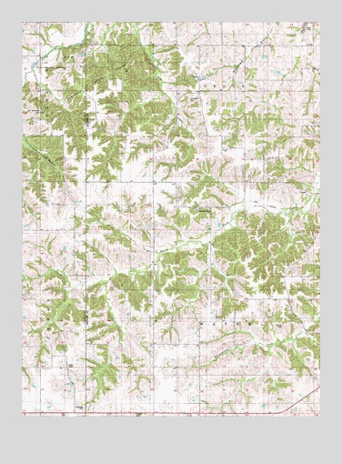
Weller, IA USGS Topographic Map
Click on map above to begin viewing in our Map Viewer.

This topographic map contains these locations and features:
Feature Name Type Latitude Longitude GNIS ID View Map
Allen CemeteryCemeteryN41.0162°W93.1086°1823346View Map
Bell SchoolSchoolN41.0925°W93.0008°465573View Map
Brown SchoolSchoolN41.1242°W93.0019°465574View Map
BucknellPopulated PlaceN41.0661°W93.0444°465575View Map
Bucknell Post Office (historical)Post OfficeN41.0661°W93.0444°1970362View Map
Bucknell RuinsLocaleN41.0661°W93.0463°1823349View Map
Butcher SchoolSchoolN41.0878°W93.0399°465576View Map
Cedar Center SchoolSchoolN41.1178°W93.0394°465577View Map
Coal GlenSchoolN41.1181°W93.1166°455499View Map
Coal Glen SchoolSchoolN41.0886°W93.1133°465578View Map
ConsolPopulated PlaceN41.0714°W93.0019°465579View Map
Consol (historical)LocaleN41.0714°W93.0019°1970355View Map
Consol Post Office (historical)Post OfficeN41.0714°W93.0019°1970356View Map
Falvy SchoolSchoolN41.0583°W93.0688°465585View Map
Foutch CemeteryCemeteryN41.0389°W93.0696°1970432View Map
Happy Hollow SchoolSchoolN41.0011°W93.0108°465588View Map
Haydock Post Office (historical)Post OfficeN41.0667°W93.0377°1975658View Map
Hickory Point SchoolSchoolN41.0886°W93.0788°465590View Map
Judge SchoolSchoolN41.0292°W93.0066°465593View Map
La Grange CemeteryCemeteryN41.0027°W93.0990°1823348View Map
La Grange Post Office (historical)Post OfficeN41.0014°W93.1024°1970577View Map
LaGrange SchoolSchoolN41.0000°W93.1158°465594View Map
Liberty SchoolSchoolN41.1172°W93.0777°465595View Map
Manley CemeteryCemeteryN41.0290°W93.0171°1823345View Map
O'Brien CemeteryCemeteryN41.1111°W93.0752°1970431View Map
Park SchoolSchoolN41.0883°W93.1133°465604View Map
Pershing SchoolSchoolN41.0583°W93.1205°460095View Map
Peterson CemeteryCemeteryN41.0667°W93.0502°1970430View Map
Prather CemeteryCemeteryN41.0006°W93.0778°1823347View Map
Roundtop SchoolSchoolN41.0303°W93.0680°465607View Map
Saint Marys CemeteryCemeteryN41.1068°W93.0523°1823350View Map
Smithfield CemeteryCemeteryN41.1007°W93.0553°1823434View Map
Stephens State Forest - Thousand Acre UnitForestN41.1083°W93.0891°1970566View Map
Stoneking CemeteryCemeteryN41.0963°W93.1178°1823344View Map
Township of CedarCivilN41.1174°W93.0414°467560View Map
Township of WayneCivilN41.0302°W93.0413°468959View Map
Wayne Center SchoolSchoolN41.0297°W93.0385°465611View Map
Wayne SchoolSchoolN41.0008°W93.0688°465612View Map
WellerPopulated PlaceN41.1072°W93.0494°465614View Map
Weller Post Office (historical)Post OfficeN41.1075°W93.0502°466555View Map

Note: Coordinates in the location and feature list above are referenced to NAD83 datum.


Copyright (C) 2008-2024 Ryan Niemi / Sunset Dynamics ... All Rights Reserved