TopoQuest Logo
Do you find TopoQuest useful?
Help keep TopoQuest running and adding new maps/features by donating!
Bitcoin:  19c7KJd3qBynnjoSw5npx9KScwjBe4ifkT
Litecoin:  LXs6TkuXGGXo1vDsWCkWVdjQX94eUKd6ui
Home View Maps Find Maps Find Places Resources & Links


Melrose, Minnesota Topographic Map

USGS Map Title: Melrose, MN
USGS Map MRC: 45094F7
DRG (GeoTIFF) Download: o45094f7.tif


Neighboring USGS Topographic Map Quads:


  Sauk Lake, MN  
45094G8
 

  Ward Springs, MN  
45094G7
 

  Burtrum, MN  
45094G6
 

  Sauk Centre, MN  
45094F8
 

  Melrose, MN  
45094F7
 

  Freeport, MN  
45094F6
 

  Elrosa, MN  
45094E8
 

  Greenwald, MN  
45094E7
 

  Saint Martin, MN  
45094E6


Map MRC Location:

N46°
W95°
N46°
W94°
H8 H7 H6 H5 H4 H3 H2 H1
G8 G7 G6 G5 G4 G3 G2 G1
F8 F7 F6 F5 F4 F3 F2 F1
E8 E7 E6 E5 E4 E3 E2 E1
D8 D7 D6 D5 D4 D3 D2 D1
C8 C7 C6 C5 C4 C3 C2 C1
B8 B7 B6 B5 B4 B3 B2 B1
A8 A7 A6 A5 A4 A3 A2 A1
N45°
W95°
N45°
W94°

Melrose, MN USGS 1:24K Topographic Map Preview:
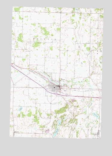
Melrose, MN USGS Topographic Map
Click on map above to begin viewing in our Map Viewer.

This topographic map contains these locations and features:
Feature Name Type Latitude Longitude GNIS ID View Map
Adley CreekStreamN45.6825°W94.7697°639214View Map
Black Oak LakeLakeN45.6337°W94.8102°640222View Map
Centracare Clinic at MelroseHospitalN45.6758°W94.8225°2068027View Map
City of Meire GroveCivilN45.6255°W94.8687°2395085View Map
City of MelroseCivilN45.6758°W94.8132°2395088View Map
City of New MunichCivilN45.6308°W94.7525°2395210View Map
County Ditch Number FortytwoCanalN45.6764°W94.8320°642085View Map
County Ditch Number ThirtythreeCanalN45.7108°W94.7820°641973View Map
Frevels LakeLakeN45.6475°W94.7571°643948View Map
Great River Regional LibraryBuildingN45.6750°W94.8106°2068016View Map
Immaculate Conception ChurchChurchN45.6322°W94.7525°2068237View Map
Interchange 135CrossingN45.6669°W94.8111°2068401View Map
Interchange 137CrossingN45.6647°W94.7514°2068400View Map
Lake IsabelleLakeN45.6521°W94.8608°645469View Map
Meadowlark Country ClubLocaleN45.6653°W94.8194°2068030View Map
Meire GrovePopulated PlaceN45.6297°W94.8692°647745View Map
Meire Grove City HallBuildingN45.6294°W94.8681°2068127View Map
Meiregrove Post Office (historical)Post OfficeN45.6297°W94.8689°2068269View Map
MelrosePopulated PlaceN45.6747°W94.8075°647757View Map
Melrose (historical)LocaleN45.6736°W94.8092°2068019View Map
Melrose Area HospitalHospitalN45.6755°W94.8234°2068028View Map
Melrose Area MuseumBuildingN45.6728°W94.8056°2068013View Map
Melrose Area Public SchoolsSchoolN45.6819°W94.8056°2068246View Map
Melrose Fire DepartmentBuildingN45.6706°W94.8122°2068017View Map
Melrose LakeReservoirN45.6733°W94.8086°1776762View Map
Melrose Mobile Home ParkPopulated PlaceN45.6903°W94.8056°2068026View Map
Melrose Police DepartmentBuildingN45.6762°W94.8103°2068015View Map
Melrose Post OfficePost OfficeN45.6747°W94.8097°2068014View Map
Melrose Riverside Airfield (historical)AirportN45.6850°W94.8331°2069183View Map
New MunichPopulated PlaceN45.6302°W94.7536°648515View Map
New Munich (historical)LocaleN45.6256°W94.7506°2068235View Map
New Munich City HallBuildingN45.6303°W94.7533°2068234View Map
New Munich Fire DepartmentBuildingN45.6265°W94.7537°2666559View Map
New Munich Post OfficePost OfficeN45.6303°W94.7533°2068236View Map
Oak Hill CemeteryCemeteryN45.6744°W94.7917°648818View Map
Pine Villa Nursing HomeHospitalN45.6756°W94.8225°2068029View Map
Rose Terrace Mobile Home ParkPopulated PlaceN45.6722°W94.8222°2068025View Map
Saint John's ChurchChurchN45.6294°W94.8683°2068022View Map
Saint John's SchoolSchoolN45.6294°W94.8678°2068023View Map
Saint Johns CemeteryCemeteryN45.6291°W94.8667°650683View Map
Saint Mary's ChurchChurchN45.6725°W94.8075°2068020View Map
Saint Mary's SchoolSchoolN45.6725°W94.8067°2068021View Map
Saint Marys CemeteryCemeteryN45.6708°W94.8028°650861View Map
Saint Michael's ChurchChurchN45.6747°W94.8072°2068012View Map
Saint Patrick CemeteryCemeteryN45.6694°W94.8136°650940View Map
Saint Paul's Lutheran ChurchChurchN45.6803°W94.8117°2068018View Map
Sauk River DamDamN45.6733°W94.8086°1776761View Map
School Number 1978SchoolN45.7450°W94.8086°651455View Map
School Number 2046SchoolN45.7166°W94.7678°651486View Map
School Number 2047SchoolN45.7072°W94.8497°651487View Map
School Number 2062SchoolN45.7125°W94.8092°651492View Map
Township of GroveCivilN45.6285°W94.8289°664358View Map
Township of MelroseCivilN45.7258°W94.8304°664954View Map

Note: Coordinates in the location and feature list above are referenced to NAD83 datum.


Copyright (C) 2008-2025 Ryan Niemi / Sunset Dynamics ... All Rights Reserved