TopoQuest Logo
Do you find TopoQuest useful?
Help keep TopoQuest running and adding new maps/features by donating!
Bitcoin:  19c7KJd3qBynnjoSw5npx9KScwjBe4ifkT
Litecoin:  LXs6TkuXGGXo1vDsWCkWVdjQX94eUKd6ui
Home View Maps Find Maps Find Places Resources & Links


Memphis, Ohio Topographic Map

USGS Map Title: Memphis, OH
USGS Map MRC: 39083D5
DRG (GeoTIFF) Download: o39083d5.tif


Neighboring USGS Topographic Map Quads:


  Bowersville, OH  
39083E6
 

  Milledgeville, OH  
39083E5
 

  Washington Court House, OH  
39083E4
 

  Sabina, OH  
39083D6
 

  Memphis, OH  
39083D5
 

  New Martinsburg, OH  
39083D4
 

  New Vienna, OH  
39083C6
 

  Leesburg, OH  
39083C5
 

  Greenfield, OH  
39083C4


Map MRC Location:

N40°
W84°
N40°
W83°
H8 H7 H6 H5 H4 H3 H2 H1
G8 G7 G6 G5 G4 G3 G2 G1
F8 F7 F6 F5 F4 F3 F2 F1
E8 E7 E6 E5 E4 E3 E2 E1
D8 D7 D6 D5 D4 D3 D2 D1
C8 C7 C6 C5 C4 C3 C2 C1
B8 B7 B6 B5 B4 B3 B2 B1
A8 A7 A6 A5 A4 A3 A2 A1
N39°
W84°
N39°
W83°

Memphis, OH USGS 1:24K Topographic Map Preview:
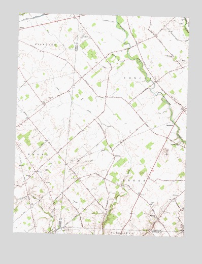
Memphis, OH USGS Topographic Map
Click on map above to begin viewing in our Map Viewer.

This topographic map contains these locations and features:
Feature Name Type Latitude Longitude GNIS ID View Map
Anders CemeteryCemeteryN39.3938°W83.5248°1037411View Map
Asbury School (historical)SchoolN39.4365°W83.5735°1080769View Map
Brimstone School (historical)SchoolN39.4051°W83.5769°1080770View Map
Bunker Hill School (historical)SchoolN39.4887°W83.5249°1080763View Map
Canney CemeteryCemeteryN39.3876°W83.5963°1963037View Map
Connor School (historical)SchoolN39.4526°W83.5477°1080768View Map
Evans CemeteryCemeteryN39.4517°W83.6005°1040253View Map
GeorgetownPopulated PlaceN39.4381°W83.5091°1062780View Map
Hicks DitchCanalN39.4453°W83.5185°1041532View Map
Jeff CemeteryCemeteryN39.4034°W83.6002°1042058View Map
Lees Creek BranchStreamN39.4176°W83.5402°1042476View Map
Locust Grove School (historical)SchoolN39.4967°W83.5933°1053414View Map
Luttrell CemeteryCemeteryN39.4109°W83.6033°1042844View Map
Mark DitchCanalN39.4984°W83.5124°1042996View Map
MemphisPopulated PlaceN39.4098°W83.6094°1062886View Map
Memphis Post Office (historical)Post OfficeN39.4098°W83.6096°1966648View Map
Oakview School (historical)SchoolN39.3867°W83.5771°1080771View Map
Olive Chapel School (historical)SchoolN39.3865°W83.5210°1080766View Map
Olive Elementary SchoolSchoolN39.3984°W83.5330°1081730View Map
Persinger DitchCanalN39.4965°W83.5599°1044397View Map
Richland CemeteryCemeteryN39.4070°W83.6130°1044978View Map
Sabina Airport (historical)AirportN39.4890°W83.5771°1963064View Map
Snider School (historical)SchoolN39.4770°W83.6008°1053415View Map
Township of ConcordCivilN39.4694°W83.5334°1086086View Map
Township of GreenCivilN39.4111°W83.5276°1086087View Map
Waddle DitchCanalN39.4703°W83.5577°1047480View Map
Waddle School (historical)SchoolN39.4759°W83.5616°1080767View Map
Walnut Hill ChurchChurchN39.3862°W83.5208°1070979View Map
Walnut Hill School (historical)SchoolN39.4240°W83.5177°1080765View Map
White Oak Grove CemeteryCemeteryN39.4284°W83.5046°1961517View Map
White Oak Grove United Methodist ChurchChurchN39.4278°W83.5060°1067054View Map
Wilson CemeteryCemeteryN39.3981°W83.5062°1047975View Map
Worthington School (historical)SchoolN39.4551°W83.5119°1080764View Map

Note: Coordinates in the location and feature list above are referenced to NAD83 datum.


Copyright (C) 2008-2025 Ryan Niemi / Sunset Dynamics ... All Rights Reserved