TopoQuest Logo
Do you find TopoQuest useful?
Help keep TopoQuest running and adding new maps/features by donating!
Bitcoin:  19c7KJd3qBynnjoSw5npx9KScwjBe4ifkT
Litecoin:  LXs6TkuXGGXo1vDsWCkWVdjQX94eUKd6ui
Home View Maps Find Maps Find Places Resources & Links


New Vienna, Ohio Topographic Map

USGS Map Title: New Vienna, OH
USGS Map MRC: 39083C6
DRG (GeoTIFF) Download: o39083c6.tif


Neighboring USGS Topographic Map Quads:


  Wilmington, OH  
39083D7
 

  Sabina, OH  
39083D6
 

  Memphis, OH  
39083D5
 

  Martinsville, OH  
39083C7
 

  New Vienna, OH  
39083C6
 

  Leesburg, OH  
39083C5
 

  Lynchburg, OH  
39083B7
 

  New Market, OH  
39083B6
 

  Hillsboro, OH  
39083B5


Map MRC Location:

N40°
W84°
N40°
W83°
H8 H7 H6 H5 H4 H3 H2 H1
G8 G7 G6 G5 G4 G3 G2 G1
F8 F7 F6 F5 F4 F3 F2 F1
E8 E7 E6 E5 E4 E3 E2 E1
D8 D7 D6 D5 D4 D3 D2 D1
C8 C7 C6 C5 C4 C3 C2 C1
B8 B7 B6 B5 B4 B3 B2 B1
A8 A7 A6 A5 A4 A3 A2 A1
N39°
W84°
N39°
W83°

New Vienna, OH USGS 1:24K Topographic Map Preview:
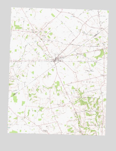
New Vienna, OH USGS Topographic Map
Click on map above to begin viewing in our Map Viewer.

This topographic map contains these locations and features:
Feature Name Type Latitude Longitude GNIS ID View Map
Achor CemeteryCemeteryN39.3065°W83.7324°1963032View Map
Auburn CemeteryCemeteryN39.2923°W83.6321°1058556View Map
Auburn Methodist ChurchChurchN39.2923°W83.6319°1060836View Map
Bloomington Post Office (historical)Post OfficeN39.3709°W83.7069°1966636View Map
Brick School (historical)SchoolN39.2840°W83.7096°1053227View Map
Burnett CemeteryCemeteryN39.3306°W83.6623°1038538View Map
CareytownPopulated PlaceN39.3101°W83.6291°1062685View Map
Careytown FarmsLocaleN39.2775°W83.6308°2724620View Map
Careytown Post Office (historical)Post OfficeN39.3098°W83.6291°2009672View Map
Carthagenia ChurchChurchN39.3137°W83.6488°1060926View Map
Clark CemeteryCemeteryN39.2790°W83.6860°1039134View Map
Clear Creek School (historical)SchoolN39.2928°W83.6499°1053228View Map
Clinton Highland Joint Fire DistrictBuildingN39.3239°W83.7042°2550150View Map
Duncan School (historical)SchoolN39.2795°W83.6777°1053229View Map
Emerald Pines Mobile Home ParkPopulated PlaceN39.3283°W83.6950°2515632View Map
Fairview ChurchChurchN39.3676°W83.6674°1068201View Map
Fallsville (historical)Populated PlaceN39.2923°W83.6313°1053230View Map
Fallsville State Wildlife AreaParkN39.2884°W83.6455°1040380View Map
Fetterling CemeteryCemeteryN39.2884°W83.7238°1040429View Map
Gist CemeteryCemeteryN39.3134°W83.6483°1806551View Map
Gist SettlementPopulated PlaceN39.3159°W83.6471°1062782View Map
Green Township HouseBuildingN39.3231°W83.6949°1960667View Map
Lynchburg QuarryMineN39.2594°W83.7436°2724918View Map
M and M FarmLocaleN39.2861°W83.7331°2724740View Map
McCoy CemeteryCemeteryN39.2573°W83.7013°1806561View Map
Mount Olive CemeteryCemeteryN39.2842°W83.6971°1806566View Map
Mount Olive ChurchChurchN39.2851°W83.6969°1068209View Map
New ViennaPopulated PlaceN39.3237°W83.6910°1065138View Map
New Vienna CemeteryCemeteryN39.3281°W83.6921°1960674View Map
New Vienna Church of ChristChurchN39.3228°W83.6946°1067374View Map
New Vienna Elementary SchoolSchoolN39.3237°W83.6871°1054199View Map
New Vienna Municipal BuildingBuildingN39.3245°W83.6910°1960675View Map
New Vienna Police DepartmentBuildingN39.3246°W83.6911°2732608View Map
New Vienna Post OfficePost OfficeN39.3231°W83.6921°1960676View Map
New Vienna United Methodist ChurchChurchN39.3227°W83.7095°1067375View Map
Newby School (historical)SchoolN39.3020°W83.6916°1053233View Map
Pitstick FarmsLocaleN39.2556°W83.7175°2724608View Map
Plainview School (historical)SchoolN39.2703°W83.6283°1053234View Map
Polk CemeteryCemeteryN39.3223°W83.6385°1806574View Map
Polk School (historical)SchoolN39.3273°W83.6530°1053235View Map
Sharpsville (historical)Populated PlaceN39.2576°W83.7491°1053239View Map
Sharpsville Post Office (historical)Post OfficeN39.2570°W83.7485°2013532View Map
Shockley-Ross CemeteryCemeteryN39.3162°W83.6911°1046233View Map
Snow HillPopulated PlaceN39.3506°W83.7202°1065490View Map
Snow Hill Country ClubLocaleN39.3506°W83.7163°1080197View Map
Snow Hill Post Office (historical)Post OfficeN39.3501°W83.7208°1966656View Map
Swingley Farm CemeteryCemeteryN39.3474°W83.7107°1046907View Map
Terrell Airport (historical)AirportN39.3390°W83.6860°1082901View Map
Thompson CemeteryCemeteryN39.2584°W83.7290°1047031View Map
Township of GreenCivilN39.3701°W83.7142°1085879View Map
Township of UnionCivilN39.2574°W83.7174°1086313View Map
Underwood CemeteryCemeteryN39.2987°W83.6749°1047264View Map
Village of New ViennaCivilN39.3256°W83.6937°2399484View Map
WillettsvillePopulated PlaceN39.2526°W83.7027°1063096View Map
Willettville Post Office (historical)Post OfficeN39.2528°W83.7027°2013536View Map

Note: Coordinates in the location and feature list above are referenced to NAD83 datum.


Copyright (C) 2008-2025 Ryan Niemi / Sunset Dynamics ... All Rights Reserved