TopoQuest Logo
Do you find TopoQuest useful?
Help keep TopoQuest running and adding new maps/features by donating!
Bitcoin:  19c7KJd3qBynnjoSw5npx9KScwjBe4ifkT
Litecoin:  LXs6TkuXGGXo1vDsWCkWVdjQX94eUKd6ui
Home View Maps Find Maps Find Places Resources & Links


Atwood, Indiana Topographic Map

USGS Map Title: Atwood, IN
USGS Map MRC: 41085C8
DRG (GeoTIFF) Download: o41085c8.tif


Neighboring USGS Topographic Map Quads:


  Nappanee West, IN  
41086D1
 

  Nappanee East, IN  
41085D8
 

  Milford, IN  
41085D7
 

  Bourbon, IN  
41086C1
 

  Atwood, IN  
41085C8
 

  Leesburg, IN  
41085C7
 

  Mentone, IN  
41086B1
 

  Burket, IN  
41085B8
 

  Warsaw, IN  
41085B7


Map MRC Location:

N42°
W86°
N42°
W85°
H8 H7 H6 H5 H4 H3 H2 H1
G8 G7 G6 G5 G4 G3 G2 G1
F8 F7 F6 F5 F4 F3 F2 F1
E8 E7 E6 E5 E4 E3 E2 E1
D8 D7 D6 D5 D4 D3 D2 D1
C8 C7 C6 C5 C4 C3 C2 C1
B8 B7 B6 B5 B4 B3 B2 B1
A8 A7 A6 A5 A4 A3 A2 A1
N41°
W86°
N41°
W85°

Atwood, IN USGS 1:24K Topographic Map Preview:
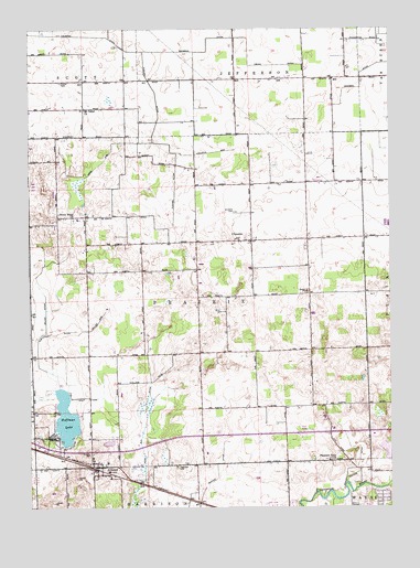
Atwood, IN USGS Topographic Map
Click on map above to begin viewing in our Map Viewer.

This topographic map contains these locations and features:
Feature Name Type Latitude Longitude GNIS ID View Map
AtwoodPopulated PlaceN41.2609°W85.9753°430332View Map
Atwood Elementary SchoolSchoolN41.2639°W85.9789°447466View Map
Atwood Fire DepartmentBuildingN41.2616°W85.9757°2701457View Map
Atwood Volunteer Fire DepartmentBuildingN41.2616°W85.9756°2626405View Map
Berkey Field Airport (historical)AirportN41.2878°W85.9006°2676953View Map
ClunettePopulated PlaceN41.3198°W85.9228°432694View Map
Clunette CemeteryCemeteryN41.3273°W85.9281°432695View Map
Easterday DitchCanalN41.2956°W85.9925°433943View Map
Fleugel DitchCanalN41.3484°W85.9564°434596View Map
Graber CemeteryCemeteryN41.3612°W85.9889°435250View Map
Hatfield ArmCanalN41.3428°W85.9361°435872View Map
Highland CemeteryCemeteryN41.2609°W85.9492°436157View Map
Hoffman LakeLakeN41.2734°W85.9874°436280View Map
Huffer DitchCanalN41.2625°W85.8864°436581View Map
Lake ArmCanalN41.3431°W85.9714°437518View Map
Marsh DitchCanalN41.2509°W85.8955°438651View Map
Miller ArmCanalN41.2987°W85.9761°439178View Map
Miller DitchCanalN41.3084°W85.9972°439217View Map
Miller Hog FarmLocaleN41.3353°W85.9108°2710710View Map
Mount Tabor ChurchChurchN41.3539°W85.9808°439712View Map
Pleasant View ChurchChurchN41.2625°W85.8964°441347View Map
Pole Run DitchCanalN41.2748°W85.9589°441401View Map
Stony Point ChurchChurchN41.3259°W85.9847°444231View Map
Township of PrairieCivilN41.3043°W85.9416°453769View Map
Truax DitchCanalN41.3656°W85.9183°444928View Map
Walnut CreekStreamN41.2559°W85.8764°445409View Map
Wolf ArmCanalN41.2789°W85.9769°446232View Map
WTCA-AM (Plymouth)TowerN41.3184°W85.9547°448415View Map

Note: Coordinates in the location and feature list above are referenced to NAD83 datum.


Copyright (C) 2008-2025 Ryan Niemi / Sunset Dynamics ... All Rights Reserved