TopoQuest Logo
Do you find TopoQuest useful?
Help keep TopoQuest running and adding new maps/features by donating!
Bitcoin:  19c7KJd3qBynnjoSw5npx9KScwjBe4ifkT
Litecoin:  LXs6TkuXGGXo1vDsWCkWVdjQX94eUKd6ui
Home View Maps Find Maps Find Places Resources & Links


Meredith SW, Michigan Topographic Map

USGS Map Title: Meredith SW, MI
USGS Map MRC: 44084A6
DRG (GeoTIFF) Download: o44084a6.tif


Neighboring USGS Topographic Map Quads:


  Meredith NW, MI  
44084B6
 

  Meredith, MI  
44084B5


  Meredith SW, MI  
44084A6
 

  Skeels, MI  
44084A5


  Browns Corners, MI  
43084H6
 

  Coleman NE, MI  
43084H5


Map MRC Location:

N45°
W85°
N45°
W84°
H8 H7 H6 H5 H4 H3 H2 H1
G8 G7 G6 G5 G4 G3 G2 G1
F8 F7 F6 F5 F4 F3 F2 F1
E8 E7 E6 E5 E4 E3 E2 E1
D8 D7 D6 D5 D4 D3 D2 D1
C8 C7 C6 C5 C4 C3 C2 C1
B8 B7 B6 B5 B4 B3 B2 B1
A8 A7 A6 A5 A4 A3 A2 A1
N44°
W85°
N44°
W84°

Meredith SW, MI USGS 1:24K Topographic Map Preview:
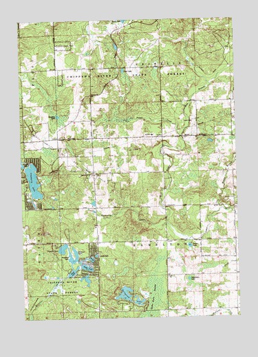
Meredith SW, MI USGS Topographic Map
Click on map above to begin viewing in our Map Viewer.

This topographic map contains these locations and features:
Feature Name Type Latitude Longitude GNIS ID View Map
Amble SchoolSchoolN44.0767°W84.6736°620047View Map
Boathouse LakeLakeN44.0195°W84.7205°621668View Map
Canada LakeLakeN44.0261°W84.7074°622678View Map
Cedar Shores CampgroundLocaleN44.0267°W84.7311°2516549View Map
Cedar View CemeteryCemeteryN44.0605°W84.7067°2516671View Map
Church of God in ChristChurchN44.0603°W84.7075°623291View Map
Cranberry CreekStreamN44.0389°W84.6656°623960View Map
Cranberry LakeLakeN44.0576°W84.7430°623978View Map
Decker LakeLakeN44.0298°W84.6531°624440View Map
Devil's Knob Golf CourseLocaleN44.0439°W84.7083°2516554View Map
Dodge LakeLakeN44.0211°W84.7132°624731View Map
Dunham LakeLakeN44.0850°W84.7284°624992View Map
Frost LakeLakeN44.1034°W84.6897°626531View Map
Hamilton CemeteryCemeteryN44.0497°W84.6264°627674View Map
Haven LakeLakeN44.0247°W84.7106°627947View Map
Icehouse LakeLakeN44.0257°W84.7183°628918View Map
Middle Branch Cedar RiverStreamN44.0445°W84.6317°632230View Map
North Hamilton Oil and Gas FieldOilfieldN44.0639°W84.7147°1623532View Map
Popple CreekStreamN44.0759°W84.6567°635247View Map
River of Hope Christian ChurchChurchN44.0758°W84.6733°2516525View Map
Sand LakeLakeN44.0200°W84.7206°637187View Map
Schiemann LakeLakeN44.0159°W84.6539°637337View Map
Spike Horn SwampSwampN44.0097°W84.6747°638513View Map
Springwood LakesLakeN44.0099°W84.6914°638635View Map
Townline LakeLakeN44.0292°W84.7275°1615013View Map
Township of FranklinCivilN44.1182°W84.6680°1626306View Map
Township of HamiltonCivilN44.0322°W84.6673°1626421View Map
Tuohy LakeLakeN44.1247°W84.6892°1615164View Map
West Branch Cedar RiverStreamN44.0389°W84.6656°1616024View Map

Note: Coordinates in the location and feature list above are referenced to NAD83 datum.


Copyright (C) 2008-2025 Ryan Niemi / Sunset Dynamics ... All Rights Reserved