TopoQuest Logo
Do you find TopoQuest useful?
Help keep TopoQuest running and adding new maps/features by donating!
Bitcoin:  19c7KJd3qBynnjoSw5npx9KScwjBe4ifkT
Litecoin:  LXs6TkuXGGXo1vDsWCkWVdjQX94eUKd6ui
Home View Maps Find Maps Find Places Resources & Links


Meredith, Michigan Topographic Map

USGS Map Title: Meredith, MI
USGS Map MRC: 44084B5
DRG (GeoTIFF) Download: o44084b5.tif


Neighboring USGS Topographic Map Quads:


  Prudenville, MI  
44084C6
 

  Backus Lake, MI  
44084C5
 

  Saint Helen, MI  
44084C4
 

  Meredith NW, MI  
44084B6
 

  Meredith, MI  
44084B5
 

  Butman, MI  
44084B4
 

  Meredith SW, MI  
44084A6
 

  Skeels, MI  
44084A5
 

  Wagarville, MI  
44084A4


Map MRC Location:

N45°
W85°
N45°
W84°
H8 H7 H6 H5 H4 H3 H2 H1
G8 G7 G6 G5 G4 G3 G2 G1
F8 F7 F6 F5 F4 F3 F2 F1
E8 E7 E6 E5 E4 E3 E2 E1
D8 D7 D6 D5 D4 D3 D2 D1
C8 C7 C6 C5 C4 C3 C2 C1
B8 B7 B6 B5 B4 B3 B2 B1
A8 A7 A6 A5 A4 A3 A2 A1
N44°
W85°
N44°
W84°

Meredith, MI USGS 1:24K Topographic Map Preview:
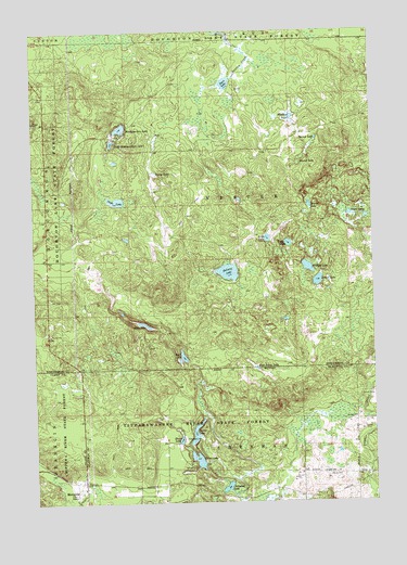
Meredith, MI USGS Topographic Map
Click on map above to begin viewing in our Map Viewer.

This topographic map contains these locations and features:
Feature Name Type Latitude Longitude GNIS ID View Map
Achill Post Office (historical)Post OfficeN44.1800°W84.5194°2508864View Map
Atchel LakeLakeN44.1835°W84.5203°620294View Map
Beaver LakeLakeN44.2039°W84.5233°620931View Map
Doyle LakeLakeN44.2050°W84.5941°624863View Map
Headquarters LakeLakeN44.2242°W84.5922°628025View Map
Hoister LakeLakeN44.1433°W84.5661°628404View Map
House LakeLakeN44.1416°W84.5715°628680View Map
House Lake State Forest CampgroundLocaleN44.1417°W84.5694°2515982View Map
Huntley LakeLakeN44.2271°W84.5293°628843View Map
Leith LakeLakeN44.1950°W84.5389°630294View Map
Little Headquarters LakeLakeN44.2205°W84.5956°630637View Map
Little LakeLakeN44.1936°W84.5311°630660View Map
Marl LakeLakeN44.1636°W84.5703°631590View Map
MeredithPopulated PlaceN44.1306°W84.6072°632119View Map
Meredith Post Office (historical)Post OfficeN44.1306°W84.5906°2516456View Map
Meridith CemeteryCemeteryN44.1300°W84.6111°2516668View Map
Rollway LakeLakeN44.1861°W84.5532°636140View Map
Round LakeLakeN44.2147°W84.5270°636302View Map
Rust Eaton LakeLakeN44.1606°W84.5431°636412View Map
Ryan LakeLakeN44.2361°W84.5532°636437View Map
Slide LakeLakeN44.1722°W84.5845°638106View Map
Spruce LakeLakeN44.2211°W84.5206°638643View Map
Streaked LakeLakeN44.1290°W84.5547°638947View Map
Sugar LakeLakeN44.2014°W84.5086°639021View Map
Trout LakeLakeN44.1363°W84.5654°1615113View Map
Trout Lake State Forest CampgroundLocaleN44.1353°W84.5681°2515981View Map
Willing LakeLakeN44.1872°W84.5239°1616520View Map
Young LakeLakeN44.2122°W84.5801°1616900View Map

Note: Coordinates in the location and feature list above are referenced to NAD83 datum.


Copyright (C) 2008-2025 Ryan Niemi / Sunset Dynamics ... All Rights Reserved