TopoQuest Logo
Do you find TopoQuest useful?
Help keep TopoQuest running and adding new maps/features by donating!
Bitcoin:  19c7KJd3qBynnjoSw5npx9KScwjBe4ifkT
Litecoin:  LXs6TkuXGGXo1vDsWCkWVdjQX94eUKd6ui
Home View Maps Find Maps Find Places Resources & Links


Skeels, Michigan Topographic Map

USGS Map Title: Skeels, MI
USGS Map MRC: 44084A5
DRG (GeoTIFF) Download: o44084a5.tif


Neighboring USGS Topographic Map Quads:


  Meredith NW, MI  
44084B6
 

  Meredith, MI  
44084B5
 

  Butman, MI  
44084B4
 

  Meredith SW, MI  
44084A6
 

  Skeels, MI  
44084A5
 

  Wagarville, MI  
44084A4
 

  Browns Corners, MI  
43084H6
 

  Coleman NE, MI  
43084H5
 

  Gladwin, MI  
43084H4


Map MRC Location:

N45°
W85°
N45°
W84°
H8 H7 H6 H5 H4 H3 H2 H1
G8 G7 G6 G5 G4 G3 G2 G1
F8 F7 F6 F5 F4 F3 F2 F1
E8 E7 E6 E5 E4 E3 E2 E1
D8 D7 D6 D5 D4 D3 D2 D1
C8 C7 C6 C5 C4 C3 C2 C1
B8 B7 B6 B5 B4 B3 B2 B1
A8 A7 A6 A5 A4 A3 A2 A1
N44°
W85°
N44°
W84°

Skeels, MI USGS 1:24K Topographic Map Preview:
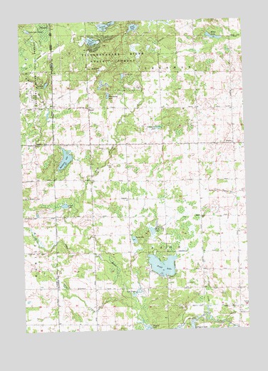
Skeels, MI USGS Topographic Map
Click on map above to begin viewing in our Map Viewer.

This topographic map contains these locations and features:
Feature Name Type Latitude Longitude GNIS ID View Map
Blue LakeLakeN44.1223°W84.5608°621632View Map
Chappel DamDamN44.0034°W84.5300°623103View Map
Christ Centered ChurchChurchN44.0136°W84.5250°2515880View Map
Emmanuel Baptist ChurchChurchN44.0094°W84.5353°2515881View Map
Garrity CemeteryCemeteryN44.0578°W84.6167°2516665View Map
Gladwin County Recreation AreaParkN44.0117°W84.5450°2515862View Map
Grace Fellowship ChurchChurchN44.0908°W84.5869°2515894View Map
Grass LakeLakeN44.1168°W84.5844°627194View Map
Greasy Jim LakeLakeN44.0818°W84.5476°627272View Map
Haymarsh LakeSwampN44.1056°W84.5792°627994View Map
Island LakeLakeN44.1231°W84.5765°629120View Map
Lake ContosLakeN44.0152°W84.5623°623715View Map
Lake Little GeorgeLakeN44.1211°W84.6197°630626View Map
Lindy LakeLakeN44.0996°W84.6103°630510View Map
McGilvery LakeLakeN44.0695°W84.6004°631897View Map
Mud LakeLakeN44.0406°W84.5518°632981View Map
North Branch Cedar RiverStreamN44.0272°W84.5764°633496View Map
OberlinPopulated PlaceN44.0745°W84.5061°1617755View Map
Oberlin Post Office (historical)Post OfficeN44.0744°W84.5061°2515955View Map
Peach LakeLakeN44.0508°W84.6013°634512View Map
PodunkPopulated PlaceN44.0528°W84.5658°1617795View Map
Pratt LakeLakeN44.0260°W84.5474°635403View Map
Puro LakeLakeN44.0367°W84.5628°635525View Map
Schoolhouse LakeLakeN44.0950°W84.5757°637426View Map
Silver CreekStreamN44.0050°W84.5220°637905View Map
Skeel CemeteryCemeteryN44.0905°W84.5769°2500974View Map
SkeelsPopulated PlaceN44.0900°W84.5867°638050View Map
Skeels Northern Christian SchoolSchoolN44.0903°W84.5869°2515893View Map
Skeels Oil FieldOilfieldN44.0872°W84.6170°1623637View Map
Skeels Post Office (historical)Post OfficeN44.0900°W84.5867°2515954View Map
Smith CreekStreamN44.0092°W84.5633°638139View Map
Township of SageCivilN44.0321°W84.5475°1627019View Map
Township of ShermanCivilN44.1178°W84.5468°1627070View Map
Wallic LakeLakeN44.1180°W84.5161°1615727View Map

Note: Coordinates in the location and feature list above are referenced to NAD83 datum.


Copyright (C) 2008-2024 Ryan Niemi / Sunset Dynamics ... All Rights Reserved