TopoQuest Logo
Do you find TopoQuest useful?
Help keep TopoQuest running and adding new maps/features by donating!
Bitcoin:  19c7KJd3qBynnjoSw5npx9KScwjBe4ifkT
Litecoin:  LXs6TkuXGGXo1vDsWCkWVdjQX94eUKd6ui
Home View Maps Find Maps Find Places Resources & Links


Browns Corners, Michigan Topographic Map

USGS Map Title: Browns Corners, MI
USGS Map MRC: 43084H6
DRG (GeoTIFF) Download: o43084h6.tif


Neighboring USGS Topographic Map Quads:


  Meredith SW, MI  
44084A6
 

  Skeels, MI  
44084A5


  Browns Corners, MI  
43084H6
 

  Coleman NE, MI  
43084H5


  Loomis, MI  
43084G6
 

  Coleman, MI  
43084G5


Map MRC Location:

N44°
W85°
N44°
W84°
H8 H7 H6 H5 H4 H3 H2 H1
G8 G7 G6 G5 G4 G3 G2 G1
F8 F7 F6 F5 F4 F3 F2 F1
E8 E7 E6 E5 E4 E3 E2 E1
D8 D7 D6 D5 D4 D3 D2 D1
C8 C7 C6 C5 C4 C3 C2 C1
B8 B7 B6 B5 B4 B3 B2 B1
A8 A7 A6 A5 A4 A3 A2 A1
N43°
W85°
N43°
W84°

Browns Corners, MI USGS 1:24K Topographic Map Preview:
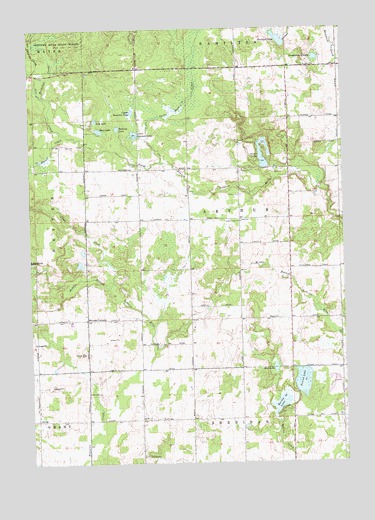
Browns Corners, MI USGS Topographic Map
Click on map above to begin viewing in our Map Viewer.

This topographic map contains these locations and features:
Feature Name Type Latitude Longitude GNIS ID View Map
Arthur CemeteryCemeteryN43.9517°W84.6658°620253View Map
Arthur Center ChurchChurchN43.9442°W84.6658°620254View Map
Arthur Township HallBuildingN43.9450°W84.6661°2516656View Map
Bailey LakeLakeN43.8916°W84.6510°620454View Map
Bass LakeLakeN43.9707°W84.7219°620696View Map
Beaver CreekStreamN43.9692°W84.7345°620908View Map
Browns CornersLocaleN43.9164°W84.7278°622107View Map
Clare County Historical Society and MuseumBuildingN43.8875°W84.7475°2516584View Map
Clear CreekStreamN43.9259°W84.7184°623403View Map
DoverPopulated PlaceN43.8875°W84.7478°624833View Map
Dover Post Office (historical)Post OfficeN43.8875°W84.7478°2516461View Map
Drachenburg LakeLakeN43.9913°W84.6355°624869View Map
Eagle ChurchChurchN43.8878°W84.7061°625071View Map
Howland LakeLakeN43.9965°W84.6498°628724View Map
Jose CreekStreamN43.9692°W84.7345°619754View Map
Lily LakeLakeN43.9736°W84.7235°630398View Map
Lower Brennan LakeLakeN43.9697°W84.7080°631163View Map
Mostellar CreekStreamN43.9806°W84.7436°632759View Map
Mud LakeLakeN43.9022°W84.6528°632976View Map
Nestor LakesLakeN43.9625°W84.6570°633301View Map
Norway LakeLakeN43.9714°W84.7147°633755View Map
Ott CemeteryCemeteryN43.9667°W84.7356°634165View Map
River Valley RV ParkLocaleN43.9581°W84.6403°2516443View Map
Round LakeLakeN43.8966°W84.6425°636299View Map
Saint John's Lutheran CemeteryCemeteryN43.9886°W84.6378°2516672View Map
Saint Johns ChurchChurchN43.9892°W84.6359°636740View Map
Spike Horn CreekStreamN43.9611°W84.6975°638512View Map
Thompson CemeteryCemeteryN43.8772°W84.7061°2516669View Map
Tonkin Post Office (historical)Post OfficeN43.9100°W84.6967°2516452View Map
Township of ArthurCivilN43.9453°W84.6670°1625851View Map
Upper Brennan LakeLakeN43.9760°W84.7088°1615397View Map
Wood CemeteryCemeteryN43.8953°W84.7272°1616720View Map

Note: Coordinates in the location and feature list above are referenced to NAD83 datum.


Copyright (C) 2008-2025 Ryan Niemi / Sunset Dynamics ... All Rights Reserved