TopoQuest Logo
Do you find TopoQuest useful?
Help keep TopoQuest running and adding new maps/features by donating!
Bitcoin:  19c7KJd3qBynnjoSw5npx9KScwjBe4ifkT
Litecoin:  LXs6TkuXGGXo1vDsWCkWVdjQX94eUKd6ui
Home View Maps Find Maps Find Places Resources & Links


Meshoppen, Pennsylvania Topographic Map

USGS Map Title: Meshoppen, PA
USGS Map MRC: 41076E1
DRG (GeoTIFF) Download: o41076e1.tif


Neighboring USGS Topographic Map Quads:


  Laceyville, PA  
41076F2
 

  Auburn Center, PA  
41076F1
 

  Springville, PA  
41075F8
 

  Jenningsville, PA  
41076E2
 

  Meshoppen, PA  
41076E1
 

  Tunkhannock, PA  
41075E8
 

  Dutch Mountain, PA  
41076D2
 

  Noxen, PA  
41076D1
 

  Center Moreland, PA  
41075D8


Map MRC Location:

N42°
W77°
N42°
W76°
H8 H7 H6 H5 H4 H3 H2 H1
G8 G7 G6 G5 G4 G3 G2 G1
F8 F7 F6 F5 F4 F3 F2 F1
E8 E7 E6 E5 E4 E3 E2 E1
D8 D7 D6 D5 D4 D3 D2 D1
C8 C7 C6 C5 C4 C3 C2 C1
B8 B7 B6 B5 B4 B3 B2 B1
A8 A7 A6 A5 A4 A3 A2 A1
N41°
W77°
N41°
W76°

Meshoppen, PA USGS 1:24K Topographic Map Preview:
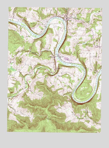
Meshoppen, PA USGS Topographic Map
Click on map above to begin viewing in our Map Viewer.

This topographic map contains these locations and features:
Feature Name Type Latitude Longitude GNIS ID View Map
Black WalnutLocaleN41.6142°W76.1174°1212529View Map
Black Walnut CreekStreamN41.6112°W76.1197°1169747View Map
Blue Ridge MountainSummitN41.6079°W76.0930°1169893View Map
Borough of MeshoppenCivilN41.6119°W76.0458°1215733View Map
Bowman HollowValleyN41.5272°W76.1238°1170066View Map
Carney FlatFlatN41.5726°W76.0413°1171232View Map
Cedar HillSummitN41.5423°W76.1213°1171378View Map
Chambers AirportAirportN41.5531°W76.0523°1194255View Map
Doll MountainSummitN41.5292°W76.0513°1173354View Map
Dorn Blazer PondLakeN41.5895°W76.0227°1173395View Map
Endless MountainsRangeN41.6001°W76.0496°1214684View Map
Florey KnobSummitN41.5929°W76.0044°1174914View Map
Forkston - Windom - Mehoopany Volunteer Fire CompanyBuildingN41.5767°W76.0625°2653213View Map
Forkston MountainSummitN41.5042°W76.0660°1175000View Map
Fox HollowValleyN41.5549°W76.1023°1175099View Map
Fox Hollow ChurchChurchN41.5695°W76.1219°1175101View Map
Grist FlatFlatN41.5551°W76.0288°1176255View Map
Jayne BendBendN41.6017°W76.0616°1177993View Map
Jayne PondLakeN41.5213°W76.0190°1177994View Map
Little Mehoopany CreekStreamN41.5762°W76.0599°1179597View Map
Little Meshoppen CreekStreamN41.6140°W76.0480°1179598View Map
Little Round TopSummitN41.5704°W76.1091°1199059View Map
Maynard HillSummitN41.5534°W76.0738°1180579View Map
Maynard HillLocaleN41.5559°W76.0591°1202095View Map
MehoopanyPopulated PlaceN41.5634°W76.0605°1180870View Map
Mehoopany CreekStreamN41.5734°W76.0580°1199906View Map
Mehoopany Fire TowerTowerN41.5140°W76.0702°1213284View Map
Mehoopany MountainSummitN41.5426°W76.0719°1180871View Map
Mehoopany Post OfficePost OfficeN41.5652°W76.0639°2773201View Map
Mehoopany StationLocaleN41.5765°W76.0563°1180872View Map
MeshoppenPopulated PlaceN41.6142°W76.0466°1180960View Map
Meshoppen CreekStreamN41.6126°W76.0505°1180961View Map
Meshoppen Fire CompanyBuildingN41.6148°W76.0490°2653123View Map
Meshoppen Post OfficePost OfficeN41.6152°W76.0488°2773202View Map
MyobeachPopulated PlaceN41.6020°W76.0816°1204250View Map
Nort's Resort AirportAirportN41.5960°W76.0305°2443045View Map
North Branch Mehoopany CreekStreamN41.5348°W76.1224°1193036View Map
North MehoopanyPopulated PlaceN41.5759°W76.0621°1182608View Map
Overfield CemeteryCemeteryN41.6076°W76.0749°1183136View Map
Places PondLakeN41.5570°W76.0572°1183985View Map
Rogers HollowValleyN41.5428°W76.0987°1185392View Map
Russell HillSummitN41.5884°W76.0058°1185650View Map
Russell Hill SchoolSchoolN41.5759°W76.0063°1185652View Map
ScottsvillePopulated PlaceN41.5962°W76.0963°1204598View Map
The NeckCapeN41.5459°W76.0196°1189434View Map
Township of MehoopanyCivilN41.5603°W76.0704°1217269View Map
Township of MeshoppenCivilN41.6239°W76.0571°1217270View Map
Township of WashingtonCivilN41.5920°W76.0010°1217278View Map
Tunket HoleBendN41.5473°W76.0996°1189920View Map
VosburgPopulated PlaceN41.5612°W76.0044°1204879View Map
Vosburg TunnelTunnelN41.5631°W76.0135°1190455View Map
West Branch Meshoppen CreekStreamN41.6215°W76.0091°1190916View Map
Wyoming CountyCivilN41.5183°W76.0166°1209192View Map

Note: Coordinates in the location and feature list above are referenced to NAD83 datum.


Copyright (C) 2008-2025 Ryan Niemi / Sunset Dynamics ... All Rights Reserved