TopoQuest Logo
Do you find TopoQuest useful?
Help keep TopoQuest running and adding new maps/features by donating!
Bitcoin:  19c7KJd3qBynnjoSw5npx9KScwjBe4ifkT
Litecoin:  LXs6TkuXGGXo1vDsWCkWVdjQX94eUKd6ui
Home View Maps Find Maps Find Places Resources & Links


Laceyville, Pennsylvania Topographic Map

USGS Map Title: Laceyville, PA
USGS Map MRC: 41076F2
DRG (GeoTIFF) Download: o41076f2.tif


Neighboring USGS Topographic Map Quads:


  Rome, PA  
41076G3
 

  Le Raysville, PA  
41076G2
 

  Lawton, PA  
41076G1
 

  Wyalusing, PA  
41076F3
 

  Laceyville, PA  
41076F2
 

  Auburn Center, PA  
41076F1
 

  Colley, PA  
41076E3
 

  Jenningsville, PA  
41076E2
 

  Meshoppen, PA  
41076E1


Map MRC Location:

N42°
W77°
N42°
W76°
H8 H7 H6 H5 H4 H3 H2 H1
G8 G7 G6 G5 G4 G3 G2 G1
F8 F7 F6 F5 F4 F3 F2 F1
E8 E7 E6 E5 E4 E3 E2 E1
D8 D7 D6 D5 D4 D3 D2 D1
C8 C7 C6 C5 C4 C3 C2 C1
B8 B7 B6 B5 B4 B3 B2 B1
A8 A7 A6 A5 A4 A3 A2 A1
N41°
W77°
N41°
W76°

Laceyville, PA USGS 1:24K Topographic Map Preview:
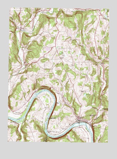
Laceyville, PA USGS Topographic Map
Click on map above to begin viewing in our Map Viewer.

This topographic map contains these locations and features:
Feature Name Type Latitude Longitude GNIS ID View Map
Ackley PondLakeN41.7082°W76.1848°1168048View Map
Beaver Meadow CemeteryCemeteryN41.7404°W76.1282°1169016View Map
Beaver Meadow PondLakeN41.7431°W76.1293°1169018View Map
Beaver Meadow SwampSwampN41.7484°W76.1293°1169020View Map
Bennet CreekStreamN41.7498°W76.1738°1192121View Map
Billings CreekStreamN41.7292°W76.2380°1169624View Map
Borough of LaceyvilleCivilN41.6458°W76.1590°1215732View Map
Brown PondLakeN41.6616°W76.1863°1170373View Map
BrowntownPopulated PlaceN41.6509°W76.2402°1203173View Map
Browntown MountainSummitN41.6895°W76.2222°1170421View Map
Camps CreekStreamN41.7292°W76.2358°1192038View Map
CamptownPopulated PlaceN41.7312°W76.2347°1171144View Map
Camptown CemeteryCemeteryN41.7259°W76.2350°2776410View Map
Camptown Post OfficePost OfficeN41.7297°W76.2357°2773091View Map
Chamberlain LakeReservoirN41.6651°W76.1497°1195730View Map
Chamberlain Pond DamDamN41.6651°W76.1497°1195731View Map
Cold CreekStreamN41.7459°W76.2094°1172145View Map
Dodd IslandIslandN41.6373°W76.2038°1173330View Map
Doolittle HillSummitN41.6423°W76.1280°1173388View Map
Dug Road CreekStreamN41.7017°W76.1330°1173581View Map
Edingers SchoolSchoolN41.6731°W76.1574°1174023View Map
Fargo CreekStreamN41.6554°W76.1366°1174616View Map
Goodwill Fire Company Number 5BuildingN41.6454°W76.1605°2653135View Map
Huff HillSummitN41.7192°W76.1780°1177556View Map
Lacey Street CemeteryCemeteryN41.6342°W76.1847°1178740View Map
LaceyvillePopulated PlaceN41.6459°W76.1613°1178741View Map
Laceyville Post OfficePost OfficeN41.6456°W76.1613°2772776View Map
Little Tuscarora CreekStreamN41.6437°W76.1630°1209348View Map
Long SwampLakeN41.7330°W76.1650°1179909View Map
Lyons CemeteryCemeteryN41.6967°W76.2051°1180137View Map
Madison CemeteryCemeteryN41.7136°W76.1317°2776459View Map
McCloe PondLakeN41.6697°W76.1539°1180632View Map
MerryallPopulated PlaceN41.6987°W76.2305°1204159View Map
Merryall CemeteryCemeteryN41.7132°W76.2330°1180957View Map
Mill CreekStreamN41.6995°W76.1338°1181134View Map
Mill Creek DamDamN41.7217°W76.1713°1195750View Map
Mill Creek ReservoirReservoirN41.7247°W76.1731°1195751View Map
Morrow Family CemeteryCemeteryN41.7174°W76.2474°2776465View Map
North FlatFlatN41.6340°W76.1555°1182574View Map
North Flat CemeteryCemeteryN41.6290°W76.1485°1182575View Map
Patton CreekStreamN41.7270°W76.2422°1193093View Map
Quicks BendBendN41.6620°W76.2072°1184553View Map
Quicks Bend CemeteryCemeteryN41.6568°W76.2035°1184554View Map
Quimby CemeteryCemeteryN41.7031°W76.1346°1184559View Map
Rocky ForestPopulated PlaceN41.6345°W76.1974°1185348View Map
Rocky Forest CreekStreamN41.6304°W76.1994°1185349View Map
SilvaraPopulated PlaceN41.6987°W76.1344°1187667View Map
Silvara CemeteryCemeteryN41.6950°W76.1338°2776496View Map
Skinners EddyPopulated PlaceN41.6415°W76.1466°1187760View Map
Snyder SwampSwampN41.7134°W76.1899°1187961View Map
Spring HillPopulated PlaceN41.7029°W76.1849°1204703View Map
Spring Hill CemeteryCemeteryN41.7120°W76.1875°1188235View Map
Spring Hill SchoolSchoolN41.7073°W76.1877°1188237View Map
Sturdevant CemeteryCemeteryN41.7186°W76.1428°2776504View Map
Sturdevant PondLakeN41.7015°W76.1552°1188910View Map
Sugar RunPopulated PlaceN41.6423°W76.2416°1188961View Map
Sugar Run CreekStreamN41.6465°W76.2305°1193496View Map
Tewksbury PondLakeN41.7069°W76.1621°1189377View Map
Township of BraintrimCivilN41.6368°W76.1465°1217262View Map
Township of TuscaroraCivilN41.6994°W76.1612°1216000View Map
Transue CreekStreamN41.6540°W76.1352°1189720View Map
Tuscarora CreekStreamN41.6384°W76.1483°1189982View Map
Underhill SwampSwampN41.7059°W76.1793°1190082View Map
Wilmot Fire Company Station 27BuildingN41.6427°W76.2418°2653198View Map

Note: Coordinates in the location and feature list above are referenced to NAD83 datum.


Copyright (C) 2008-2025 Ryan Niemi / Sunset Dynamics ... All Rights Reserved