TopoQuest Logo
Do you find TopoQuest useful?
Help keep TopoQuest running and adding new maps/features by donating!
Bitcoin:  19c7KJd3qBynnjoSw5npx9KScwjBe4ifkT
Litecoin:  LXs6TkuXGGXo1vDsWCkWVdjQX94eUKd6ui
Home View Maps Find Maps Find Places Resources & Links


Springville, Pennsylvania Topographic Map

USGS Map Title: Springville, PA
USGS Map MRC: 41075F8
DRG (GeoTIFF) Download: o41075f8.tif


Neighboring USGS Topographic Map Quads:


  Lawton, PA  
41076G1
 

  Montrose West, PA  
41075G8
 

  Montrose East, PA  
41075G7
 

  Auburn Center, PA  
41076F1
 

  Springville, PA  
41075F8
 

  Hop Bottom, PA  
41075F7
 

  Meshoppen, PA  
41076E1
 

  Tunkhannock, PA  
41075E8
 

  Factoryville, PA  
41075E7


Map MRC Location:

N42°
W76°
N42°
W75°
H8 H7 H6 H5 H4 H3 H2 H1
G8 G7 G6 G5 G4 G3 G2 G1
F8 F7 F6 F5 F4 F3 F2 F1
E8 E7 E6 E5 E4 E3 E2 E1
D8 D7 D6 D5 D4 D3 D2 D1
C8 C7 C6 C5 C4 C3 C2 C1
B8 B7 B6 B5 B4 B3 B2 B1
A8 A7 A6 A5 A4 A3 A2 A1
N41°
W76°
N41°
W75°

Springville, PA USGS 1:24K Topographic Map Preview:
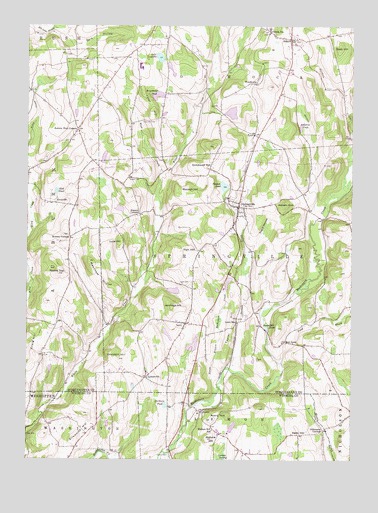
Springville, PA USGS Topographic Map
Click on map above to begin viewing in our Map Viewer.

This topographic map contains these locations and features:
Feature Name Type Latitude Longitude GNIS ID View Map
Auburn Four CornersPopulated PlaceN41.7201°W75.9802°1168498View Map
AveryPopulated PlaceN41.6387°W75.9310°1203002View Map
Avery HillSummitN41.6381°W75.9213°1168519View Map
Bennett CornersLocaleN41.6890°W75.9833°1169249View Map
Broadhead PondLakeN41.7300°W75.9496°1170297View Map
Bunnell CemeteryCemeteryN41.6995°W75.9885°1170687View Map
Craig HillSummitN41.6584°W75.9963°1172599View Map
Dark HollowValleyN41.7493°W75.9898°1172936View Map
Dean HillSummitN41.7442°W75.8791°1173033View Map
DimockPopulated PlaceN41.7465°W75.8983°1173283View Map
Dimock Post OfficePost OfficeN41.7461°W75.8987°2780025View Map
Dimock StationLocaleN41.7487°W75.9063°1173285View Map
East LynnPopulated PlaceN41.6590°W75.8996°1203478View Map
Ellsworth HillSummitN41.6306°W75.9813°1174166View Map
Fish HillSummitN41.6854°W75.9363°1174807View Map
Gardners PondLakeN41.6406°W75.9461°1175446View Map
Gobblers KnobSummitN41.6987°W75.9005°1175766View Map
Hall PondLakeN41.7023°W75.9883°1176396View Map
Jennings HillSummitN41.6690°W75.9435°1178043View Map
Kasson CornersLocaleN41.6959°W75.9566°1178246View Map
Lake CrystellaLakeN41.7409°W75.9488°1172807View Map
Lake WalterReservoirN41.6589°W75.9350°1195724View Map
Lake Walter DamDamN41.6567°W75.9363°1195725View Map
Lemon CemeteryCemeteryN41.6262°W75.9441°1179190View Map
Loomis SwampSwampN41.6251°W75.9245°1179939View Map
Luce HillSummitN41.6879°W75.9630°1180057View Map
LymanvillePopulated PlaceN41.6487°W75.9530°1180112View Map
LynnPopulated PlaceN41.6645°W75.9377°1180122View Map
Lynn CemeteryCemeteryN41.6756°W75.9369°1180123View Map
Lynn StationLocaleN41.6648°W75.9183°1180126View Map
Meachem HillSummitN41.6823°W75.9752°1213634View Map
Mitchell HillSummitN41.7026°W75.9358°1181373View Map
Negro HollowValleyN41.6859°W75.9137°1182225View Map
North Branch Meshoppen CreekStreamN41.6479°W75.9241°1182542View Map
Pa-Rc and D-105 DamDamN41.7017°W75.9246°1195741View Map
Pollywog PondLakeN41.7208°W75.8945°1184218View Map
Pond BrookStreamN41.6534°W75.9021°1184230View Map
Quick CemeteryCemeteryN41.7059°W75.9602°1184552View Map
Round TopSummitN41.6787°W75.9877°1193229View Map
Schlessers CornersLocaleN41.6337°W75.8841°1187087View Map
Seely HillSummitN41.6340°W75.8938°1187221View Map
Sheldon HillSummitN41.6545°W75.9635°1187441View Map
SpringvillePopulated PlaceN41.6976°W75.9177°1188311View Map
Springville Post OfficePost OfficeN41.6977°W75.9187°2772989View Map
Springville Volunteer Fire CompanyBuildingN41.6980°W75.9178°2653022View Map
States Mill PondLakeN41.6631°W75.9066°1188565View Map
Stevens CreekStreamN41.6931°W75.8899°1188626View Map
Strickland HillSummitN41.7095°W75.9308°1188876View Map
Taylor HillSummitN41.6579°W75.9224°1189307View Map
Thomas CreekStreamN41.6517°W75.9210°1189478View Map
Thomas PondReservoirN41.7038°W75.9239°1189486View Map
Township of DimockCivilN41.7467°W75.9098°1217081View Map
Township of SpringvilleCivilN41.6793°W75.9084°1217097View Map
TylerPopulated PlaceN41.7187°W75.9119°1204844View Map
Tyler HillSummitN41.7259°W75.9508°1190040View Map
Tyler Hill CemeteryCemeteryN41.7228°W75.9502°1190041View Map
Wallace HillSummitN41.6312°W75.9291°1190514View Map
Wallace Hill SchoolSchoolN41.6334°W75.9271°1190515View Map
West CreekStreamN41.7067°W75.9474°1190950View Map
White CreekStreamN41.6406°W75.9927°1192055View Map
WoodhousePopulated PlaceN41.7334°W75.9135°1204988View Map

Note: Coordinates in the location and feature list above are referenced to NAD83 datum.


Copyright (C) 2008-2024 Ryan Niemi / Sunset Dynamics ... All Rights Reserved