TopoQuest Logo
Do you find TopoQuest useful?
Help keep TopoQuest running and adding new maps/features by donating!
Bitcoin:  19c7KJd3qBynnjoSw5npx9KScwjBe4ifkT
Litecoin:  LXs6TkuXGGXo1vDsWCkWVdjQX94eUKd6ui
Home View Maps Find Maps Find Places Resources & Links


Metter SE, Georgia Topographic Map

USGS Map Title: Metter SE, GA
USGS Map MRC: 32082C1
DRG (GeoTIFF) Download: o32082c1.tif


Neighboring USGS Topographic Map Quads:


  Stillmore, GA  
32082D2
 

  Metter, GA  
32082D1
 

  Pulaski, GA  
32081D8
 

  Cobbtown, GA  
32082C2
 

  Metter SE, GA  
32082C1
 

  Register, GA  
32081C8
 

  Ohoopee, GA  
32082B2
 

  Collins, GA  
32082B1
 

  Claxton, GA  
32081B8


Map MRC Location:

N33°
W83°
N33°
W82°
H8 H7 H6 H5 H4 H3 H2 H1
G8 G7 G6 G5 G4 G3 G2 G1
F8 F7 F6 F5 F4 F3 F2 F1
E8 E7 E6 E5 E4 E3 E2 E1
D8 D7 D6 D5 D4 D3 D2 D1
C8 C7 C6 C5 C4 C3 C2 C1
B8 B7 B6 B5 B4 B3 B2 B1
A8 A7 A6 A5 A4 A3 A2 A1
N32°
W83°
N32°
W82°

Metter SE, GA USGS 1:24K Topographic Map Preview:
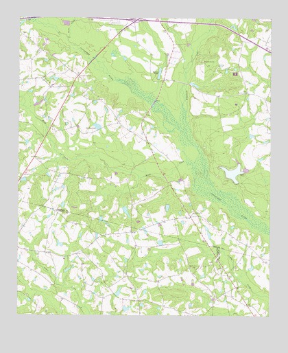
Metter SE, GA USGS Topographic Map
Click on map above to begin viewing in our Map Viewer.

This topographic map contains these locations and features:
Feature Name Type Latitude Longitude GNIS ID View Map
Bethesda School (historical)SchoolN32.2669°W82.0704°347381View Map
Bowens PondReservoirN32.3519°W82.0553°354823View Map
Brannen LakeReservoirN32.3103°W82.0182°341588View Map
Brannen Lake DamDamN32.3052°W82.0165°341587View Map
Callaway PondReservoirN32.2532°W82.0706°341362View Map
Callaway Pond DamDamN32.2519°W82.0715°341361View Map
Central School (historical)SchoolN32.3249°W82.0615°342858View Map
Charlton Grove ChurchChurchN32.2699°W82.0390°312580View Map
Cowart BridgeBridgeN32.3102°W82.0687°342859View Map
Daniels LakeReservoirN32.3715°W82.0186°341582View Map
Daniels Lake DamDamN32.3718°W82.0198°341581View Map
Dixon Grove CemeteryCemeteryN32.3566°W82.0334°313502View Map
Dixon Grove ChurchChurchN32.3441°W82.0118°313503View Map
Dutch Ford BridgeBridgeN32.3480°W82.0423°342861View Map
Evergreen ChurchChurchN32.2930°W82.0376°314012View Map
Everitt CemeteryCemeteryN32.3096°W82.0123°355746View Map
Exit 23CrossingN32.3746°W82.0657°1704986View Map
Fifteenmile CreekStreamN32.3238°W82.0396°355792View Map
Flat Ford BridgeBridgeN32.3391°W82.0582°342868View Map
Glisson LakeReservoirN32.2943°W82.0713°341584View Map
Glisson Lake DamDamN32.2952°W82.0715°341583View Map
Green BridgeBridgeN32.3118°W82.0462°342870View Map
Hensley LakeReservoirN32.2801°W82.1039°341360View Map
Hensley Lake DamDamN32.2785°W82.1032°341359View Map
Holland CemeteryCemeteryN32.2585°W82.0276°347415View Map
Laniers PondReservoirN32.3295°W82.0857°316648View Map
Laniers Pond DamDamN32.3282°W82.0846°335973View Map
Metter Municipal AirportAirportN32.3727°W82.0793°351844View Map
Primitive Grove ChurchChurchN32.3502°W82.0943°321143View Map
Sams CreekStreamN32.3666°W82.1007°322392View Map
Steep Hill ChurchChurchN32.3091°W82.1229°323558View Map
Turner BridgeBridgeN32.3585°W82.0873°342903View Map
West LakeReservoirN32.2958°W82.0506°341586View Map
West Lake DamDamN32.2968°W82.0498°341585View Map
Wolfe CreekStreamN32.3146°W82.0418°325512View Map

Note: Coordinates in the location and feature list above are referenced to NAD83 datum.


Copyright (C) 2008-2025 Ryan Niemi / Sunset Dynamics ... All Rights Reserved