TopoQuest Logo
Do you find TopoQuest useful?
Help keep TopoQuest running and adding new maps/features by donating!
Bitcoin:  19c7KJd3qBynnjoSw5npx9KScwjBe4ifkT
Litecoin:  LXs6TkuXGGXo1vDsWCkWVdjQX94eUKd6ui
Home View Maps Find Maps Find Places Resources & Links


Ohoopee, Georgia Topographic Map

USGS Map Title: Ohoopee, GA
USGS Map MRC: 32082B2
DRG (GeoTIFF) Download: o32082b2.tif


Neighboring USGS Topographic Map Quads:


  Oak Park, GA  
32082C3
 

  Cobbtown, GA  
32082C2
 

  Metter SE, GA  
32082C1
 

  Lyons, GA  
32082B3
 

  Ohoopee, GA  
32082B2
 

  Collins, GA  
32082B1
 

  Johnson Corner, GA  
32082A3
 

  Reidsville West, GA  
32082A2
 

  Reidsville East, GA  
32082A1


Map MRC Location:

N33°
W83°
N33°
W82°
H8 H7 H6 H5 H4 H3 H2 H1
G8 G7 G6 G5 G4 G3 G2 G1
F8 F7 F6 F5 F4 F3 F2 F1
E8 E7 E6 E5 E4 E3 E2 E1
D8 D7 D6 D5 D4 D3 D2 D1
C8 C7 C6 C5 C4 C3 C2 C1
B8 B7 B6 B5 B4 B3 B2 B1
A8 A7 A6 A5 A4 A3 A2 A1
N32°
W83°
N32°
W82°

Ohoopee, GA USGS 1:24K Topographic Map Preview:
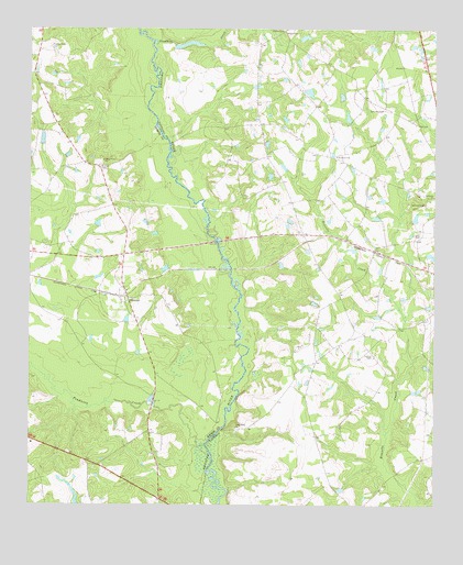
Ohoopee, GA USGS Topographic Map
Click on map above to begin viewing in our Map Viewer.

This topographic map contains these locations and features:
Feature Name Type Latitude Longitude GNIS ID View Map
Blue Ridge School (historical)SchoolN32.2382°W82.2490°345158View Map
Collins CemeteryCemeteryN32.1646°W82.1434°312851View Map
Collins CemeteryCemeteryN32.2496°W82.1715°312852View Map
Danton (historical)Populated PlaceN32.1949°W82.1526°347398View Map
East Toombs Volunteer Fire Department Station 1BuildingN32.1899°W82.2353°2604759View Map
Findley CemeteryCemeteryN32.2457°W82.2437°314125View Map
Jackson CemeteryCemeteryN32.2041°W82.1276°316002View Map
Jarriel Bridge (historical)BridgeN32.2196°W82.2068°347416View Map
Little Flock ChurchChurchN32.1455°W82.1860°317071View Map
Lynn Bridge (historical)BridgeN32.1449°W82.1910°347424View Map
Lynn CemeteryCemeteryN32.1960°W82.1290°317504View Map
Mount Zion CemeteryCemeteryN32.2143°W82.2279°335304View Map
Oakey Grove ChurchChurchN32.2155°W82.2271°319856View Map
OhoopeePopulated PlaceN32.1802°W82.2196°332562View Map
Pendleton CreekStreamN32.1407°W82.1954°320355View Map
Pine Grove ChurchChurchN32.2169°W82.1551°320567View Map
Rewis CemeteryCemeteryN32.2488°W82.1709°321532View Map
Sandhill CreekStreamN32.2463°W82.2118°322449View Map
Saturday CemeteryCemeteryN32.2288°W82.1404°322582View Map
Sikes Farm AirportAirportN32.2230°W82.1314°2717254View Map
Weyherhauser LakeReservoirN32.1256°W82.2352°341152View Map

Note: Coordinates in the location and feature list above are referenced to NAD83 datum.


Copyright (C) 2008-2025 Ryan Niemi / Sunset Dynamics ... All Rights Reserved