TopoQuest Logo
Do you find TopoQuest useful?
Help keep TopoQuest running and adding new maps/features by donating!
Bitcoin:  19c7KJd3qBynnjoSw5npx9KScwjBe4ifkT
Litecoin:  LXs6TkuXGGXo1vDsWCkWVdjQX94eUKd6ui
Home View Maps Find Maps Find Places Resources & Links


Collins, Georgia Topographic Map

USGS Map Title: Collins, GA
USGS Map MRC: 32082B1
DRG (GeoTIFF) Download: o32082b1.tif


Neighboring USGS Topographic Map Quads:


  Cobbtown, GA  
32082C2
 

  Metter SE, GA  
32082C1
 

  Register, GA  
32081C8
 

  Ohoopee, GA  
32082B2
 

  Collins, GA  
32082B1
 

  Claxton, GA  
32081B8
 

  Reidsville West, GA  
32082A2
 

  Reidsville East, GA  
32082A1
 

  Deans Crossing, GA  
32081A8


Map MRC Location:

N33°
W83°
N33°
W82°
H8 H7 H6 H5 H4 H3 H2 H1
G8 G7 G6 G5 G4 G3 G2 G1
F8 F7 F6 F5 F4 F3 F2 F1
E8 E7 E6 E5 E4 E3 E2 E1
D8 D7 D6 D5 D4 D3 D2 D1
C8 C7 C6 C5 C4 C3 C2 C1
B8 B7 B6 B5 B4 B3 B2 B1
A8 A7 A6 A5 A4 A3 A2 A1
N32°
W83°
N32°
W82°

Collins, GA USGS 1:24K Topographic Map Preview:
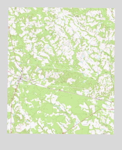
Collins, GA USGS Topographic Map
Click on map above to begin viewing in our Map Viewer.

This topographic map contains these locations and features:
Feature Name Type Latitude Longitude GNIS ID View Map
Anderson Primitive Baptist ChurchChurchN32.1902°W82.0298°354307View Map
Bethaven ChurchChurchN32.1769°W82.0943°311144View Map
Bethaven ChurchChurchN32.2063°W82.1248°311145View Map
Calloway LakeReservoirN32.2024°W82.0365°347391View Map
Cedar Creek Primitive Baptist ChurchChurchN32.2407°W82.1007°355053View Map
Cedar Creek School (historical)SchoolN32.2357°W82.1115°347392View Map
City of CollinsCivilN32.1794°W82.1103°2404100View Map
City of ManassasCivilN32.1603°W82.0200°2405003View Map
CollinsPopulated PlaceN32.1813°W82.1090°312845View Map
Collins District Volunteer Fire DepartmentBuildingN32.1806°W82.1102°2604649View Map
Collins DivisionCivilN32.2324°W82.1219°1936192View Map
Collins Junior High SchoolSchoolN32.1869°W82.1087°347395View Map
Collins Police DepartmentBuildingN32.1806°W82.1100°2734197View Map
Collins Water Pollution Control PlantLocaleN32.1822°W82.1038°2502449View Map
Cypress Flat CreekStreamN32.1874°W82.0451°313245View Map
Dixon LakeReservoirN32.1527°W82.0670°341354View Map
Dixon Lake DamDamN32.1485°W82.0615°341353View Map
Harris LakeReservoirN32.1886°W82.0893°341352View Map
Harris Lake DamDamN32.1885°W82.0882°341351View Map
Jerrell CemeteryCemeteryN32.2288°W82.1209°316084View Map
Kingdom HallChurchN32.1355°W82.1198°316437View Map
Lighthouse Pentecostal Holiness ChurchChurchN32.1643°W82.1104°2502882View Map
ManassasPopulated PlaceN32.1605°W82.0196°332310View Map
Mount Carmel ChurchChurchN32.1441°W82.1015°318597View Map
Mount Pilgrim ChurchChurchN32.1785°W82.0973°318806View Map
Old Anderson ChurchChurchN32.1930°W82.0443°319939View Map
Old Tippins CemeteryCemeteryN32.1355°W82.0312°320030View Map
Rewis CemeteryCemeteryN32.2002°W82.0868°321531View Map
Rodgers ChurchChurchN32.2402°W82.0673°321865View Map
Rogers LakeReservoirN32.2274°W82.0208°341350View Map
Rogers Lake DamDamN32.2285°W82.0215°341349View Map
Rome ChurchChurchN32.1446°W82.1021°321884View Map
Tattnall CampgroundLocaleN32.1257°W82.0098°323931View Map
Tippins CemeteryCemeteryN32.1488°W82.0032°324193View Map
Wilkinson CemeteryCemeteryN32.1891°W82.0757°325308View Map

Note: Coordinates in the location and feature list above are referenced to NAD83 datum.


Copyright (C) 2008-2025 Ryan Niemi / Sunset Dynamics ... All Rights Reserved