TopoQuest Logo
Do you find TopoQuest useful?
Help keep TopoQuest running and adding new maps/features by donating!
Bitcoin:  19c7KJd3qBynnjoSw5npx9KScwjBe4ifkT
Litecoin:  LXs6TkuXGGXo1vDsWCkWVdjQX94eUKd6ui
Home View Maps Find Maps Find Places Resources & Links


Cobbtown, Georgia Topographic Map

USGS Map Title: Cobbtown, GA
USGS Map MRC: 32082C2
DRG (GeoTIFF) Download: o32082c2.tif


Neighboring USGS Topographic Map Quads:


  Nunez, GA  
32082D3
 

  Stillmore, GA  
32082D2
 

  Metter, GA  
32082D1
 

  Oak Park, GA  
32082C3
 

  Cobbtown, GA  
32082C2
 

  Metter SE, GA  
32082C1
 

  Lyons, GA  
32082B3
 

  Ohoopee, GA  
32082B2
 

  Collins, GA  
32082B1


Map MRC Location:

N33°
W83°
N33°
W82°
H8 H7 H6 H5 H4 H3 H2 H1
G8 G7 G6 G5 G4 G3 G2 G1
F8 F7 F6 F5 F4 F3 F2 F1
E8 E7 E6 E5 E4 E3 E2 E1
D8 D7 D6 D5 D4 D3 D2 D1
C8 C7 C6 C5 C4 C3 C2 C1
B8 B7 B6 B5 B4 B3 B2 B1
A8 A7 A6 A5 A4 A3 A2 A1
N32°
W83°
N32°
W82°

Cobbtown, GA USGS 1:24K Topographic Map Preview:
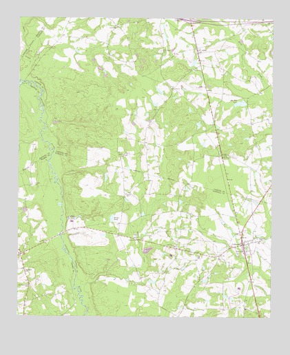
Cobbtown, GA USGS Topographic Map
Click on map above to begin viewing in our Map Viewer.

This topographic map contains these locations and features:
Feature Name Type Latitude Longitude GNIS ID View Map
AlinePopulated PlaceN32.3610°W82.1604°331020View Map
Aline ChurchChurchN32.3455°W82.1735°310439View Map
Aline DivisionCivilN32.3477°W82.1439°1936073View Map
Anderson Dam TwoDamN32.3418°W82.1332°335970View Map
Anderson LakeReservoirN32.3398°W82.1404°340241View Map
Anderson Lake DamDamN32.3402°W82.1382°340240View Map
Bazemore CemeteryCemeteryN32.2691°W82.2460°310900View Map
Beaver CreekStreamN32.2627°W82.2173°310975View Map
Boatright LakeReservoirN32.3566°W82.1638°341570View Map
Boatright Lake DamDamN32.3552°W82.1632°341569View Map
Brown PondReservoirN32.2915°W82.2035°311878View Map
City of CobbtownCivilN32.2806°W82.1388°2404087View Map
CobbtownPopulated PlaceN32.2805°W82.1387°355208View Map
Cobbtown Fire DepartmentBuildingN32.2781°W82.1386°2603717View Map
Coleman BridgeBridgeN32.2844°W82.2290°345170View Map
Connors ChurchChurchN32.2799°W82.1715°355273View Map
Cool Springs ChurchChurchN32.3716°W82.2015°355285View Map
East Toombs Volunteer Fire Department Station 2BuildingN32.2740°W82.2483°2604758View Map
Eden ChurchChurchN32.3182°W82.1976°313849View Map
Elton (historical)Populated PlaceN32.2557°W82.2460°345173View Map
Exit 22CrossingN32.3743°W82.1660°1704985View Map
Findley CemeteryCemeteryN32.3052°W82.2418°355795View Map
Griffins Ferry BridgeBridgeN32.3482°W82.2476°342871View Map
Hebron CemeteryCemeteryN32.3007°W82.1973°315294View Map
Hillside ChurchChurchN32.2705°W82.1723°315440View Map
Jacks CreekStreamN32.3491°W82.2487°315991View Map
Mac Wac LakeReservoirN32.3398°W82.1404°317509View Map
Mount Olive ChurchChurchN32.3613°W82.1601°342888View Map
New Eden ChurchChurchN32.3182°W82.1987°319305View Map
New Life ChurchChurchN32.3538°W82.1640°319464View Map
Oak Chapel CemeteryCemeteryN32.3616°W82.1798°319737View Map
Old Reedy Creek CemeteryCemeteryN32.2627°W82.2437°320014View Map
Piney Grove ChurchChurchN32.3174°W82.1460°320711View Map
Roxy Church (historical)ChurchN32.3513°W82.1896°342893View Map
Stones PondReservoirN32.2952°W82.2198°337743View Map
Stones Pond DamDamN32.2952°W82.2198°337742View Map
Sunlight CemeteryCemeteryN32.2832°W82.1315°323758View Map
Sunlight Primitive Baptist ChurchChurchN32.2830°W82.1335°347444View Map

Note: Coordinates in the location and feature list above are referenced to NAD83 datum.


Copyright (C) 2008-2025 Ryan Niemi / Sunset Dynamics ... All Rights Reserved