TopoQuest Logo
Do you find TopoQuest useful?
Help keep TopoQuest running and adding new maps/features by donating!
Bitcoin:  19c7KJd3qBynnjoSw5npx9KScwjBe4ifkT
Litecoin:  LXs6TkuXGGXo1vDsWCkWVdjQX94eUKd6ui
Home View Maps Find Maps Find Places Resources & Links


Michigan Bluff, California Topographic Map

USGS Map Title: Michigan Bluff, CA
USGS Map MRC: 39120A6
DRG (GeoTIFF) Download: o39120a6.tif


Neighboring USGS Topographic Map Quads:


  Dutch Flat, CA  
39120B7
 

  Westville, CA  
39120B6
 

  Duncan Peak, CA  
39120B5
 

  Foresthill, CA  
39120A7
 

  Michigan Bluff, CA  
39120A6
 

  Greek Store, CA  
39120A5
 

  Georgetown, CA  
38120H7
 

  Tunnel Hill, CA  
38120H6
 

  Devil Peak, CA  
38120H5


Map MRC Location:

N40°
W121°
N40°
W120°
H8 H7 H6 H5 H4 H3 H2 H1
G8 G7 G6 G5 G4 G3 G2 G1
F8 F7 F6 F5 F4 F3 F2 F1
E8 E7 E6 E5 E4 E3 E2 E1
D8 D7 D6 D5 D4 D3 D2 D1
C8 C7 C6 C5 C4 C3 C2 C1
B8 B7 B6 B5 B4 B3 B2 B1
A8 A7 A6 A5 A4 A3 A2 A1
N39°
W121°
N39°
W120°

Michigan Bluff, CA USGS 1:24K Topographic Map Preview:
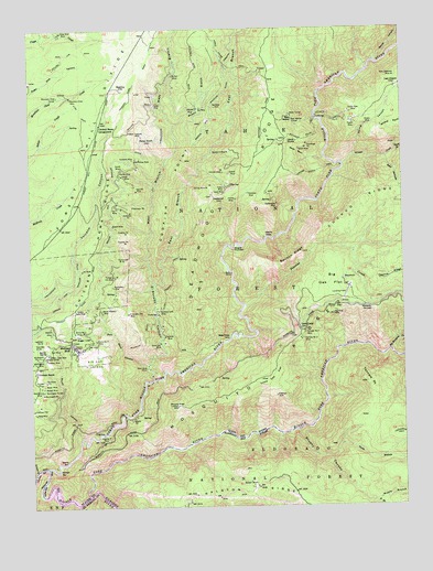
Michigan Bluff, CA USGS Topographic Map
Click on map above to begin viewing in our Map Viewer.

This topographic map contains these locations and features:
Feature Name Type Latitude Longitude GNIS ID View Map
Adams PitMineN39.0232°W120.7166°217974View Map
Afterbay 1030-004 DamDamN39.0032°W120.7460°1664179View Map
Alabama BarBarN39.0038°W120.7433°1701137View Map
Anderson MineMineN39.0288°W120.6688°218263View Map
Anderson PitMineN39.0768°W120.7166°218268View Map
Anna Sue MineMineN39.0430°W120.7072°218289View Map
Bachelor PitMineN39.0782°W120.7158°218496View Map
Bake OvenLocaleN39.0435°W120.6849°218535View Map
Bake Oven TrailTrailN39.0410°W120.6947°274997View Map
Balloon RidgeRidgeN39.0643°W120.6630°218631View Map
Basin MineMineN39.0932°W120.6597°218720View Map
Bear WallowBasinN39.1010°W120.6624°218897View Map
Bear Wallow TunnelMineN39.1010°W120.6622°218911View Map
Bear WallowsValleyN39.0910°W120.6313°256741View Map
Beehive MineMineN39.0471°W120.7444°218969View Map
Big Chief MineMineN39.0502°W120.6491°219161View Map
Big Gun DiggingsLocaleN39.0380°W120.7302°219195View Map
Big Mosquito CreekStreamN39.0405°W120.6302°256974View Map
Big Oak FlatFlatN39.0585°W120.6502°219222View Map
Bogus ThunderBendN39.0671°W120.6824°219590View Map
Bowen MineMineN39.0732°W120.7227°219712View Map
Bower MineMineN39.0318°W120.7466°219713View Map
Breece and Wheeler DitchCanalN39.1030°W120.6885°257443View Map
Britt MineMineN39.0243°W120.7497°219853View Map
Brushy CanyonValleyN39.0196°W120.6616°219942View Map
Brushy CreekStreamN39.0199°W120.6621°1701145View Map
Buckeye PitMineN39.0399°W120.7474°220040View Map
Bullion MineMineN39.1127°W120.7013°220133View Map
Burnham PitMineN39.0330°W120.7460°220205View Map
Burns Number One MineMineN39.0457°W120.7330°254683View Map
Burns Number Two MineMineN39.0438°W120.7291°254684View Map
Burroughs PitMineN39.0296°W120.7472°220249View Map
Burroughs TunnelMineN39.0305°W120.7466°220251View Map
Butte MineMineN39.0607°W120.6830°220296View Map
Byrds ValleyBasinN39.0410°W120.7488°220332View Map
Cameron MineMineN39.0907°W120.7158°220433View Map
Cedar SpringsLocaleN39.0530°W120.6446°1662431View Map
Central MineMineN39.0868°W120.6833°220843View Map
Chicken Hawk CampgroundLocaleN39.0999°W120.7266°220976View Map
Chicken Hawk RidgeRidgeN39.0708°W120.7264°2778587View Map
Codfish PointRidgeN39.0838°W120.7035°221291View Map
Comet MineMineN39.0888°W120.7194°221429View Map
Cuckoo RidgeRidgeN39.0830°W120.6333°258982View Map
Daniel Webster MineMineN39.0513°W120.7274°222009View Map
Darling MineMineN39.0832°W120.6902°222027View Map
DeadwoodLocaleN39.0810°W120.6883°222138View Map
Deadwood RidgeRidgeN39.1021°W120.6708°259160View Map
Derby MineMineN39.1055°W120.7072°222270View Map
Devils BasinBasinN39.0921°W120.6608°222284View Map
Devils GateChannelN39.0699°W120.6702°222306View Map
Devils ThumbPillarN39.0955°W120.6633°222330View Map
Ditch CampLocaleN39.0460°W120.6602°222418View Map
Dix MineMineN39.1043°W120.6922°222426View Map
Double O MineMineN39.0927°W120.6833°222548View Map
Drummond PitMineN39.0646°W120.7205°222600View Map
East Branch El Dorado CanyonValleyN39.0582°W120.7091°266672View Map
Eastman MineMineN39.0443°W120.7058°222946View Map
El Dorado CanyonValleyN39.0332°W120.7097°223031View Map
El Dorado Hill MineMineN39.0505°W120.7183°223034View Map
Eldorado CreekStreamN39.0332°W120.7099°1701158View Map
Elkhorn MineMineN39.0880°W120.6855°223138View Map
Fairview Number One MineMineN39.0452°W120.6585°223351View Map
Fairview Number Two MineMineN39.0435°W120.6591°223352View Map
Foresthell Seed OrchardLocaleN39.0871°W120.7355°274991View Map
Forks House TrailTrailN39.1168°W120.6849°274992View Map
Forks House TrailTrailN39.1152°W120.6830°223689View Map
Franklin PitMineN39.0691°W120.7185°223821View Map
Franklin PitMineN39.0716°W120.7183°223822View Map
Gas Hill MineMineN39.0827°W120.7147°224088View Map
Golden Chief MineMineN39.0399°W120.7452°224284View Map
Golden Gate MineMineN39.0516°W120.7324°224293View Map
Gorman PitMineN39.0324°W120.7477°224349View Map
Gorman RanchLocaleN39.0352°W120.7497°224350View Map
Grouse CreekStreamN39.0888°W120.6455°260947View Map
Grouse Creek TrailTrailN39.0868°W120.6572°224660View Map
Harkness MineMineN39.0818°W120.6769°224936View Map
Hermit MineMineN39.0880°W120.7194°225204View Map
Hidden Treasure MineMineN39.0968°W120.7124°225251View Map
Hornby MineMineN39.0802°W120.6808°225586View Map
Imperial MineMineN39.0182°W120.7249°225836View Map
Indian BarBarN39.0038°W120.7488°225850View Map
Indian CreekStreamN39.0582°W120.7097°1701166View Map
Junction BarBarN39.0095°W120.7488°226377View Map
Keokuk MineMineN39.0385°W120.7460°226528View Map
Last ChanceLocaleN39.1091°W120.6280°226910View Map
Last Chance TrailTrailN39.0605°W120.7030°1655128View Map
Lightfoot PitMineN39.0438°W120.7474°227080View Map
Lightfoot TunnelMineN39.0399°W120.7466°227081View Map
Little Oak FlatFlatN39.0335°W120.6713°227320View Map
Lloyd MineMineN39.0818°W120.6863°227445View Map
MaintopLocaleN39.1096°W120.7210°227974View Map
Manhattan MineMineN39.0574°W120.7230°228013View Map
Mary Anna MineMineN39.0363°W120.7119°228191View Map
Michigan BluffPopulated PlaceN39.0430°W120.7413°1659121View Map
Middle Branch Brushy CanyonValleyN39.0013°W120.6355°263493View Map
Middle Branch El Dorado CanyonValleyN39.0993°W120.7013°228572View Map
Mitchell MineMineN39.1041°W120.6935°228872View Map
Mosquito NarrowsGapN39.0521°W120.6385°229115View Map
Mosquito RidgeRidgeN39.0396°W120.6663°229117View Map
Mosquito Ridge LookoutLocaleN39.0263°W120.7016°229118View Map
Mountain Chief MineMineN39.1071°W120.7369°229178View Map
Mountain Chief TunnelMineN39.1074°W120.7410°229179View Map
Muir MineMineN39.0407°W120.7416°229289View Map
New Caledonia MineMineN39.1121°W120.6280°229485View Map
North Branch Brushy CanyonValleyN39.0124°W120.6508°264119View Map
North Fork of Middle Fork American RiverStreamN39.0105°W120.7460°267064View Map
Oro MineMineN39.0780°W120.7213°230104View Map
Oxbow BarBarN39.0041°W120.7455°1733783View Map
Oxbow ReservoirReservoirN39.0009°W120.7353°274993View Map
Pacific MineMineN39.1002°W120.6424°230209View Map
Pacific Slab MineMineN39.1030°W120.6430°230213View Map
Peavine CreekStreamN39.0524°W120.6785°264606View Map
Peters MineMineN39.0832°W120.6844°230565View Map
Placer CountyCivilN39.0634°W120.7177°277295View Map
Poor Mans CanyonValleyN39.0371°W120.7113°230932View Map
Rainbow Land MineMineN39.0513°W120.7077°231183View Map
Rainbow MineMineN39.1041°W120.6872°231184View Map
Ralston (historical)Populated PlaceN39.0049°W120.6760°1701178View Map
Ralston CampgroundLocaleN39.0046°W120.7338°274995View Map
Ralston CorralLocaleN39.0068°W120.6780°274994View Map
Ralston MineMineN39.0060°W120.6760°231196View Map
Ralston Picnic AreaLocaleN39.0055°W120.7333°274996View Map
Rattlesnake MineMineN39.0788°W120.6674°231267View Map
Root CabinLocaleN39.0068°W120.6421°1655210View Map
Rubicon RiverStreamN39.0027°W120.7324°265647View Map
Rublin MineMineN39.0996°W120.6377°232000View Map
Russel MineMineN39.0313°W120.7469°232036View Map
Secret CanyonValleyN39.1166°W120.6344°265970View Map
Shady Grove RunStreamN39.1196°W120.6258°266027View Map
Skunk CanyonValleyN39.0182°W120.7344°233203View Map
Snow Bird MineMineN39.1243°W120.7397°234765View Map
Sourdough PitMineN39.0946°W120.6572°234916View Map
South Branch Brushy CanyonValleyN39.0013°W120.6358°267404View Map
South Branch Grouse CreekStreamN39.0930°W120.6280°267406View Map
Specimen PitMineN39.0421°W120.7494°235180View Map
Spring CanyonValleyN39.0916°W120.6416°235233View Map
Stoney BarBarN39.0116°W120.7413°235538View Map
Stumps BarBarN39.0093°W120.7424°235626View Map
Sugar LoafSummitN39.0435°W120.7344°1659892View Map
Sunny SouthLocaleN39.0968°W120.7124°235786View Map
Swiftshore MineMineN39.0910°W120.7144°235906View Map
Tanners PointSummitN39.0324°W120.6383°236016View Map
Tanners Point TrailTrailN39.0193°W120.6266°236017View Map
Tickell MineMineN39.0863°W120.7194°236342View Map
Turkey Hill MineMineN39.0605°W120.7216°236641View Map
Washburn MineMineN39.0302°W120.7477°237267View Map
Washington MineMineN39.0388°W120.7477°237285View Map
West Branch El Dorado CanyonValleyN39.0582°W120.7091°268868View Map
Willow BarBarN39.0077°W120.7463°237870View Map

Note: Coordinates in the location and feature list above are referenced to NAD83 datum.


Copyright (C) 2008-2025 Ryan Niemi / Sunset Dynamics ... All Rights Reserved