TopoQuest Logo
Do you find TopoQuest useful?
Help keep TopoQuest running and adding new maps/features by donating!
Bitcoin:  19c7KJd3qBynnjoSw5npx9KScwjBe4ifkT
Litecoin:  LXs6TkuXGGXo1vDsWCkWVdjQX94eUKd6ui
Home View Maps Find Maps Find Places Resources & Links


Westville, California Topographic Map

USGS Map Title: Westville, CA
USGS Map MRC: 39120B6
DRG (GeoTIFF) Download: o39120b6.tif


Neighboring USGS Topographic Map Quads:


  Washington, CA  
39120C7
 

  Blue Canyon, CA  
39120C6
 

  Cisco Grove, CA  
39120C5
 

  Dutch Flat, CA  
39120B7
 

  Westville, CA  
39120B6
 

  Duncan Peak, CA  
39120B5
 

  Foresthill, CA  
39120A7
 

  Michigan Bluff, CA  
39120A6
 

  Greek Store, CA  
39120A5


Map MRC Location:

N40°
W121°
N40°
W120°
H8 H7 H6 H5 H4 H3 H2 H1
G8 G7 G6 G5 G4 G3 G2 G1
F8 F7 F6 F5 F4 F3 F2 F1
E8 E7 E6 E5 E4 E3 E2 E1
D8 D7 D6 D5 D4 D3 D2 D1
C8 C7 C6 C5 C4 C3 C2 C1
B8 B7 B6 B5 B4 B3 B2 B1
A8 A7 A6 A5 A4 A3 A2 A1
N39°
W121°
N39°
W120°

Westville, CA USGS 1:24K Topographic Map Preview:
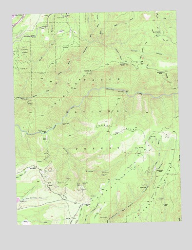
Westville, CA USGS Topographic Map
Click on map above to begin viewing in our Map Viewer.

This topographic map contains these locations and features:
Feature Name Type Latitude Longitude GNIS ID View Map
Alameda TunnelMineN39.1549°W120.6849°218051View Map
American Eagle MineMineN39.1843°W120.7144°218231View Map
American Eagle TrailTrailN39.1580°W120.7416°1662416View Map
American Eagle TrailTrailN39.1813°W120.7213°274918View Map
Blackhawk MineMineN39.1805°W120.7305°219420View Map
Blue CanyonValleyN39.2005°W120.7474°219485View Map
Burnett CanyonValleyN39.2324°W120.6860°254682View Map
Burnett Canyon TrailTrailN39.2285°W120.6513°220195View Map
Cape Horn TunnelMineN39.1538°W120.6855°220577View Map
China Wall Iowa Hill DitchCanalN39.1563°W120.6633°221063View Map
Clara TunnelTunnelN39.1288°W120.6833°221145View Map
Corral SpringSpringN39.1686°W120.6580°1662417View Map
DamascusLocaleN39.1466°W120.7177°221989View Map
Dorer MineMineN39.1821°W120.7233°222522View Map
Dorer RanchLocaleN39.1757°W120.7266°222523View Map
Drum ForebayReservoirN39.2499°W120.7499°222597View Map
Drum Forebay 97-020 DamDamN39.2493°W120.7491°1663598View Map
East Fork North Fork North Fork American RiverStreamN39.2327°W120.6863°253881View Map
Elliot MeadowFlatN39.1580°W120.7416°1662415View Map
Elliot RanchLocaleN39.1585°W120.7397°223154View Map
Euchre Bar TrailTrailN39.1821°W120.7466°1655213View Map
Eureka TunnelMineN39.1457°W120.6519°223280View Map
ForebayPopulated PlaceN39.2366°W120.7366°252676View Map
Forest Hill DivideRidgeN39.1632°W120.6613°233889View Map
Forks HouseLocaleN39.1363°W120.7005°223688View Map
Fulda CreekStreamN39.2327°W120.6891°223981View Map
Goat SpringSpringN39.1279°W120.7104°224254View Map
Golden River TunnelMineN39.1488°W120.6999°224296View Map
Government SpringSpringN39.2134°W120.6372°224366View Map
Helester PointSummitN39.2135°W120.6930°225125View Map
Herman MineMineN39.1343°W120.6385°225202View Map
Honey TunnelMineN39.1466°W120.6516°225517View Map
Humbug BarBarN39.1793°W120.7294°225749View Map
Humbug CanyonValleyN39.1793°W120.7266°225750View Map
Humbug CreekStreamN39.1791°W120.7274°1701165View Map
Humbug RidgeRidgeN39.1788°W120.6719°225757View Map
Indian CreekStreamN39.1560°W120.6449°225861View Map
Indian Springs RavineValleyN39.1560°W120.6452°1701167View Map
Iowa Hill DivideRidgeN39.1360°W120.7066°252299View Map
Italian BarBarN39.2027°W120.6660°226016View Map
Italian Bar TrailTrailN39.1935°W120.6738°226017View Map
Jarvis TunnelMineN39.1452°W120.7035°226149View Map
Lost Camp MineMineN39.2388°W120.7149°227692View Map
Lynn MineMineN39.1621°W120.7310°227864View Map
Marrs MineMineN39.2027°W120.6677°228131View Map
Maxwell SawmillLocaleN39.1552°W120.6435°228252View Map
Monumental CreekStreamN39.2485°W120.6424°228997View Map
Mountain Gate TunnelMineN39.1491°W120.7185°229180View Map
Mumford Bar TrailTrailN39.1916°W120.6252°263961View Map
Osborne TunnelTunnelN39.1385°W120.6419°230130View Map
Pioneer MineMineN39.1668°W120.7263°230761View Map
RawhidePopulated PlaceN39.2002°W120.7449°1701179View Map
Rawhide MineMineN39.1963°W120.7397°231284View Map
Red PointCliffN39.1485°W120.7010°231367View Map
Red Point (historical)Populated PlaceN39.1471°W120.7016°1701180View Map
Sailor RavineValleyN39.2391°W120.6888°232127View Map
Sawtooth RidgeRidgeN39.2193°W120.6802°234654View Map
Shady RunStreamN39.2068°W120.7424°1701187View Map
Texas HillSummitN39.2357°W120.6433°1659974View Map
Texas Hill SpringSpringN39.2377°W120.6391°236138View Map
WestvillePopulated PlaceN39.1749°W120.6480°1660155View Map
Westville Post Office (historical)Post OfficeN39.1749°W120.6480°1940049View Map
Willmont CanyonValleyN39.2299°W120.6766°237868View Map
Willmont SaddleGapN39.2188°W120.6649°237869View Map

Note: Coordinates in the location and feature list above are referenced to NAD83 datum.


Copyright (C) 2008-2025 Ryan Niemi / Sunset Dynamics ... All Rights Reserved